Viber 2019 11 27 17 10 08


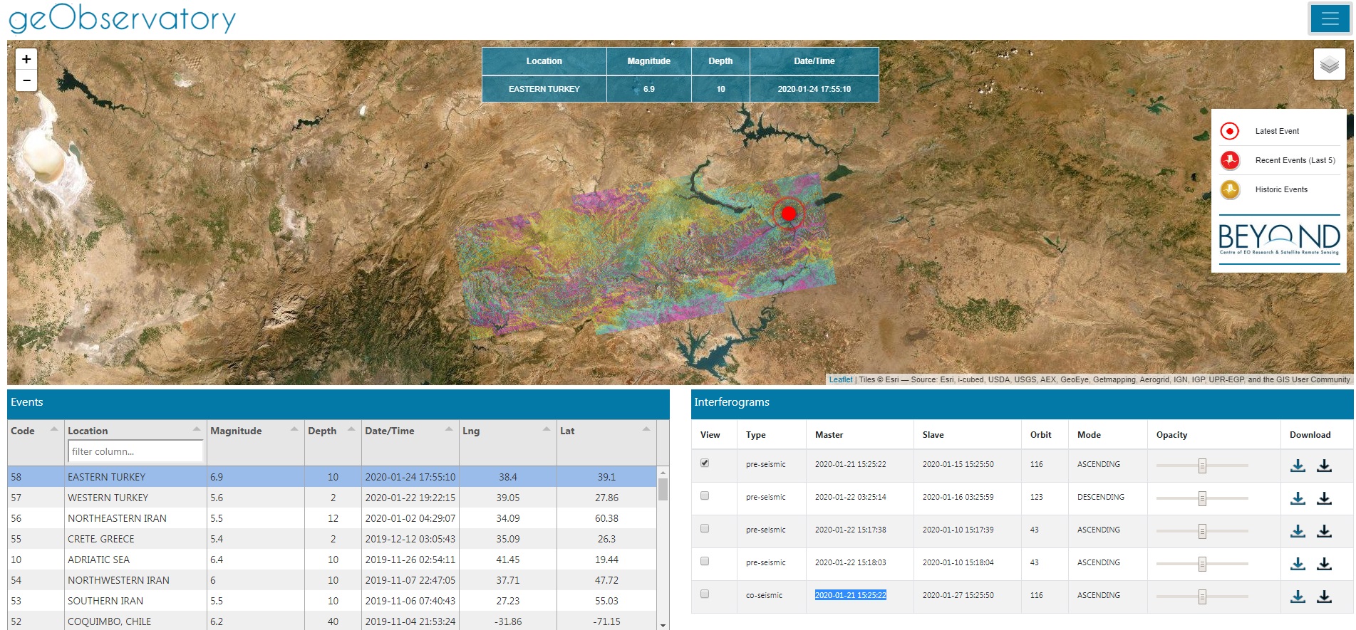
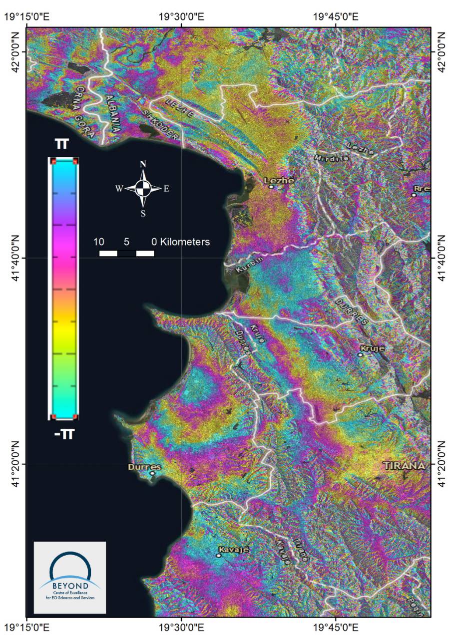
Pre-seismic and co-seismic interferograms for the latest Mw6.5 #Durres earthquake in Albania are available to view and download: https://bit.ly/2Legbsb
Fully automatic solution from BEYOND geObservatory.
Each color fringe represents 2.8cm of surface displacement in the satellite line-of-sight.
http://geobservatory.beyond-eocenter.eu/

albania


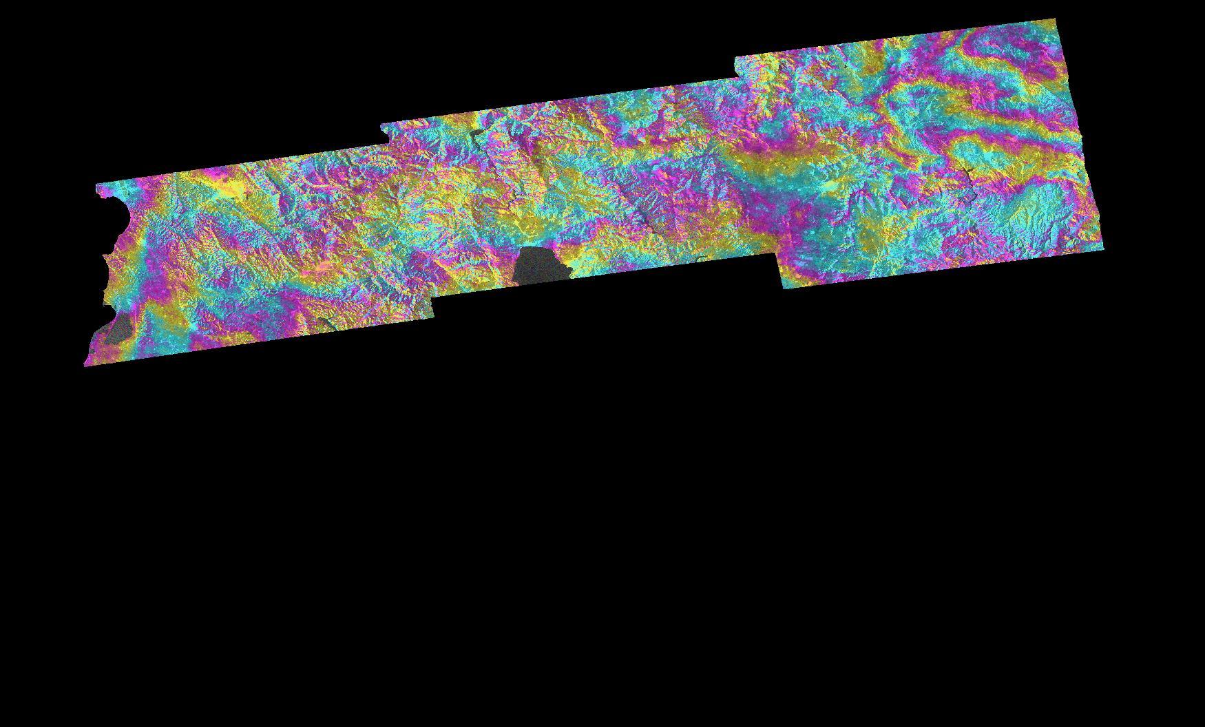
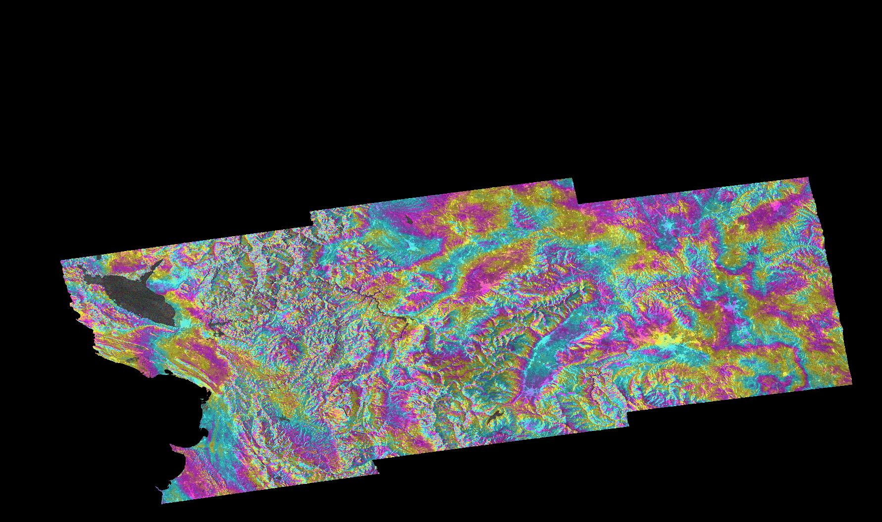
No deformation fringes for the Magnitude 5.6, 2019-09-21 shallow Albania EQ.
6-day Sentinel-1A&B repeat pass cycle is impressive though for rapid deformation assessment.
Co-seismic and pre-seismic interferograms available at BEYOND geObservatory: http://tiny.cc/hal6cz

albania1

zakynthos lowResolution

Το Κέντρο Αριστείας BEYOND του ΕΑΑ παρήγαγε ένα πρώτο διαφορικό συμβολόγραμμα που αφορά τον σημερινό σεισμό στη Ζάκυνθο και στο οποίο δεν ανιχνεύεται κάποια εδαφική παραμόρφωση.

Για την ανάλυση χρησιμοποιήθηκαν δεδομένα Sentinel-1 και η επεξεργασία των εικόνων ξεκίνησε αυτόματα με τη λήψη της πρώτης διαθέσιμης εικόνας μετά τον σεισμό.

Η υπηρεσία geObservatory είναι διαθέσιμη στη σελίδα :

http://beyond-eocenter.eu/geohub/ του Κέντρου Αριστείας BEYOND και παράγει αυτοματοποιημένα προϊόντα συμβολομετρίας μετά από σημαντικά σεισμικά γεγονότα και ηφαιστειακές εξάρσεις οπουδήποτε στον κόσμο.

Οι χρήστες μπορούν να προβάλλουν και να κατεβάζουν ελεύθερα τα προϊόντα που βρίσκονται στην εφαρμογή geObservatory.


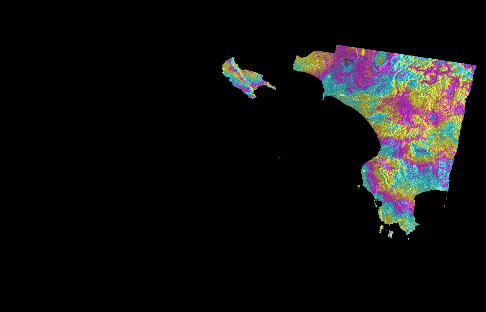
Α quicklook of the differential interferogram produced for today’s earthquake in Zakynthos island, Greece. This is a raw interferogram, and no manual operations for fine-tuning the processing parameters have been applied.
No fringe pattern is evident in the island.

Sentinel-1 data were used and a fully automatic processing engine was activated a few minutes after the earthquake occurrence. This engine is named geObservatory and a beta-version front-end is available here:

http://beyond-eocenter.eu/geohub/

Note that this is work in progress and any feedback on the functionality of geObservatory is welcome!

The event’s specific page is available here:


http://beyond-eocenter.eu/geohub/ionian-sea-2018-10-25-225451/

More interferograms will automatically populate this page as new Sentinel-1 data arrive.

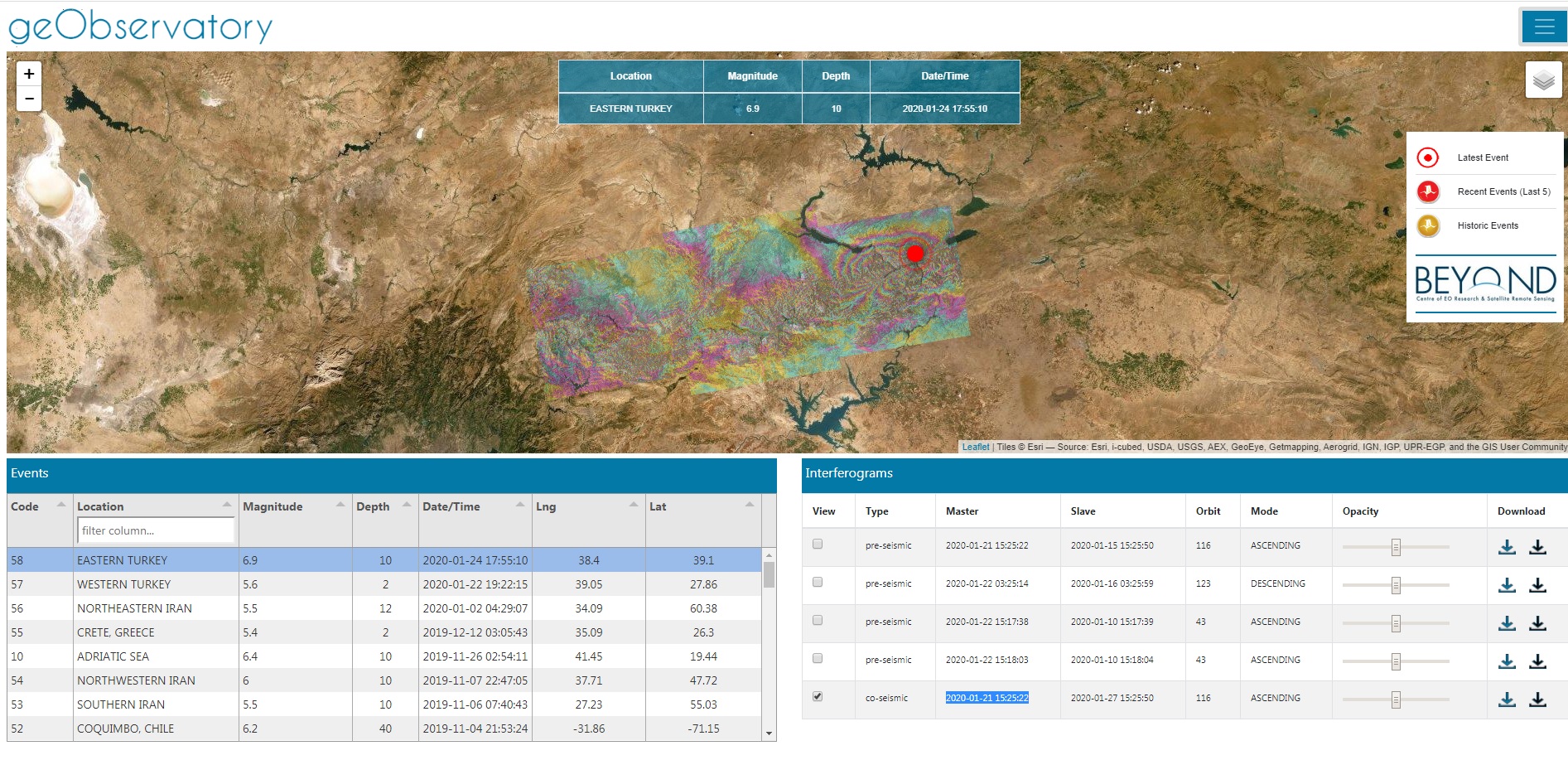
Users can freely visualize and download the raw interferograms that are output from the geObservatory application of BEYOND Center Of Excellence.


After a week of intense micro-seismic activity in the wider area of the Kīlauea volcano in Hawaii, suddenly last Thursday a volcanic crack appeared near the road network, from which lava and hot steam appeared. The Civil Protection instructed residents of the Puna community (~ 10,000) to leave their homes immediately. On Friday, May 4, 2018, a powerful 6.9 earthquake hit the Big Island, the largest in the past 43 years.

The 2018 Oaxaca earthquake occurred on February 16, 2018 at 17:39 local time (23:39 UTC) in the Sierra Madre del Sur in Oaxaca state in Southern Mexico. It had a magnitude of 7.2 on the moment magnitude scale and a maximum felt intensity of VII (very strong) on the Mercalli intensity scale. The hypocenter was located at a depth of 24.6 km and approximately 37 km northeast of Pinotepa de Don Luis.

On 12/11/2017, late Sunday, an earthquake of magnitude 7.3 struck near the border of Iran and Iraq. At least 452 people were killed and thousands injured, while the earthquake was felt as far away as Turkey and Pakistan. Around 100 of the dead are believed to be from one town in Iran's Kermanshah province. Mapping of the surface deformation with Sentinel-1 data, available through the Greek Mirror Site (https://sentinels.space.noa.gr/).

The main earthquake event, Mw=7,8, occurred just after midnight, on Monday 13/11/2016, near the coastal community of Kaikoura-New Zealand, 93 kilometers NE of the city of Christchurch. A series of powerful aftershocks jolted New Zealand's South Island, triggering a tsunami and sending aftershocks across the country with at least two, officially reported, casualties. Shortly after the earthquake, four successive ascending Sentinel-1 Synthetic Aperture Radar images were acquired, two before (3/11/2016) the devastating earthquake and two after (15/11/2016).

After a week of intense micro-seismic activity in the wider area of the Kīlauea volcano in Hawaii, suddenly last Thursday a volcanic crack appeared near the road network, from which lava and hot steam appeared (Figure 1). The Civil Protection instructed residents of the Puna community (~ 10,000) to leave their homes immediately. On Friday, May 4, 2018, a powerful 6.9 earthquake hit the Big Island, the largest in the past 43 years.

 294884521 752016896166226 381376954554270542 n

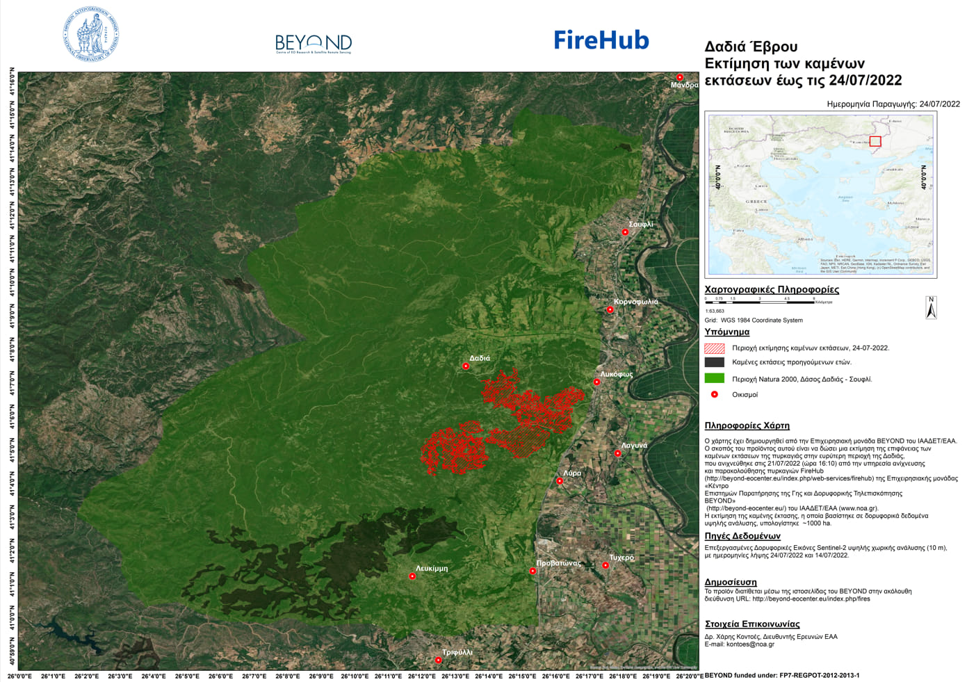
Η Επιχειρησιακή μονάδα BEYOND του Εθνικού Αστεροσκοπείου Αθηνών εκτίμησε την καμμένη έκταση της πυρκαγιάς που ξεκίνησε στην περιοχή Φράγμα Λύρας στο Σουφλί Έβρου και επεκτάθηκε στο Δάσος της Δαδιάς την Πέμπτη 21 Ιουλίου 2022 σε περίπου 1.000 εκτάρια/10.000 στρέμματα.

 cretefire

Αρχική εκτίμηση της καμένης έκτασης για την πυρκαγιά στις Μέλαμπες Ρεθύμνου - 16Ιουλίου 2022

Copernicus EMS - Mapping provides all actors involved in the management of natural disasters, man-made emergency situations and humanitarian crises, with timely and accurate geospatial information derived from satellite remote sensing and completed by available in situ or open data sources. The information generated by the service can be used as supplied (e.g. as digital or printed map outputs). It may be further combined with other data sources (e.g. as digital feature sets in a geographic information system). In both cases it may support geospatial analysis and decision making processes of emergency managers. Copernicus EMS - Mapping is provided during all phases of the emergency management cycle, in two temporal modes, and free of charge for the users. It can be activated only by authorized users.

The infrastructure and excellence developed in the BEYOND Center of Excellence are actively involved in the provision of Risk & Recovery Mapping which consists of the on-demand provision of geospatial information in support of Emergency Management activities related to Emergency Support. This applies in particular to activities dealing with prevention, preparedness, disaster risk reduction and recovery phases. There are three broad product categories: Reference Maps, Pre-disaster Situation Maps and Post-disaster Situation Maps. The research developed in BEYOND, exploits satellite data and ingests fusions of geo-partial information and data in rush mode, when, where needed, for enhanced risk modelling and improved assessment of the expected disaster impacts.

The list of methodologies developed, adapted, validated, and used in BEYOND to address risk and recovery needs of the civil protection authorities worldwide are listed below (in more details in ANNEX III):

  • Seismic Methodologies: Seismic Hazard, Seismic Vulnerability, Seismic Vulnerability of Pipelines, Seismic Risk.
  • Lava Flow Methodologies: Lava Flow Hazard, Lava Flow Vulnerability, Lava Flow Risk.
  • Forest Fires Methodologies: Fire Damage Delineation & Burn Severity Grading, Damage/Biomass Loss Statistics, Forest Fire Hazard, Population & Assets Vulnerability to Forest Fires, Forest Fire Risk – Population, Assets and Transportation Network at risk.
  • Industrial Accidents Methodologies: Industrial Accidents Hazard, Industrial Accidents Exposure, Industrial Accidents Risk.
  • Tsunami Methodologies: Tsunami Hazard Assessment, Assets Vulnerability to Tsunami, Storm Surge Hazard Risk.
  • Soil Erosion Methodology: Soil Erosion Hazard.
  • Coastal Erosion Methodology: Coastal Erosion Vulnerability.
  • Ground Deformation Methodology: Ground Deformation Dynamics.
  • Landslides Methodology: Landslide Hazard, Landslide Vulnerability, Landslide Risk.
  • Subsidence and Landslide Methodology: Subsidence and Landslide Risk.
  • Floods Methodology: Flood Delineation at peak conditions, Flood Depth at peak conditions, Flood Damage Assessment, Flood Hazard, Flood Vulnerability, Flood Risk, Flash Flood Hazard triggered by earthquakes, Flash Flood Risk triggered by earthquakes.
  • Disruption of Transportation Networks Methodology: Vulnerability of Disruption of Transportation Networks.

Up to now the BEYOND Center has been activated in the framework of the COPERNICUS EMERGENCY MANAGEMENT SERVICE in the following worldwide disaster risk and recovery cases :

An overview of missons in which UAVs were used to record raw data flighting above the affected from natural disasters areas; and to map and to assess the damages caused.