image1


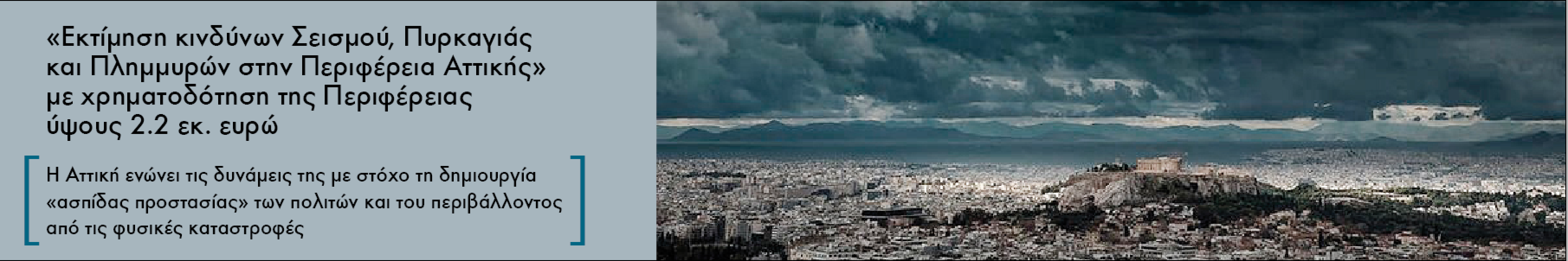
Την 1η Μαρτίου 2021, η Περιφέρεια Αττικής, το Εθνικό Αστεροσκοπείο Αθηνών (ΕΑΑ) και το Εθνικό και Καποδιστριακό Πανεπιστήμιο Αθηνών (ΕΚΠΑ), ένωσαν τις δυνάμεις τους υπογράφοντας τριμερή Προγραμματική Σύμβαση, με στόχο τη προστασία του πολίτη και του περιβάλλοντος από τις φυσικές καταστροφές και συγκεκριμένα, το Κέντρο Επιστημών Παρατήρησης της Γης και Δορυφορικής Τηλεπισκόπησης BEYOND του Εθνικού Αστεροσκοπείου Αθηνών, θα εκπονήσει έρευνα με τίτλο «Εκτίμηση κινδύνων Σεισμού, Πυρκαγιάς και Πλημμυρών στην Περιφέρεια Αττικής».

Η Περιφέρεια Αττικής θα αξιοποιήσει το έμπειρο επιστημονικό προσωπικό και την τεχνολογία αιχμής του Κέντρου Αριστείας BEYOND του Ινστιτούτου Αστρονομίας, Αστροφυσικής και Διαστημικών Εφαρμογών (ΙΑΑΔΕΤ) του ΕΑΑ, το οποίο θα συντάξει λεπτομερείς μελέτες κινδύνων από πυρκαγιά, πλημμύρα και σεισμό, και θα διαμορφώσει ένα αποτελεσματικό σχέδιο αντιμετώπισής τους  σε μια σειρά Δήμων της Περιφέρειας που επιλέχθηκαν με κριτήριο την τρωτότητα στους συγκεκριμένους κινδύνους.

Έρευνες αυτού του τύπου, για πολλαπλούς φυσικούς κινδύνους και σε κλίμακα οικισμού, θα διεξαχθούν για πρώτη φορά στη χώρα μας. Μέσω του έργου αυτού θα επιτευχθεί η δημιουργία πρωτότυπης γνώσης προς υποστήριξη της Περιφέρειας Αττικής στη βέλτιστη εφαρμογή του προβλεπόμενου Εθνικού Σχεδιασμού Πολιτικής Προστασίας και στην υποστήριξη του έργου των Συντονιστικών Οργάνων Πολιτικής Προστασίας.

Όμως γιατί επιλέχθηκε η Αττική για μια τέτοια έρευνα, ποιο είναι το πλαίσιο αυτής της συνεργασίας, ποια θα είναι τα αποτελέσματα του έργου και γιατί επιλέχθηκε το Κέντρο Επιστημών Παρατήρησης της Γης και Δορυφορικής Τηλεπισκόπησης BEYOND του ΕΑΑ/ΙΑΑΔΕΤ να είναι ένας από τους βασικούς φορείς υλοποίησης; Τελικά υπάρχουν επιστημονικά εργαλεία που μπορούν να συνεισφέρουν στην πολιτική προστασία; Οι απαντήσεις στα συγκεκριμένα ερωτήματα βρίσκονται παρακάτω:


pdf iconDownload the English version of the press release here

networkingBEYOND Center of Excellence covers the spectrum of coordination and support actions (CSA) in GEO domain. The Center is participating in important actions and strategies such as networking activities; exchange actions; cross-border access to open data and research infrastructure; studies; conferences; capacity building and training activities; EO roadmaps; and other relevant activities that leads and/or are being the basis of new research and developments at EU and international level.

In Horizon 2020, the EC wanted to simplify the list of possible types of actions, and so the various collaborative project actions have been reduced to two major types: 'Innovation actions' and 'Research and Innovation actions' (R&I).

R&I actions have research and development (R&D) activities as the core of the project, which intend to establish new scientific and technical knowledge and/or explore the feasibility of a new or improved technology, product, process, service or solution. These activities may furthermore:

  • include basic and applied research, technology development and integration, testing and validation on a small-scale prototype in a laboratory or simulated environment.
  • contain closely connected but limited demonstration or pilot activities aiming to show technical feasibility in a near to operational environment. 

procurementBEYOND Center of Excellence has also competences in Pre-Commercial Procurement (PCP) and other procurement schemes in the GEO domain, in which among many assignments it gathers, analyzes and evaluates needs from the demand side (e.g. Public Authorities) and formalize them into requirements (e.g. set of use cases, Functional and not Functional requirements, metrics etc.). Hence, the main objective is to procure the development of those requirements and in parallel to safeguard incremental or radical innovation in the relevant domain (e.g. Marine, Civil Protection), by leveraging on existing Copernicus Services and other products from the Copernicus portfolio (e.g. raw data, DWH etc.).

In Horizon 2020, the EC wanted to simplify the list of possible types of actions, and so the various collaborative project actions have been reduced to two major types: 'Innovation actions' and 'Research and Innovation actions' (R&I).

The Innovation actions primarily consist of activities directly aiming at producing plans and arrangements or designs for new, altered or improved products, processes or services. They may include prototyping, testing, demonstrating, piloting, large-scale product validation and market replication

agricultureAgriculture monitoring, for the purposes of food security, control of the implementation of sustainable agriculture policies and the improvement of the overall agricultural productivity, is a top priority for the European Union. In this broad domain, BEYOND Center of Excellence has advanced its technical capacities in the development of tailored Earth Observation (EO) based services for agriculture monitoring, addressing the diverse thematic areas of food security, monitoring of the Common Agricultural Policy (CAP) and smart/precision farming.

More specifically the Center has successfully applied and developed state-of-the-art algorithms, machine learning and AI techniques.

The BEYOND team, within the framework of the H2020 project RECAP, has developed a fully automated earth observation system for the monitoring of the Common Agricultural Policy (CAP). Specifically, RECAP aims to improve the remote monitoring of CAP Cross Compliance and Greening obligations to assist the Paying Agency inspection processes and at the same time offer farmers a tool supporting them to understand and better comply with the rules. In RECAP, we collected and analyzed datasets from the various Paying Agencies, members of the consortium. Utilizing this unique data received by the Paying Agencies and Copernicus Sentinel data (Sentinel-2) we have developed a novel parcel-based machine learning processing workflow for classifying crops, therefore directly addressing the crop diversification requirements of the CAP. We have also developed a runoff risk assessment, at parcel level, according to the Statutory Management Requirements (SMR 1) of the policy. Finally, we have developed a burn scar-mapping algorithm for the detection of stubble burning (GAEC 6), using Sentinel-2 data. Our work in RECAP has been published in http://www.mdpi.com/2072-4292/10/6/911.

The BEYOND team now seeks to extend and scale up the application of the RECAP crop monitoring scheme. This will be done by incorporating big data technologies and other mature ICT solutions for the monitoring of Food Security at national and even continental scales, this time under the scope of the H2020 project EOPEN (rice production in South Korea). Fusion of Sentinel-1 (SAR polarimetry) and Sentinel-2 data is explored, for the generation of very dense temporal profiles. In EOPEN we address the notion of big data in multiple dimensions; with respect to 1) the area of application - national and international scale, 2) the spatial resolution of thematic information, 3) the volume of data (national scale mosaics of dense time-series of S-1 and S-2), 4) computational efficiency (big data processing technologies).


solarThe EU revised Renewable Energy Directive establishes an overall policy for the production and promotion of energy from renewable sources in the EU. It requires the EU to fulfill at least 27% of its total energy needs with renewables by 2030 – to be achieved through the attainment of individual national targets. The directive promotes cooperation amongst EU countries (and with countries outside the EU) to help them meet their renewable energy targets through innovative actions and products that are targeting on the maximization of renewable (e.g. solar) energy exploitation. Within the BEYOND Center of Excellence a nowcasting system and short term forecasting system for solar energy exploitation has been developed using advanced technical capacities of Earth Observation (EO) based services in combination with scientific measurement and radiative transfer and neural network modeling results. The system (SENSE) has been already demonstrated and used within the Geo-Cradle EU funded project and targets, transmission and distribution energy operators in a European, Middle East and north Africa domains, private and national bodies, ministries and related stakeholders and the public through public awareness systems and initiatives.

climateUnderstanding the Earth system, its weather, climate, atmosphere, and natural/human-induced hazards is crucial to protecting the global environment, reducing disaster losses, and achieving sustainable development. Observations of the Earth system and its atmosphere from ground and space constitute the most critical input for advancing this understanding. The ground-sector lidar developments foreseen in BEYOND enforced ground-based monitoring activities in the Mediterranean, a geographical area of great importance in terms of aerosol and cloud properties.

The scientific results foreseen are expected to fill observational gaps and add on validation efforts of atmospheric satellite products. Atmospheric models that integrated on BEYOND provide forecasting services related to natural environmental disasters such as smoke dispersion associated with forest fires, volcanic ash advection and desert dust outbreaks.

disastersThe rapid changes in climate over the last decades, together with the explosion of human population, have shaped the context for a fragile biosphere, prone to natural and manmade disasters that result in massive flows of environmental immigrants and great disturbances of ecosystems. Nowadays, the great disasters (e.g. the Indonesian tsunami in 2004, the Fukushima nuclear disaster in 2011, the European Heat Wave in 2003, the Greece's wildfires in 2007, the Earthquake of Nepal) have shown great evidence for high quality Earth Observation (EO) services as it regards disaster and emergency management, and risk reduction (DRR & EMS). The EO community has initiated large scale initiatives in order to: a) generate operational EO services with direct impact in the biosphere and useful to the societies, b) stimulate wider participation of the society including local authorities, volunteers, NGOs, and after all the citizens, enabling the Openness effect and promoting the Open Innovation paradigm, and c) utilize the rapidly growing technologies associated with web, social media, mobile, Crowdsourcing and Participatory Sensing.

epidemicsv1

Mosquito-Borne Diseases (MBDs) infect almost 700 million people every year and are recognized in over 100 countries, causing millions of deaths annually. The changing climatic and ecological conditions, global travel and trade, human behavior, as well as the rapid and unplanned urbanization, are key factors that influence the seasonal and geographic distribution of vectors' population and therefore the transmission of the pathogens, causing the re-emerging and even more emerging of these diseases in countries where they were previously unknown. West Nile Virus (WNV) infection in humans and animals have been recorded in various areas of Greece, during the years 2010-2014 and 2017-2019, but also in other regions in Europe reaching an usually high record in 2018.

BEYOND Center of excellence has been working on the development of an Early Warning System (EWS) that utilizes new and enhanced satellite Earth Observation (EO) sensors with the purpose of forecasting and risk mapping the WNV outbreaks. Satellite EO data have been leveraged to estimate environmental variables that influence the transmission cycle of the pathogen that leads to WNV. The management and analysis of the open big satellite data has been conducted with the Open Data Cube (ODC), providing an open and freely accessible exploitation architecture. Statistical and machine learning algorithms were used for short-term forecast, while dynamical models were utilized for the seasonal forecast. This EWS for epidemics will be used as a tool for helping local decision-makers to improve health system responses, take preventive measures in order to curtail the spread of WNV in Europe and address the relevant priorities of the Sustainable Development Goals (SDGs) such as good health and well-being (SDG 3) and climate action (SDG 13).

capacity

BEYOND Center leverages on the long lasting experiences gained through competitive frameworks (FP7, H2020, ESA) and education activities (Master of Science in Space Science Technologies and Applications), in providing targeted Capacity Building activities for a broad range of interested stakeholders (e.g. Governmental bodies, Local Agencies, International Financial Institutes etc.). BEYOND through the plethora of knowledge, content and education material has anticipated in organizing Capacity Building and training events (e.g. Workshops, Webinars etc.) in providing insights on Earth Observation research and developed applications in various domains (e.g. Disasters, Energy, Agriculture Climate Change etc.).

See our training activities at http://beyond-eocenter.eu/index.php/about-us/training


The Center BEYOND, has a well-accepted and validated recognition in the provision of research and operational services in the framework of the European Union's Global Monitoring for Environment and Security Program namely Copernicus (former GMES), and to the European Space Agency (ESA). The emphasis of the Center's activity is on Emergency Response (Copernicus/Emergency Management Support), monitoring and protection of the Marine and Atmospheric Environment, as well as applications of Agriculture, Renewable Energy, and Climate Change and its impact on quality of citizens' life (e.g. natural disasters).

The BEYOND sub-systems FireHub, FloodHub, and GeoHub were developed for real-time delivery of space based services, for early detection, continuous monitoring, and management of natural disasters, the monitoring of active forest fires, flood events and seismic/volcanic risks, as well as damage assessments in rush and off-line mode. These services are routinely used by many environmental and civil protection organizations in Greece, and worldwide including EU bodies, namely the European Forest Fire Information System/EFFIS, the Global Fire Monitoring Center (GFMC), the European Copernicus/EMS Program, in a large number of Civil Protection Authorities in Europe, Africa, Latin America, Asia, and authorities as the Fire Brigade Body in Greece, the Directorate and Natural Environment Protection (Ministry of Environment), the Public Forestry Services, the Directorate for Planning and Disaster Response of the General Secretariat of Civil Protection, the Department for Natural Disasters Recovery (Min of Infrastructure and Transport), etc.

Indicatively, only over the period 2016-2018 the BEYOND Center has been activated through the Copernicus EMS program from more than 13 Civil Protection Authorities around the world, in order to address timely risk assessments across a wide range of natural disasters such as earthquakes, volcanoes, landslides, slope and coastal erosion, fires, floods, toxic gas emissions, smoke dispersion and industrial accidents.

The BEYOND Center has been selected by the EU to offer real-time satellite based active fire detection and fire-damage assessment services (FireHub) for the needs of the European Forest Fire Information System (EFFIS).

Copernicus EMS - Mapping provides all actors involved in the management of natural disasters, man-made emergency situations and humanitarian crises, with timely and accurate geospatial information derived from satellite remote sensing and completed by available in situ or open data sources. The information generated by the service can be used as supplied (e.g. as digital or printed map outputs). It may be further combined with other data sources (e.g. as digital feature sets in a geographic information system). In both cases it may support geospatial analysis and decision making processes of emergency managers. Copernicus EMS - Mapping is provided during all phases of the emergency management cycle, in two temporal modes, and free of charge for the users. It can be activated only by authorized users.

The infrastructure and excellence developed in the BEYOND Center of Excellence are actively involved in the provision of Risk & Recovery Mapping which consists of the on-demand provision of geospatial information in support of Emergency Management activities related to Emergency Support. This applies in particular to activities dealing with prevention, preparedness, disaster risk reduction and recovery phases. There are three broad product categories: Reference Maps, Pre-disaster Situation Maps and Post-disaster Situation Maps. The research developed in BEYOND, exploits satellite data and ingests fusions of geo-partial information and data in rush mode, when, where needed, for enhanced risk modelling and improved assessment of the expected disaster impacts.

The list of methodologies developed, adapted, validated, and used in BEYOND to address risk and recovery needs of the civil protection authorities worldwide are listed below (in more details in ANNEX III):

  • Seismic Methodologies: Seismic Hazard, Seismic Vulnerability, Seismic Vulnerability of Pipelines, Seismic Risk.
  • Lava Flow Methodologies: Lava Flow Hazard, Lava Flow Vulnerability, Lava Flow Risk.
  • Forest Fires Methodologies: Fire Damage Delineation & Burn Severity Grading, Damage/Biomass Loss Statistics, Forest Fire Hazard, Population & Assets Vulnerability to Forest Fires, Forest Fire Risk – Population, Assets and Transportation Network at risk.
  • Industrial Accidents Methodologies: Industrial Accidents Hazard, Industrial Accidents Exposure, Industrial Accidents Risk.
  • Tsunami Methodologies: Tsunami Hazard Assessment, Assets Vulnerability to Tsunami, Storm Surge Hazard Risk.
  • Soil Erosion Methodology: Soil Erosion Hazard.
  • Coastal Erosion Methodology: Coastal Erosion Vulnerability.
  • Ground Deformation Methodology: Ground Deformation Dynamics.
  • Landslides Methodology: Landslide Hazard, Landslide Vulnerability, Landslide Risk.
  • Subsidence and Landslide Methodology: Subsidence and Landslide Risk.
  • Floods Methodology: Flood Delineation at peak conditions, Flood Depth at peak conditions, Flood Damage Assessment, Flood Hazard, Flood Vulnerability, Flood Risk, Flash Flood Hazard triggered by earthquakes, Flash Flood Risk triggered by earthquakes.
  • Disruption of Transportation Networks Methodology: Vulnerability of Disruption of Transportation Networks.

Up to now the BEYOND Center has been activated in the framework of the COPERNICUS EMERGENCY MANAGEMENT SERVICE in the following worldwide disaster risk and recovery cases :

An overview of missons in which UAVs were used to record raw data flighting above the affected from natural disasters areas; and to map and to assess the damages caused.