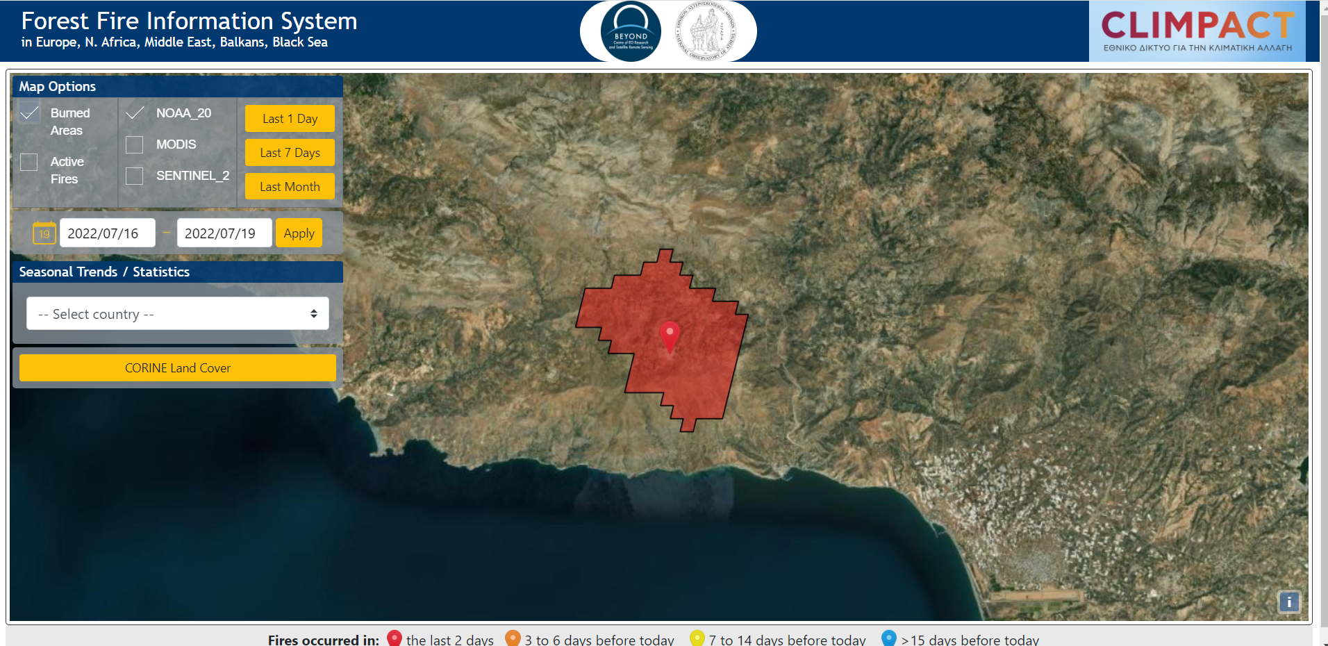
Αρχική εκτίμηση της καμένης έκτασης για την πυρκαγιά στις Μέλαμπες Ρεθύμνου - 16Ιουλίου 2022
Αρχική εκτίμηση της καμένης έκτασης για την πυρκαγιά στις Μέλαμπες Ρεθύμνου - 16Ιουλίου 2022
Πυρκαγιά βρίσκεται σε εξέλιξη σε χορτολιβαδική έκταση, στην περιοχή Κρύα Βρύση Αγίου Βασιλείου Ρεθύμνου. περιοχή η οποία ήταν σε πολύ υψηλή επικινδυνότητα σύμφωνα με τον ημερήσιο χάρτη πρόβλεψης κινδύνου πυρκαγιάς της Επιχειρησιακής μονάδας BEYOND του ΙΑΑΔΕΤ/ΕΑΑ. Το γεγονός ανιχνεύθηκε από το FireHUB του BEYOND στις 11:10 τοπική ώρα.
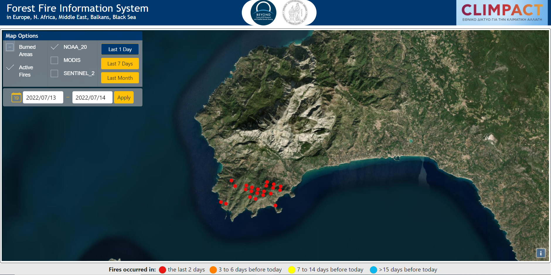
Ενεργές εστίες φωτιάς στο Παλαιοχώρι Σάμου - 14 Ιουλίου 2022
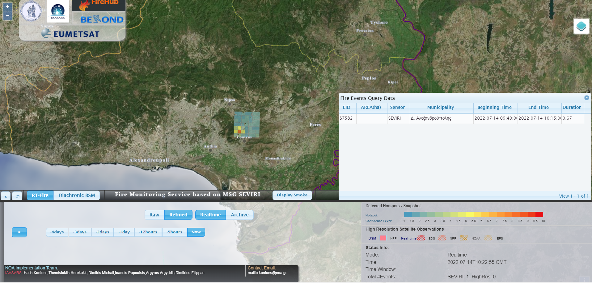
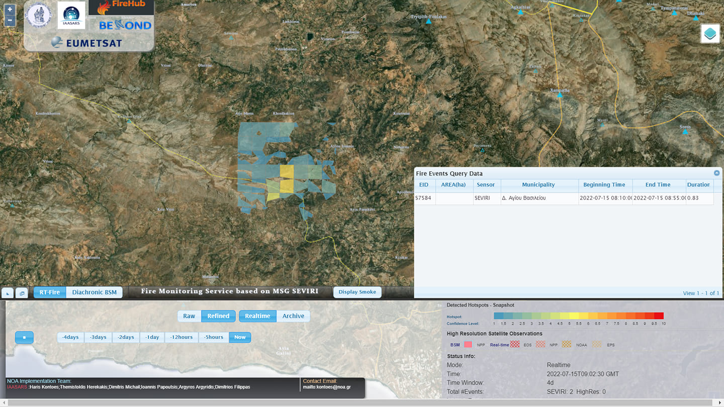
Πυρκαγιά βρίσκεται σε εξέλιξη σε δασική έκταση στην περιοχή Αρίστηνο Έβρου, περιοχή η οποία ήταν σε πολύ υψηλή επικινδυνότητα σύμφωνα με τον ημερήσιο χάρτη πρόβλεψης κινδύνου πυρκαγιάς της Επιχειρησιακής μονάδας BEYOND του ΙΑΑΔΕΤ/ΕΑΑ. Το γεγονός ανιχνεύθηκε από το FireHUB του BEYOND στις 12:40 τοπική ώρα.
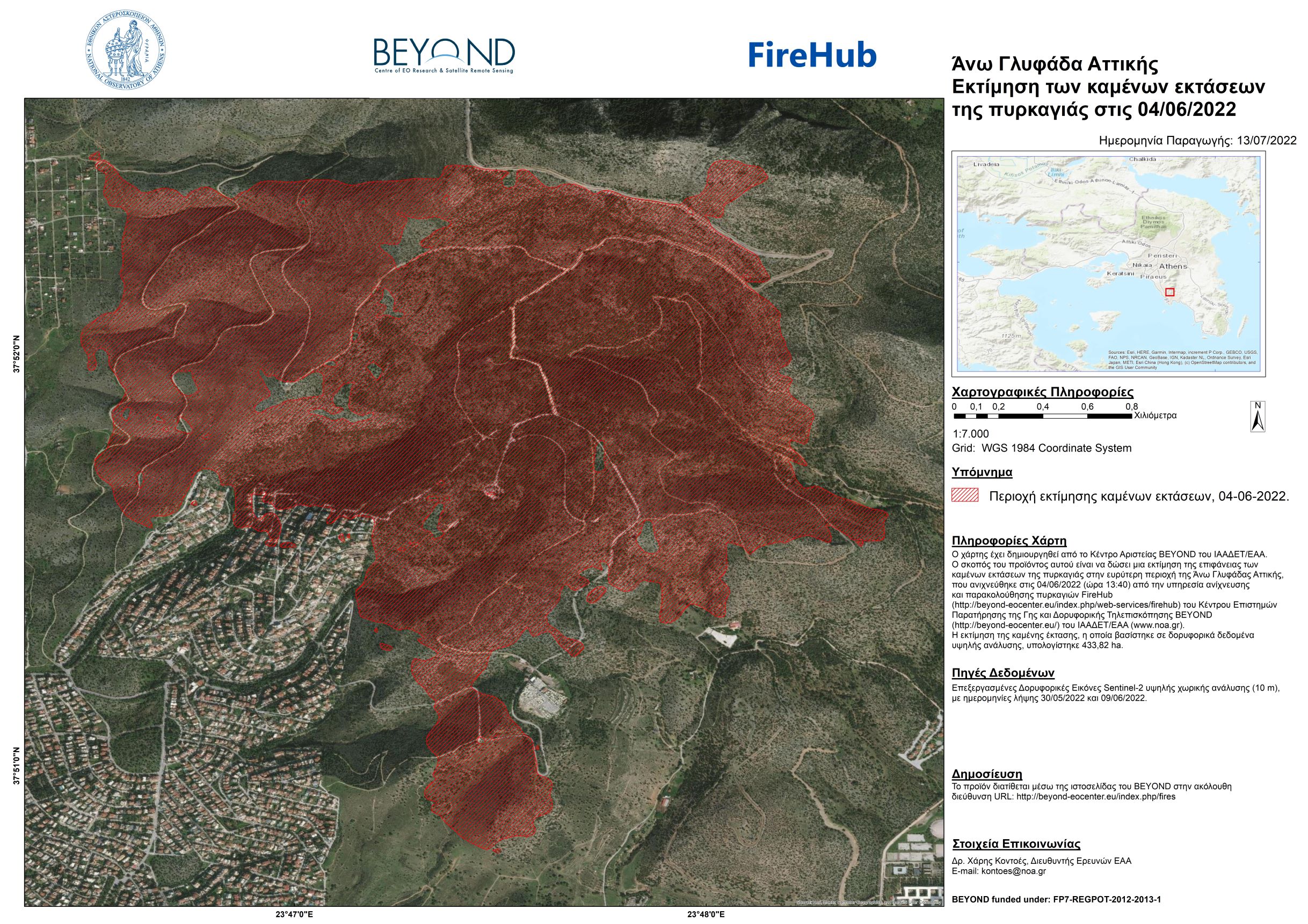
Εκτίμηση καμένων εκτάσεων - Άνω Γλυφάδα 4/6/2022
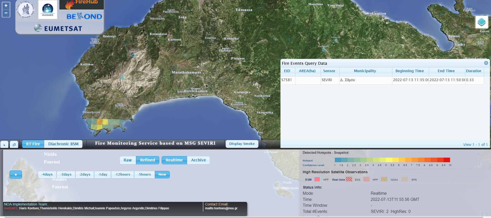
#Πυρκαγιά βρίσκεται σε εξέλιξη στο Παλαιοχώρι Σάμου. Το γεγονός ανιχνεύθηκε από το FireHUB της Επιχειρησιακής μονάδας BEYOND του ΙΑΑΔΕΤ/ΕΑΑ στις 14:35 τοπική ώρα.
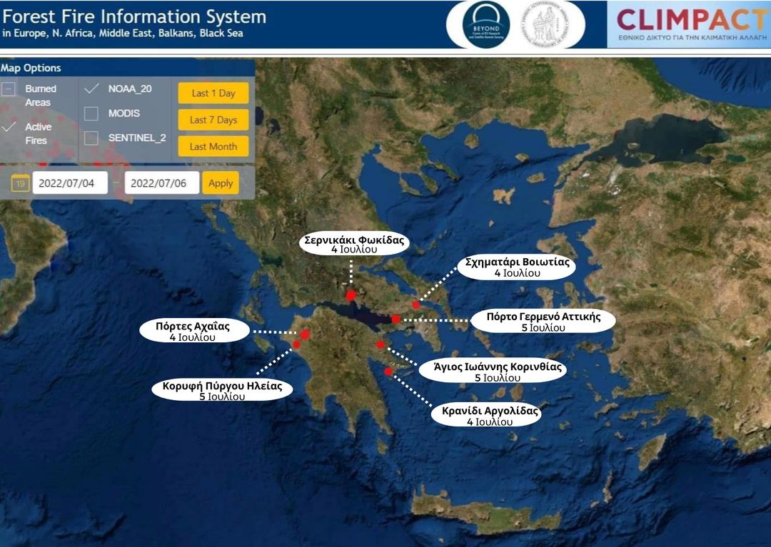
Ενεργές εστίες φωτιάς που κατεγράφησαν στη χώρα μας το διάστημα 04-06 Ιουλίου 2022
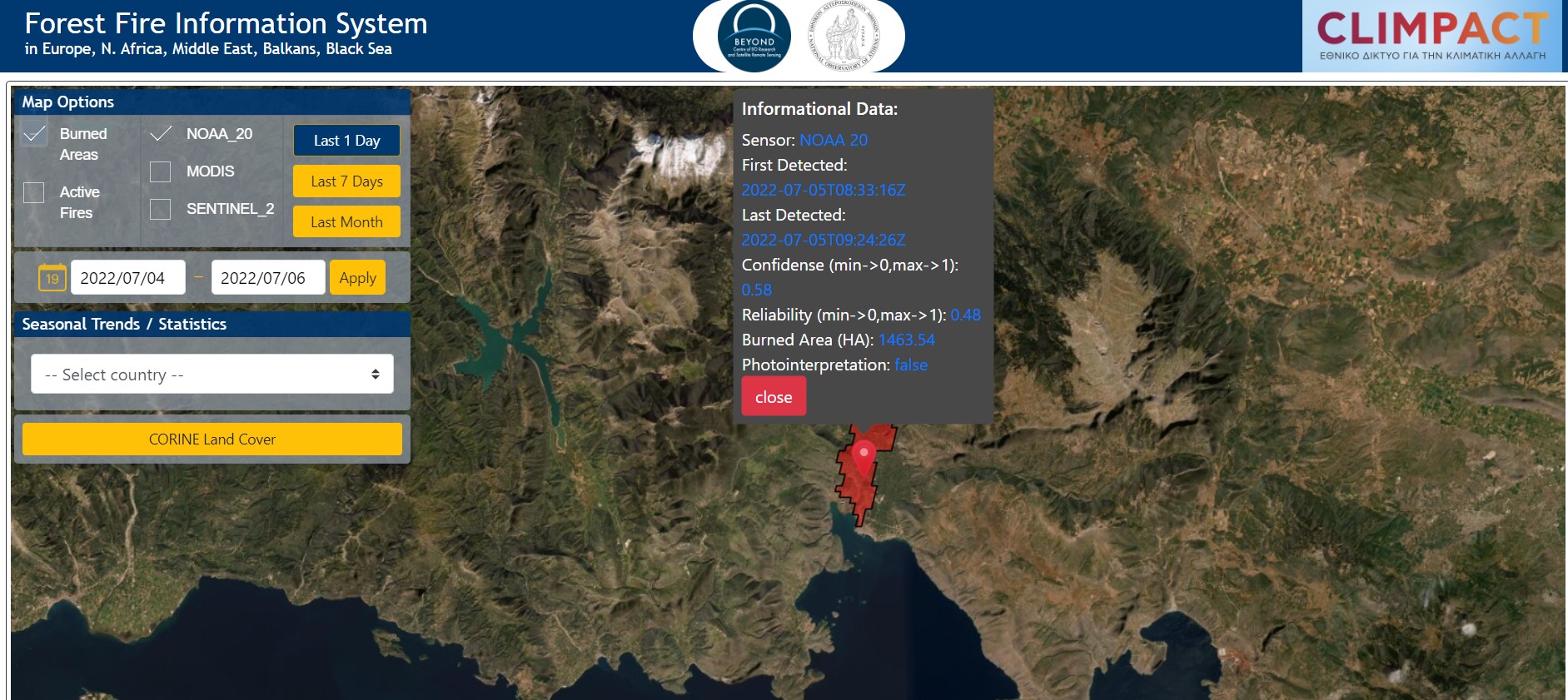
Αρχική εκτίμηση καμένης έκτασης στο Σερνικάκι Φωκίδας του Δήμου Δελφών - 4 Ιουλίου 2022
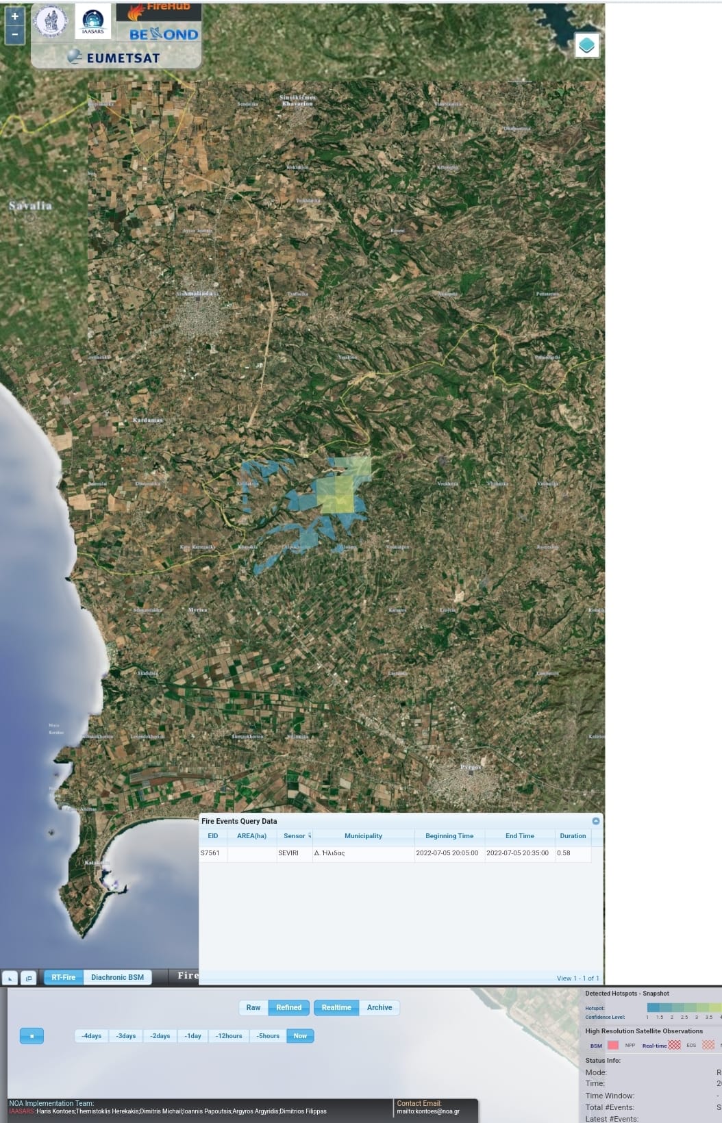
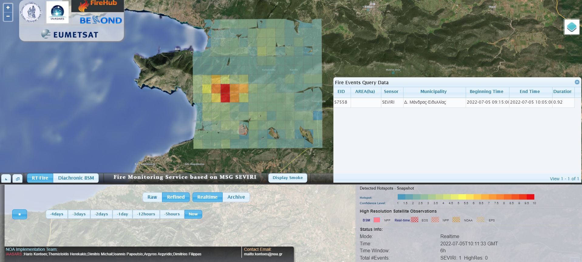
Πυρκαγιά βρίσκεται σε εξέλιξη σε δασική έκταση στην περιοχή Κορυφή Πύργου Ηλείας. #Πυρκαγιά βρίσκεται σε εξέλιξη σε δασική έκταση στην περιοχή Κορυφή Πύργου Ηλείας. Το γεγονός ανιχνεύθηκε από το FireHUB της Επιχειρησιακής μονάδας BEYOND του ΙΑΑΔΕΤ/ΕΑΑ στις 23:05 τοπική ώρα.
Πυρκαγιά βρίσκεται σε εξέλιξη σε δασική έκταση στο Πόρτο Γερμενό Αττικής, περιοχή η οποία ήταν σε πολύ υψηλή επικινδυνότητα σύμφωνα με τον ημερήσιο χάρτη πρόβλεψης κινδύνου πυρκαγιάς της Επιχειρησιακής μονάδας BEYOND του ΙΑΑΔΕΤ/ΕΑΑ. Το γεγονός ανιχνεύθηκε από το FireHUB του BEYOND στις 12:15 τοπική ώρα.
Copernicus EMS - Mapping provides all actors involved in the management of natural disasters, man-made emergency situations and humanitarian crises, with timely and accurate geospatial information derived from satellite remote sensing and completed by available in situ or open data sources. The information generated by the service can be used as supplied (e.g. as digital or printed map outputs). It may be further combined with other data sources (e.g. as digital feature sets in a geographic information system). In both cases it may support geospatial analysis and decision making processes of emergency managers. Copernicus EMS - Mapping is provided during all phases of the emergency management cycle, in two temporal modes, and free of charge for the users. It can be activated only by authorized users.
The infrastructure and excellence developed in the BEYOND Center of Excellence are actively involved in the provision of Risk & Recovery Mapping which consists of the on-demand provision of geospatial information in support of Emergency Management activities related to Emergency Support. This applies in particular to activities dealing with prevention, preparedness, disaster risk reduction and recovery phases. There are three broad product categories: Reference Maps, Pre-disaster Situation Maps and Post-disaster Situation Maps. The research developed in BEYOND, exploits satellite data and ingests fusions of geo-partial information and data in rush mode, when, where needed, for enhanced risk modelling and improved assessment of the expected disaster impacts.
The list of methodologies developed, adapted, validated, and used in BEYOND to address risk and recovery needs of the civil protection authorities worldwide are listed below (in more details in ANNEX III):
Up to now the BEYOND Center has been activated in the framework of the COPERNICUS EMERGENCY MANAGEMENT SERVICE in the following worldwide disaster risk and recovery cases :
An overview of missons in which UAVs were used to record raw data flighting above the affected from natural disasters areas; and to map and to assess the damages caused.