
The main earthquake event, Mw=7,8, occurred just after midnight, on Monday 13/11/2016, near the coastal community of Kaikoura-New Zealand, 93 kilometers NE of the city of Christchurch. A series of powerful aftershocks jolted New Zealand's South Island, triggering a tsunami and sending aftershocks across the country with at least two, officially reported, casualties. Shortly after the earthquake, four successive ascending Sentinel-1 Synthetic Aperture Radar images were acquired, two before (3/11/2016) the devastating earthquake and two after (15/11/2016).
The mapping unit of the BEYOND/NOA mosaicked the two SAR frames of the pre-event phase, and the two SAR frames of the post-event phase , in order to produce the full deformation pattern.
The first map shows the fringe pattern associated with the event, where each color cycle demonstrates phase difference of [-π π], interpreted as ground deformation equal to 2.8 cm in the direction to the satellite. The second map shows that maximum subsidence was roughly 3.7 m in the Line of sight (LOS) direction, while maximum observed uplift was 1.2m.
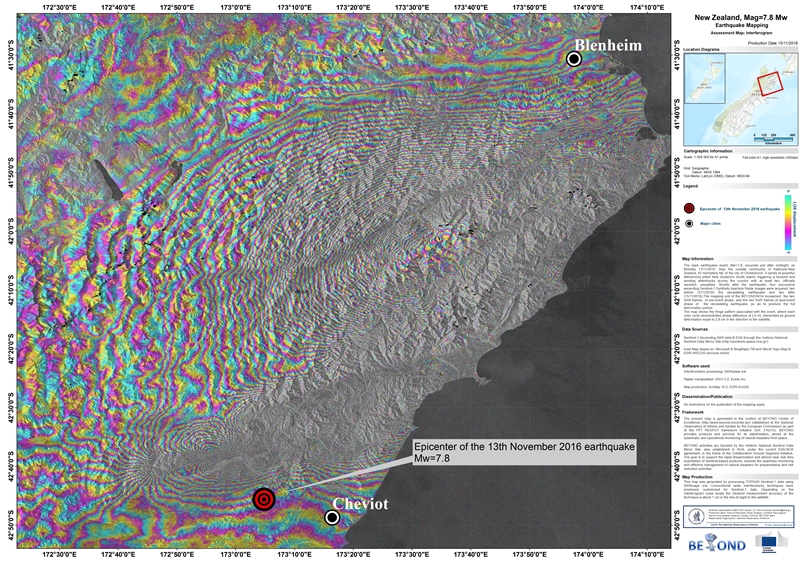
Figure 1: Fringe pattern associated with the earthquake, where each color cycle demonstrates phase difference of [-π π], interpreted as ground deformation equal to 2.8 cm in the direction to the satellite.
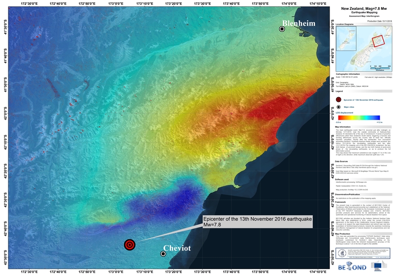
Figure 2: This image captures that maximum subsidence was roughly 3.7 m in the Line of sight (LOS) direction, while maximum observed uplift was 1.2m