
On 12/11/2017, late Sunday, an earthquake of magnitude 7.3 struck near the border of Iran and Iraq. At least 452 people were killed and thousands injured, while the earthquake was felt as far away as Turkey and Pakistan. Around 100 of the dead are believed to be from one town in Iran's Kermanshah province. Mapping of the surface deformation with Sentinel-1 data, available through the Greek Mirror Site (https://sentinels.space.noa.gr/).
Following major earthquake events, BEYOND through its GeoHub platform, activates an automatic processing workflow for the immediate and timely mapping of the earthquake impact. In the figures that follow, every fringe corresponds to 2.8 cm of line-of-sight deformation.
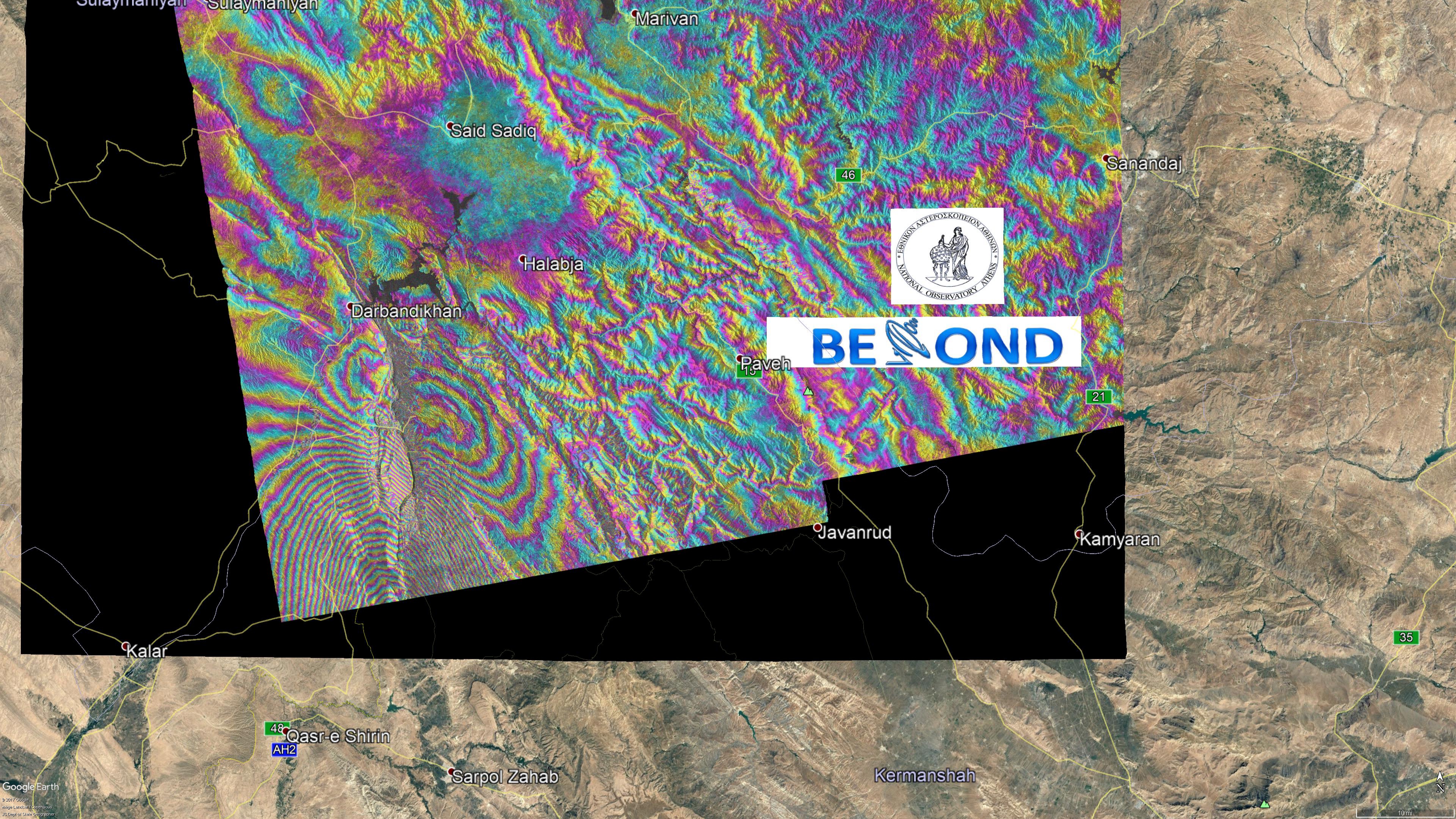
Figure 1: Co-seismic interferogram using descending Sentinel-1 data (download in kml)
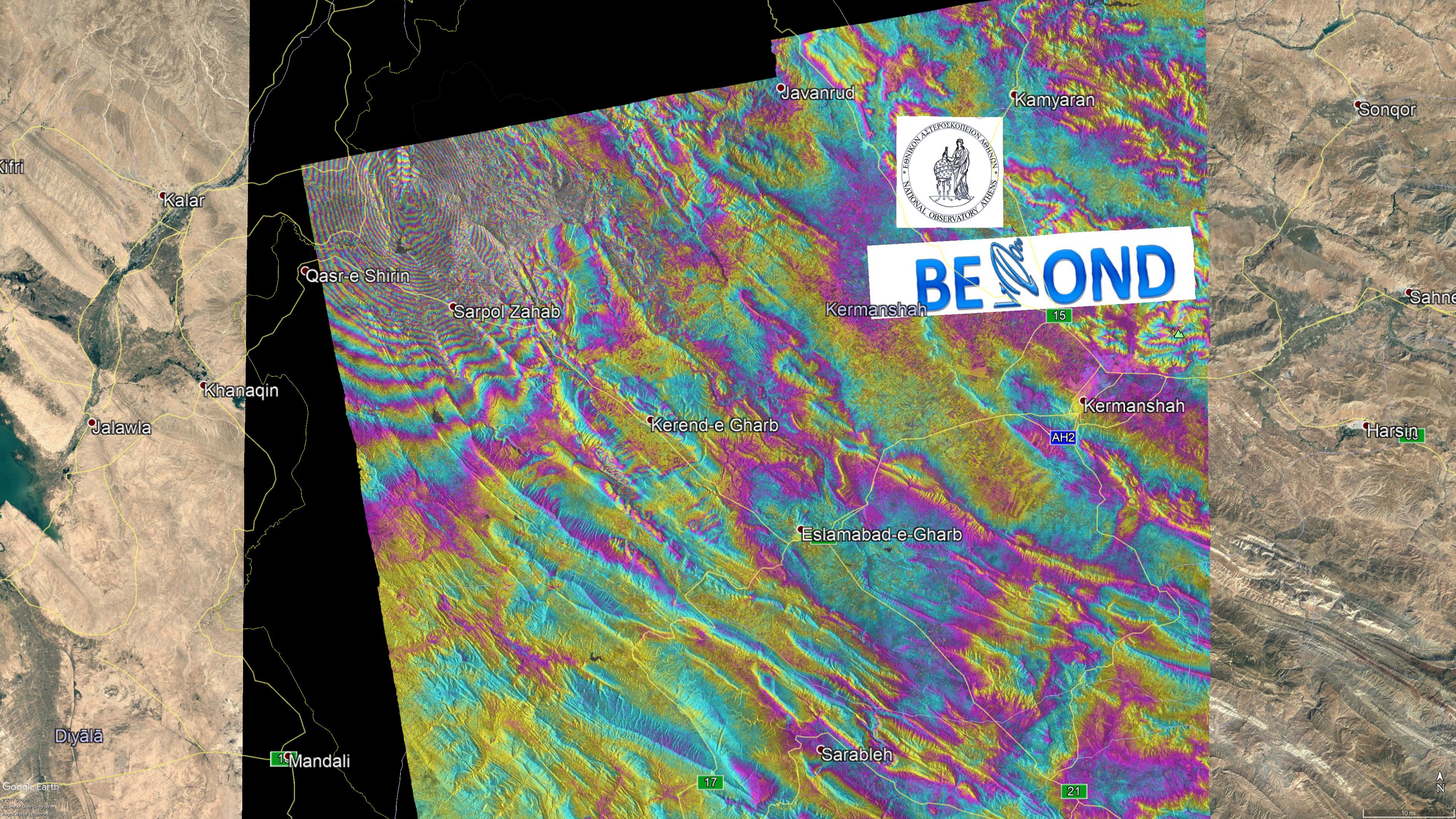
Figure 2: Co-seismic interferogram using ascending Sentinel-1 data (download in kml). North segment.
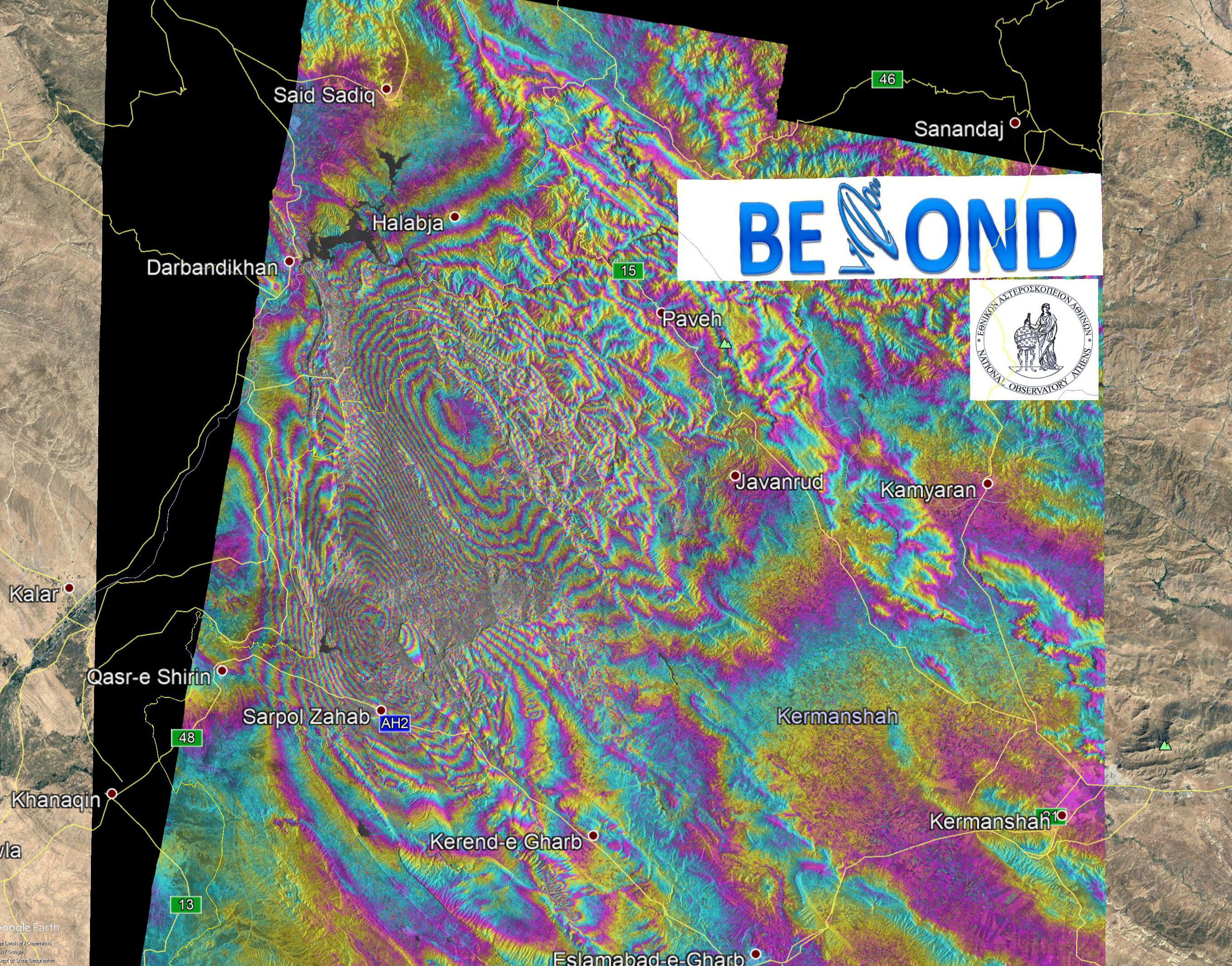
Figure 3: Co-seismic interferogram using ascending Sentinel-1 data (download in kml). South segment.