Λεπτομερής χαρτογράφηση καμένων εκτάσεων - Πυρκαγιά Σχίνος Κορινθίας 19/5/2021
Λεπτομερής χαρτογράφηση καμένων εκτάσεων - Πυρκαγιά Σχίνος Κορινθίας 19/5/2021
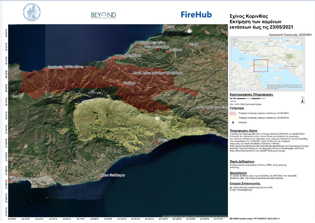
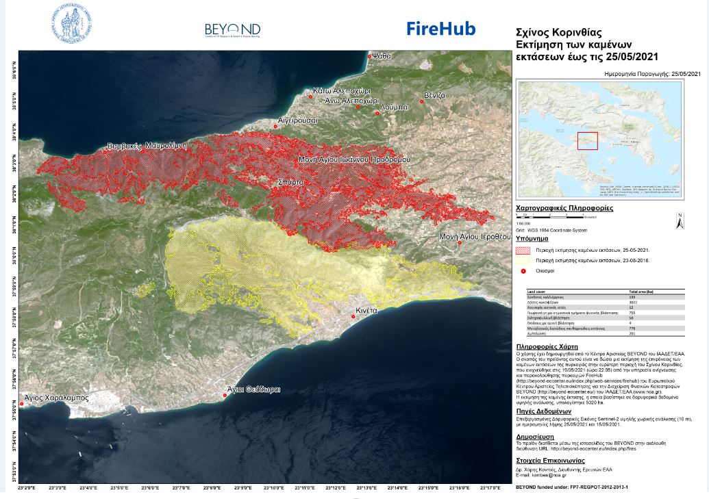
Δορυφορική εκτίμηση καμένων εκτάσεων - Πυρκαγιά Σχίνος Κορινθίας 19/5/2021
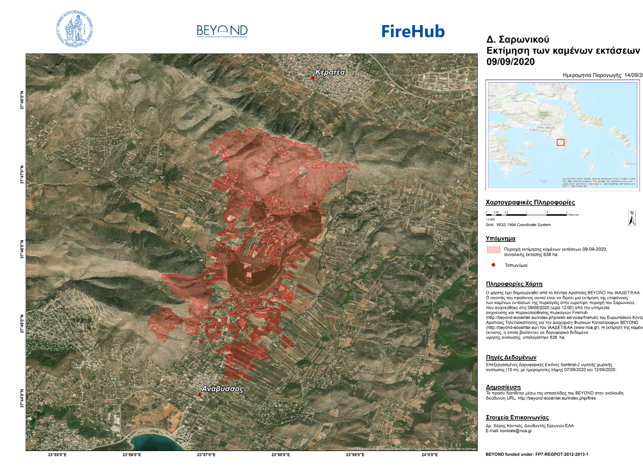
Λεπτομερής χαρτογράφηση της καμένης έκτασης στο Δήμο Σαρωνικού.
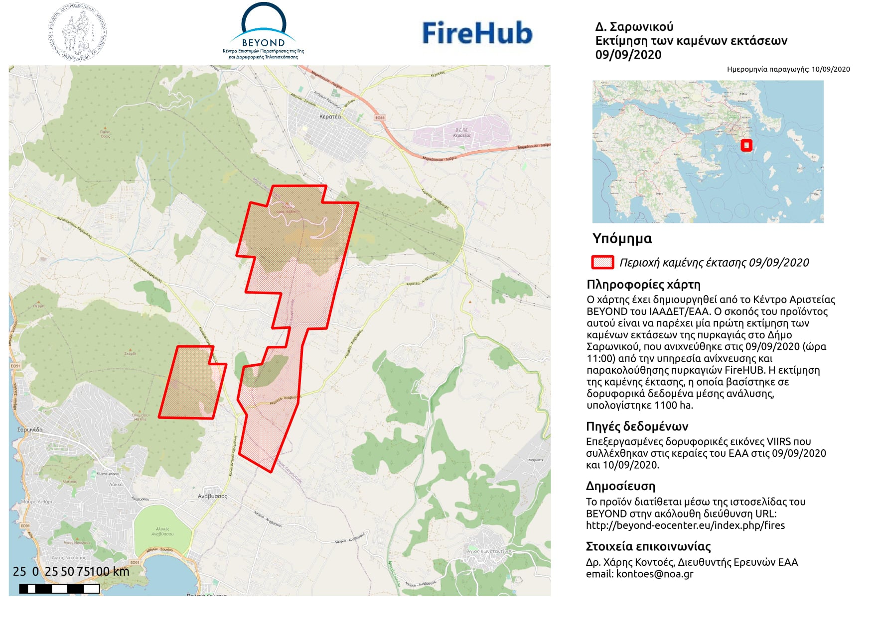
Πρώτος απολογισμός της πυρκαγιάς στην Κερατέα Αττικής, 9 Σεπτεμβρίου 2020.
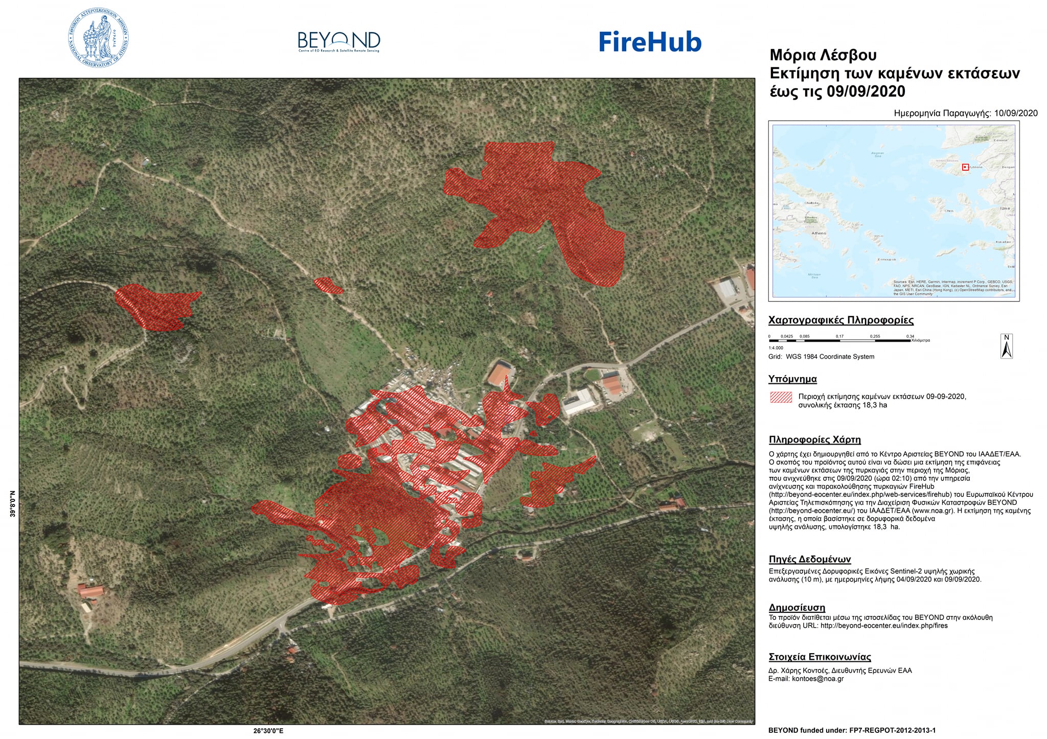
To Κέντρο Επιστημών Παρατήρησης της Γης και Δορυφορικής Τηλεπισκόπησης BEYOND του ΙΑΑΔΕΤ/ Εθνικό Αστεροσκοπείο Αθηνών δημοσιεύει σήμερα περισσότερα στοιχεία για την πυρκαγιά που ξέσπασε στη Μόρια της Λέσβου.
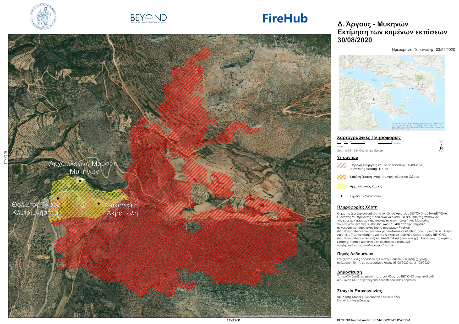
To Κέντρο Επιστημών Παρατήρησης της Γης και Δορυφορικής Τηλεπισκόπησης BEYOND του ΙΑΑΔΕΤ/ Εθνικό Αστεροσκοπείο Αθηνών δημοσιεύει σήμερα περισσότερα στοιχεία για την μεγάλη πυρκαγιά που ξέσπασε στις 30 Αυγούστου 2020 στην Δ/Ε Μυκηναίων του δήμου Άργους-Μυκηνών.
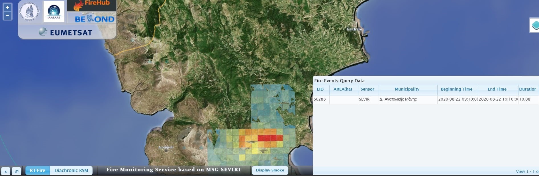
To Κέντρο Επιστημών Παρατήρησης της Γης και Δορυφορικής Τηλεπισκόπησης BEYOND του ΙΑΑΔΕΤ/ Εθνικό Αστεροσκοπείο Αθηνών δημοσιεύει σήμερα περισσότερα στοιχεία για την μεγάλη πυρκαγιά που ξέσπασε στις 22 Αυγούστου 2020 στη δασική περιοχή Λαγκάδα του δήμου Ανατολικής Μάνης Λακωνίας.
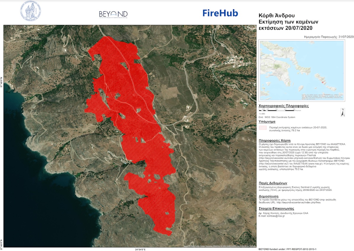
To Kέντρο Αριστείας BEYOND του Εθνικού Αστεροσκοπείου Αθηνών μέσω του συστήματος #FIREHUB εντόπισε την έναρξη της πυρκαγιάς στην περιοχή Κορθίου της Άνδρου από τα πρώτα κιόλας λεπτά που εκδηλώθηκε, 20/07/2020, ώρα 12:30 τοπική.
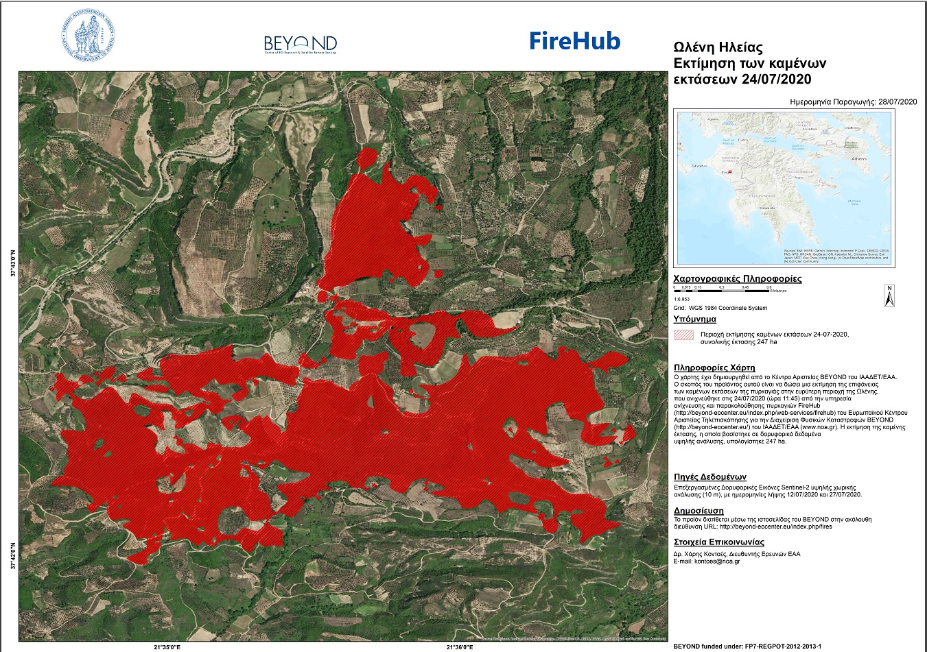
To Kέντρο Αριστείας BEYOND του Εθνικού Αστεροσκοπείου Αθηνών μέσω του συστήματος #FIREHUB εντόπισε την έναρξη της πυρκαγιάς στην περιοχή Ωλένη Ηλείας από τα πρώτα κιόλας λεπτά που εκδηλώθηκε, 24/07/2020, ώρα 11:45 τοπική.
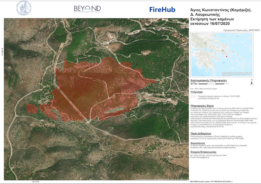
To Kέντρο Αριστείας BEYOND του Εθνικού Αστεροσκοπείου Αθηνών μέσω του συστήματος #FIREHUB εντόπισε την έναρξη της πυρκαγιάς στην περιοχή του Κάτω Σουνίου στο Λαύριο από τα πρώτα κιόλας λεπτά που εκδηλώθηκε (12.40 , τοπική ώρα).
Copernicus EMS - Mapping provides all actors involved in the management of natural disasters, man-made emergency situations and humanitarian crises, with timely and accurate geospatial information derived from satellite remote sensing and completed by available in situ or open data sources. The information generated by the service can be used as supplied (e.g. as digital or printed map outputs). It may be further combined with other data sources (e.g. as digital feature sets in a geographic information system). In both cases it may support geospatial analysis and decision making processes of emergency managers. Copernicus EMS - Mapping is provided during all phases of the emergency management cycle, in two temporal modes, and free of charge for the users. It can be activated only by authorized users.
The infrastructure and excellence developed in the BEYOND Center of Excellence are actively involved in the provision of Risk & Recovery Mapping which consists of the on-demand provision of geospatial information in support of Emergency Management activities related to Emergency Support. This applies in particular to activities dealing with prevention, preparedness, disaster risk reduction and recovery phases. There are three broad product categories: Reference Maps, Pre-disaster Situation Maps and Post-disaster Situation Maps. The research developed in BEYOND, exploits satellite data and ingests fusions of geo-partial information and data in rush mode, when, where needed, for enhanced risk modelling and improved assessment of the expected disaster impacts.
The list of methodologies developed, adapted, validated, and used in BEYOND to address risk and recovery needs of the civil protection authorities worldwide are listed below (in more details in ANNEX III):
Up to now the BEYOND Center has been activated in the framework of the COPERNICUS EMERGENCY MANAGEMENT SERVICE in the following worldwide disaster risk and recovery cases :
An overview of missons in which UAVs were used to record raw data flighting above the affected from natural disasters areas; and to map and to assess the damages caused.