Energy Droughts and Climate Risk in Mediterranean Renewables: Operational Insights from the E-DREAM Project
Energy Droughts and Climate Risk in Mediterranean Renewables: Operational Insights from the E-DREAM Project
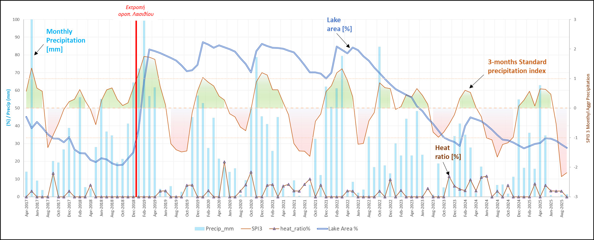
Γράφημα 1: Επιφάνεια του Ταμιευτήρα Αποσελέμη και Κλιματικοί Δείκτες Ξηρασίας (2017–2025)
Το υδροδοτικό σύστημα της βόρειας Κρήτης ενισχύεται από τον ταμιευτήρα Αποσελέμη, ο οποίος υποστηρίζει την ύδρευση της ευρύτερης περιοχής Ηρακλείου–Χερσονήσου–Μαλίων και έως Αγ. Νικόλαο–Ελούντα. Η πλήρωση του ταμιευτήρα βασίζεται σε δύο κύριες πηγές:
Η υπηρεσία FloodHUB της Επιχειρησιακής Μονάδας BEYOND του ΙΑΑΔΕΤ/ΕΑΑ εκπόνησε διαχρονική αξιολόγηση των υδρολογικών και κλιματικών συνθηκών στον ταμιευτήρα Αποσελέμη (και στη συνδεδεμένη τροφοδοσία από το Οροπέδιο Λασιθίου), ώστε να εκτιμηθεί ο βαθμός υδρολογικής πίεσης και ξηρασίας στο σύστημα για δεύτερο εξάμηνο του 2025.
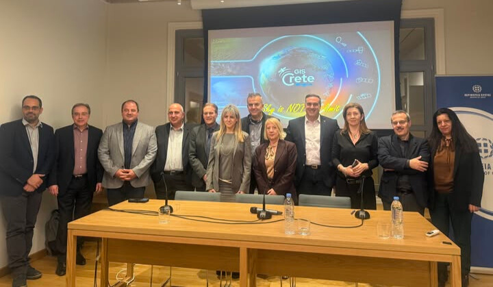
Τον καθοριστικό ρόλο των δορυφορικών τεχνολογιών και της Παρατήρησης της Γης στη στήριξη δημόσιων πολιτικών, τη βιώσιμη ανάπτυξη και τη βελτίωση της ποιότητας ζωής των πολιτών ανέδειξε η επιστημονική–ενημερωτική εκδήλωση με τίτλο «Η Κρήτη από ψηλά: Δορυφορική τηλεπισκόπηση και εφαρμογές για την Πολιτεία και τον Πολίτη», που πραγματοποιήθηκε την Τετάρτη 10 Δεκεμβρίου 2025 στο Κέντρο Επιστήμης και Πολιτισμού του Ιδρύματος Τεχνολογίας και Έρευνας (ΙΤΕ), στο Ηράκλειο. Ιδιαίτερο ενδιαφέρον παρουσίασε η ομιλία του Δρος Χάρη Κοντοέ, Διευθυντή Ερευνών και επικεφαλής της Επιχειρησιακής Μονάδας BEYOND του Ινστιτούτου Αστρονομίας, Αστροφυσικής, Διαστημικών Εφαρμογών και Τηλεπισκόπησης (ΙΑΑΔΕΤ) του Εθνικού Αστεροσκοπείου Αθηνών.
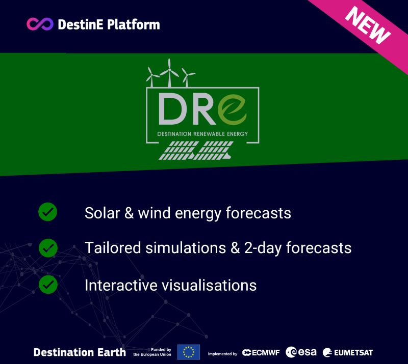
The Destination Renewable Energy (DRE) Service forecasts and assesses solar and wind energy potential using real-time and historical data, offering tailored simulations, 2-day forecasts, and interactive visualizations through the secure digital platform of Destination Earth.
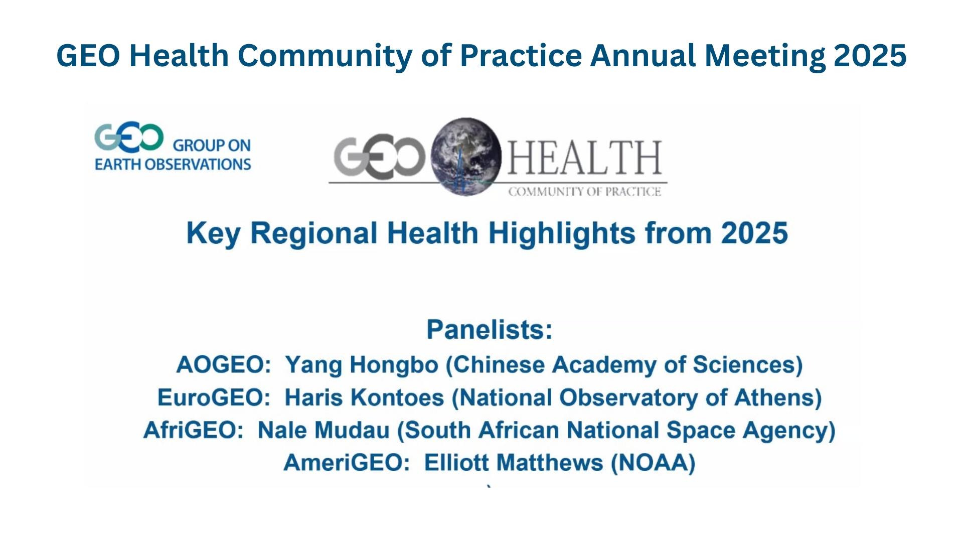
The Group on Earth Observations (GEO) Health Community of Practice (CoP) opened Day 1 of its 2025 Annual Meeting, virtually, on December 8th, bringing together global experts to discuss operational pathways for advancing One Health within the GEO Post-2025 Strategy. During the Key Regional Health Highlights 2025 Session, insights from four (4) regional GEO initiatives were featured, including a high-impact contribution from Dr. Haris Kontoes, Research Director of the National Observatory of Athens / Operational Unit BEYOND Centre for Earth Observation Research and Satellite Remote Sensing, representing EuroGEO.
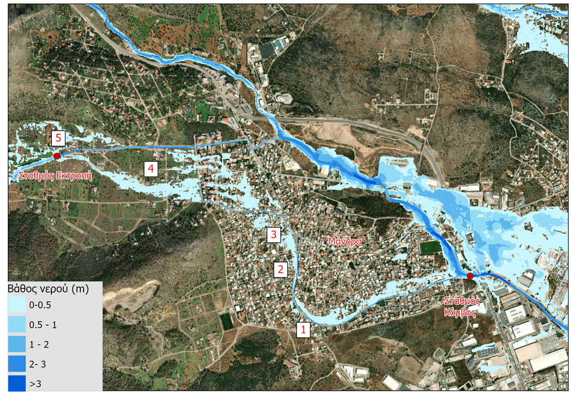
Το Επιχειρησιακό Σύστημα Χαρτογράφησης Πλημμυρών και Έγκαιρης Προειδοποίησης FloodHUB της Επιχειρησιακής Μονάδας BEYOND του Εθνικού Αστεροσκοπείου Αθηνών (ΕΑΑ) παρείχε καθόλη τη διάρκεια της κακοκαιρίας Byron (4-5/12/2025) αξιόπιστη προσομοίωση και παραγωγή επιχειρησιακής εικόνας της πλημμύρας στην Μάνδρα κάθε πέντε λεπτά της ώρας.
Ρεπορτάζ στην Καθημερινή: «Δήμοι και Περιφέρεια γνωρίζουν με ακρίβεια ποιες οδοί θα πλημμυρίσουν»
Τα επικίνδυνα σημεία της Αττικής, στα οποία πρέπει να γίνουν αντιπλημμυρικές παρεμβάσεις καθώς και σενάρια διαφυγής πολιτών σε ακραίες περιπτώσεις, έχει διαθέσει στην Τοπική Αυτοδιοίκηση η Επιχειρησιακή Μονάδα BEYOND του Εθνικού Αστεροσκοπείου Αθηνών.

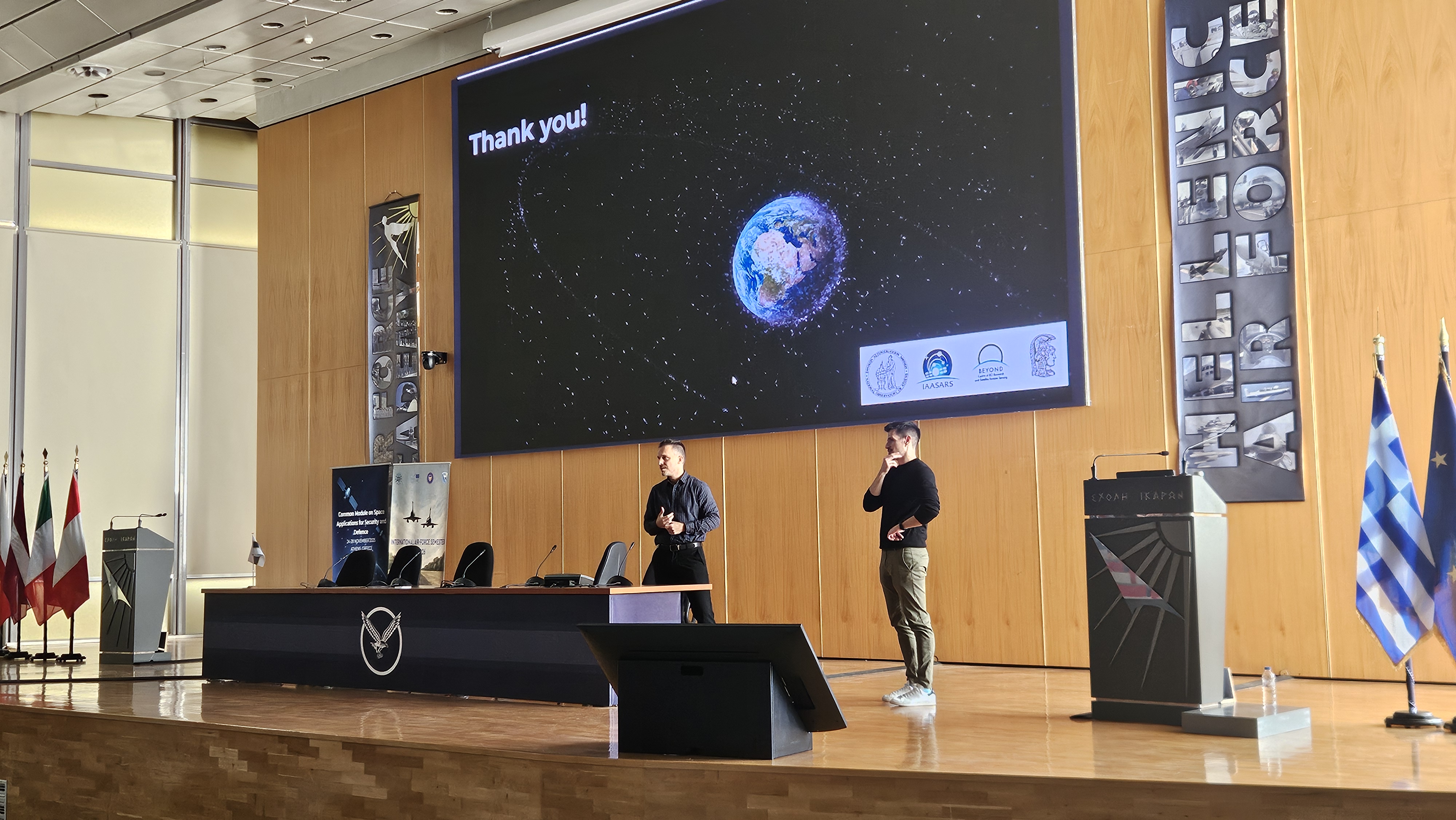
Konstantinos Tsaprailis and George Choumos delivered on 25/11 a lecture at the Hellenic Air Force Academy, presenting the Space Surveillance and Tracking activities carried out by BEYOND’s SpaceHub team, along with the contributions of the Greek partners participating in the EUSST Partnership.