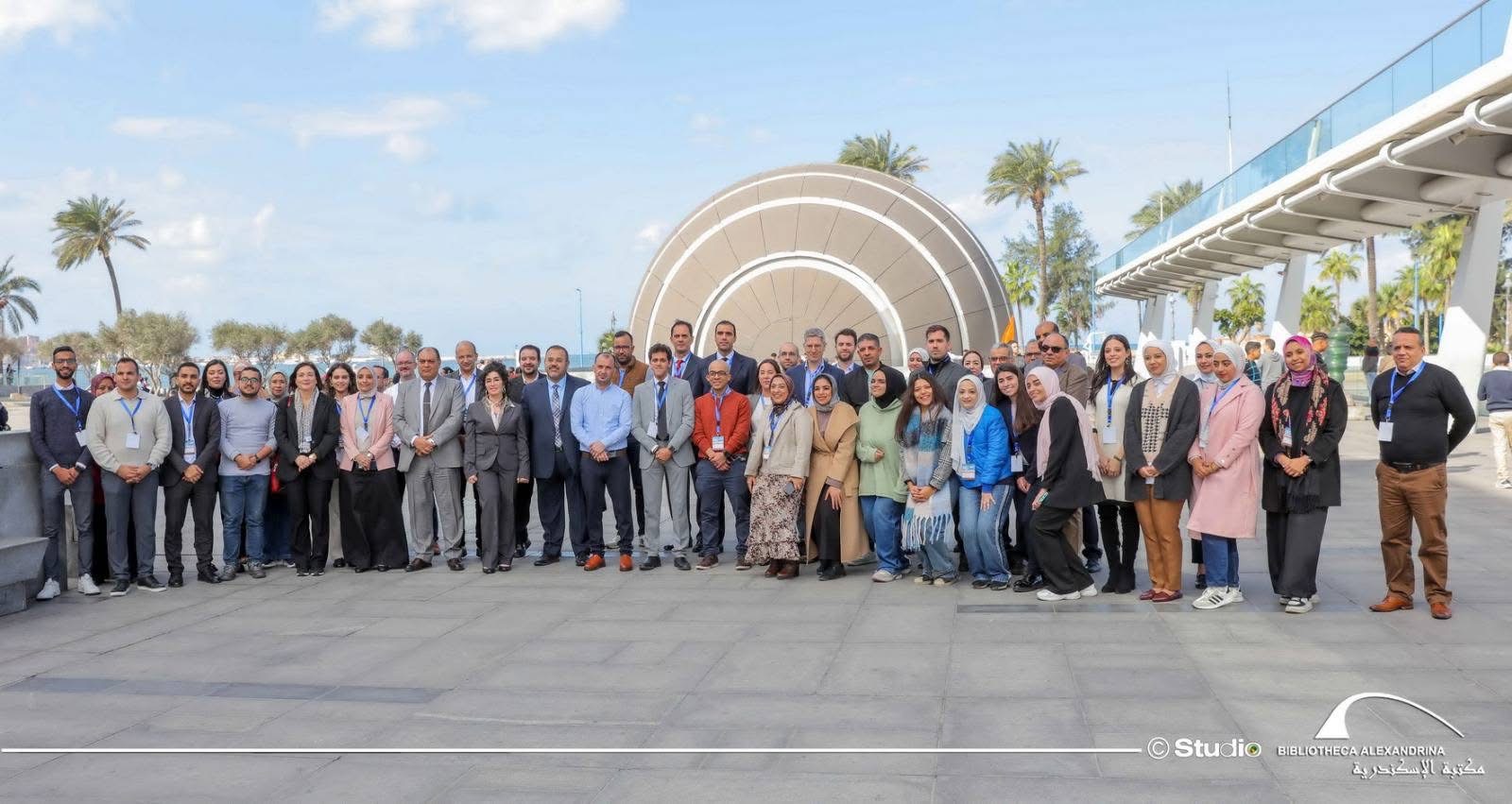
unnamed

The Operational Unit BEYOND Center for Earth Observation Research and Satellite Remote Sensing at the National Observatory of Athens is seeking to hire a highly skilled and motivated Expert on Energy Sector to join our team, contributing to implementation of the Destination Earth DESP Use Case “Destination Renewable Energy”. Our team focuses on innovative approaches to address challenges related to energy, sustainable agriculture, ecosystems, biodiversity, and climate change.

unnamed

The Operational Unit BEYOND Center for Earth Observation Research and Satellite Remote Sensing at the National Observatory of Athens is seeking a highly skilled and motivated Research Data Scientist to join our team and contribute to cutting-edge applied research at the intersection of Earth Observation and Artificial Intelligence. 


group photo


Η Περιφέρεια Αττικής σε συνεργασία με την Επιχειρησιακή Μονάδα "Κέντρο Επιστημών Παρατήρησης της Γης και Δορυφορικής Τηλεπισκόπησης BEYOND" του ΙΑΑΔΕΤ/ΕΑΑ διοργάνωσαν με μεγάλη επιτυχία και ενεργή συμμετοχή, εκπαιδευτικό σεμινάριο για τη χρήση της διαδικτυακής γεωπληροφοριακής πλατφόρμας της Περιφέρειας Αττικής, την Τετάρτη, 14 Φεβρουαρίου 2024, στις εγκαταστάσεις της Αυτοτελούς Διεύθυνσης Πολιτικής Προστασίας της Περιφέρειας Αττικής.

Η πλατφόρμα αναπτύχθηκε από το BEYOND του ΙΑΑΔΕΤ/ΕΑΑ στο πλαίσιο του έργου «Εκτίμηση κινδύνων σεισμού, πυρκαγιάς και πλημμύρας στην Περιφέρεια Αττικής» με σκοπό την οχύρωση των πόλεων και των πολιτών της Περιφέρειας Αττικής από φυσικές καταστροφές. Αξιοσημείωτη και ενθαρρυντική είναι τόσο η αναγνώριση της αξίας και του αντίκτυπου του έργου όσο και η αποδοχή του από τους σχετικούς φορείς και τις υπηρεσίες της Περιφέρειας και των Δήμων της Αττικής.

Ο Δρ. Νίκος Πασσάς, Αν. Προϊστάμενος της Αυτοτελούς Διεύθυνσης Πολιτικής Προστασίας της Περιφέρειας Αττικής συντόνισε το σεμινάριο, ενώ χαιρετισμούς απηύθηναν ο Αντιπεριφερειάρχης Πολιτικής Προστασίας κ. Λεωνίδας Μανωλάκος και ο Αντιπεριφερειάρχης Δυτικής Αττικής κ. Κλεάνθης Βαρελάς. Ο Δρ. Χάρης Κοντοές, Διευθυντής Ερευνών του ΕΑΑ και Επιστημονικός Υπεύθυνος της Επιχειρησιακής Μονάδας BEYOND του ΙΑΑΔΕΤ/ΕΑΑ ανέλυσε την επιστημονική βάση, την καινοτομία και την προστιθέμενη αξία του έργου για την Περιφέρεια Αττικής. Η επιστημονική συνεργάτιδα της Επιχειρησιακής Μονάδας BEYOND, κα Αλεξία Τσούνη, παρουσίασε την εκτίμηση κινδύνων σεισμού, πυρκαγιάς και πλημμύρας σε πολύ υψηλή χωρική ανάλυση, σε επίπεδο οικοδομικού τετραγώνου, μέσω της διαδικτυακής γεωπληροφοριακής πλατφόρμας.

Η Προγραμματική Σύμβαση μεταξύ της Περιφέρειας Αττικής και του Εθνικού Αστεροσκοπείου Αθηνών (Mέρος Α') υλοποιείται από μία υψηλού επιπέδου διεπιστημονική ομάδα ερευνητών/τριών που αποτελεί συνεργασία της Επιχειρησιακής Μονάδας BEYOND του ΙΑΑΔΕΤ/ΕΑΑ, της Σχολής Πολιτικών Μηχανικών του ΕΜΠ, Τομέας Υδρολογίας, Υδρομετεωρολογίας και Ενεργειακής Τεχνολογίας, της Σχολής Μηχανικών Μεταλλείων - Μεταλλουργών του ΕΜΠ, Τομέας Γεωλογικών Επιστημών, του Τμήματος Πολιτικών Μηχανικών του Διεθνούς Πανεπιστημίου Ελλάδας, του Τμήματος Πολιτικών Μηχανικών του Αριστοτέλειου Πανεπιστημίου Θεσσαλονίκης, Τμήμα Πολιτικών Μηχανικών, Εργαστήριο Εδαφομηχανικής, Θεμελιώσεων και Γεωτεχνικής Σεισμικής Μηχανικής καθώς και του Γεωδυναμικού Ινστιτούτου του ΕΑΑ.


PANA4878

PANA4874

PANA5240

PANA4963


3


Kick off Meeting of the Project “Copernicus Emergency Management service (CEMS) Risk and Recovery Mapping (RRM) – Tailor-Made Products (FLEX)”, JRC premises in ISPRA, January 24, 2024

We are thrilled to be selected between the contractors for realizing the Copernicus Emergency Management Service (CEMS) Risk and Recovery Mapping (RRM) for the benefit of societies on a global scale. Our consortium is led by the Centre BEYOND of Earth Observation Research and Satellite Remote Sensing of IAASARS/NOA, with the participation of the School of Mining and Metallurgical Engineering/ Engineering Geology & Hydrogeology Lab/NTUA and the IT company IDCOM. The members of the consortium fruitfully interacted with the JRC experts and shared thoroughly on scientific and contractual aspects towards a cooperation with high quality and societal impact. During the meeting the coordinator Dr. Haris Kontoes and the partner leaders of IDCOM and NTUA, Dimitris Vallianatos and Prof. Constantinos Loupasakis respectively, presented the consortium expertise and skills that ensure the proper and timely project delivery according to the Copernicus EMS RRM standards. For more information on past activations being conducted visit:
http://beyond-eocenter.eu/index.php/thematic-areas/disasters/ems-activations

Copernicus Emergency Management Service (CEMS) Risk and Recovery Mapping (RRM) – Tailor-Made Risk Assessment Products (FLEX) for the benefit of societies on a global scale

Project’s Mission

Copernicus Emergency Management Service (CEMS) Risk and Recovery Mapping RRM is the European contribution to assist global efforts of the authorized service users in Disaster Risk Reduction, communities and businesses to natural disasters, and minimization of losses in human lives and economic assets. The project aims at promoting knowledge-based decision making with the use of products generated through applying adequate processing of Earth Observation data, specifically using Copernicus knowledge base. 

Funded by: European Commission, Joint Research Centre

Project’s Duration: 24 months

More about the Project: https://emergency.copernicus.eu/

THANK YOU IGARSS 2024 


Ιστορικό Ρεκόρ Υποβολών Επιστημονικών Περιλήψεων Εργασίας (Manuscripts) σημειώθηκε στο πλαίσιο του IGARSS 2024, το οποίο πρόκειται να πραγματοποιηθεί στην Αθήνα, από τις 7 έως και τις 12 Ιουλίου 2024, στο Μέγαρο Μουσικής Αθηνών.

Οι 4.000 Επιστημονικές Περιλήψεις Εργασίας που υποβλήθηκαν, αντανακλούν την ευρεία απήχηση του φετινού Συνεδρίου που διοργανώνεται στην Αθήνα αλλά και το πάθος των ερευνητών/ερευνητριών απ΄όλον τον κόσμο στο τομέα των Γεωεπιστημών και της Παρατήρησης της Γης.

Η Οργανωτική Επιτροπή και οι φορείς που αναλαμβάνουν την ευθύνη της διοργάνωσης υπό τον συντονισμό του Εθνικού Αστεροσκοπείου Αθηνών (ΕΕΑ) – Επιχειρησιακής Μονάδας BEYOND του ΙΑΑΔΕΤ, με την υποστήριξη του Εθνικού Μετσόβιου Πολυτεχνείου και του Ιδρύματος Τεχνολογίας και Έρευνας (ΙΤΕ), συγχαίρουν όλους και όλες που συμμετείχαν στην επίτευξη του ιστορικού ρεκόρ υποβολών της φετινής διοργάνωσης του IGARSS.

Συνεχίζουμε μαζί προς νέες προκλήσεις και επιτυχίες! 

Περισσότερες πληροφορίες για το IGARSS 2024 μπορείτε να διαβάσετε εδώ 

....................................................................................................................................................................................................

Record Manuscripts Breaking News for IGARSS2024 with 4.000 manuscript submissions.

We are thrilled to announce that IGARSS 2024 has set a new milestone! This year, the conference received a record-breaking number of manuscripts that showcase the incredible depth of research and innovation within Geoscience and Remote Sensing community.
Congratulations to all the brilliant minds around the world! Your dedication and passion for advancing knowledge have truly made a mark on IGARSS history.
IGARSS2024 will be hosted in Greece , 7-12 of July 2024 by the National Observatory of Athens - Operational Unit “BEYOND Centre of Earth Observation Research and Satellite Remote Sensing” of Institute for Astronomy, Astrophysics, Space Applications and Remote Sensing, with the support of the National Technical University of Athens and the Foundation for Research and Technology – Hellas.

Venue: Megaron Athens International Conference Center Megaron - The Athens Concert Hall
Discover more: https://lnkd.in/dEyRu4AK


banner1 


BEYOND New Project on board: Introducing EuroGEO Secretariat.

Establishing the EuroGEO Secretariat to support the EuroGEO initiative.


After months of hard work, passion, and creative collaboration, we are beyond excited to introduce our new project: EuroGEOSec!

What is EuroGEOSec? It is not just a project; it's a manifestation of our commitment to innovation, growth, and pushing the boundaries of what's possible. It's the product of tireless dedication from our incredible team, fuelled by a shared vision of making a positive impact.

Project Focus

The EuroGEO Secretariat will be strengthening GEO-related coordination mechanisms at European and national levels. The focus will be on supporting increased innovation, space application development and the reinforcement of a space data ecosystem concept within Europe, whilst pursuing international cooperation to help stimulate the market and promote European technology and services. The EuroGEO secretariat will be contributing to the European Green Deal objectives by further deploying and exploiting the use of environmental observations and to a strengthened Global Earth Observation System of Systems (GEOSS).

Our Role

BEYOND/NOA leads the Task 2.2 Coordination support to EuroGEO's governance bodies and structures, which commits to identify and initiate the dialogue with the EuroGEO governance bodies (e.g. HLWG, Coordination Group, National GEOs) on the basis of their constitutional roles and responsibilities. Furthermore, BEYOND/NOA leads the Work Package 5 Communication and outreach, which overall aim is to ensure that the impact of EuroGEO will be maximized through an effective campaign of communication, dissemination and promotional activities.

BEYOND's Rocketship Team is ready to embark on this exciting new chapter and make EuroGEOSec a monumental success!

Identity: HORIZON-CL6-2023-GOVERNANCE-01

Funded by: European Commission

Discover more:  http://beyond-eocenter.eu/index.php/projects/projects-list/646-establishing-the-eurogeo-secretariat-to-support-the-eurogeo-initiativey


banner2

Blue Modern Congratulation Employee of the Month Instagram Post 

Ανακοινώθηκαν τα βραβεία του διαδικτυακού διαγωνισμού Appathon με τίτλο “Copernicus Innovative Solutions (Natural Disasters, Agriculture, Health)” που συνδιοργάνωσε η Επιχειρησιακή Μονάδα BEYOND του ΙΑΑΔΕΤ/ΕΑΑ σε συνεργασία με το Δίκτυο ΠΡΑΞΗ/ITE, στις 23-24/11/2023, στο πλαίσιο του ευρωπαϊκού προγράμματος FPCUP.

Οι ενδιαφερόμενοι κλήθηκαν να συμμετάσχουν στον διαγωνισμό με σκοπό να σχεδιάσουν λύσεις σε τρεις (3) θεματικές: Φυσικές Καταστροφές, Υγεία και Γεωργία χρησιμοποιώντας δωρεάν δορυφορικά δεδομένα από την πλατφόρμα CREODIAS (Copernicus DIAS - Copernicus Data and Information Access Service).

Την 1η θέση κέρδισε η ομάδα των κ.κ. Ιάσονα Ράπτη & Ιωάννη Πιτσιόρλα για την καινοτόμo πρότασή τους με τίτλο "AIRWATCH". 

To AIRWATCH φιλοδοξεί να στηρίξει την παρακολούθηση της ρύπανσης μέσω καθημερινών προβλέψεων για την ποιότητα του αέρα, κάνοντας χρήση δορυφορικών δεδομένων από την πλατφόρμα #CREODIAS (Copernicus DIAS - Copernicus Data and Information Access Service). Η προτεινομένη λύση αναμένεται να έχει αντίκτυπο στον τομέα της υγείας και της ποιότητας ζωής των κοινοτήτων.

Το βραβείο για την 2η θέση απονεμήθηκε στον κ. Φώτη Ζαπάντη, για την καινοτόμο πρόταση "LANDSLIDES". 

To LANDSLIDES πρόκειται να χαρτογραφήσει πιθανές κατολισθήσεις, κάνοντας χρήση δορυφορικών δεδομένων από την πλατφόρμα CREODIAS (Copernicus DIAS - Copernicus Data and Information Access Service). Η προτεινομένη λύση αναμένεται να έχει αντίκτυπο στον τομέα των Φυσικών Καταστροφών.

Το βραβείο για την 3η θέση απονεμήθηκε στον Δρ. Βασίλη Σταματόπουλο για την καινοτόμο πρόταση "INNOFY".

Το INNOFY θα επιδιώξει να αποτελέσει λύση για την Εξισορρόπηση των Διακυμάνσεων Τιμών Ελαιόλαδου, κάνοντας χρήση δορυφορικών δεδομένων από την πλατφόρμα #CREODIAS (Copernicus DIAS - Copernicus Data and Information Access Service). Η προτεινομένη λύση αναμένεται να έχει αντίκτυπο στον τομέα της γεωργίας.

Θερμά συγχαρητήρια σε όλους τους συμμετέχοντες καθώς και στους νικητές του Appathon!

Τα βραβεία των νικητών συνοδεύονται από χρηματικά έπαθλα αξίας 2000€ από την Επιχειρησιακή Μονάδα Beyond EO Centre NOA του ΙΑΑΔΕΤ/ΕΑΑ καθώς και από προσφερόμενες υπηρεσίες ‘Coaching for pitching to investors’ από το Δίκτυο ΠΡΑΞΗ PRAXI Network, στο πλαίσιο του ευρωπαϊκού έργου FPCUP.

#Copernicus #EUproject

2

GROUP 


On the 28th of November, Operational Unit “BEYOND Centre of Earth Observation Research and Satellite Remote Sensing” of the National Observatory of Athens, in collaboration with PRAXI Network/FORTH, the Higher School of Communication of Tunis (SUP’COM) and the IEEE-GRSS Tunisia Chapter organized the Capacity Building Workshop in Tunis, “EO and Copernicus data & Services, Soil Degradation and Water Resources”.

Stakeholders from public and private entities, Universities and Local Authorities, along with BEYOND’s representatives, Mrs Marietta Papakonstantinou (Project Manager in FPCUP program) and Dr. Nikos Stathopoulos (Project Manager in Soil Projects), presented the current status on Soil Degradation and Water Resources, identified the needs and gaps and set up the basis for future collaboration. 

The event aimed at the EO Capacity building in Tunisia, underlining the importance of sharing experiences and exchanging good practices for a fruitful cross border collaboration in the framework of the Copernicus User Uptake Activities.

More info: https://www.copernicus-user-uptake.eu/events/events-details/fpcup-capacity-building-workshop-in-tunisia-eo-and-copernicus-data-services-604


greece japan flood Mitigation on line workshop 2023 


On October 27, 2023, “Greece - Japan Flood Mitigation Online Workshop” was co-organized by the National Research Institute for Earth Science and Disaster Resilience (NIED) of Japan and the Government of Greece to reflect back on the severe flooding events that occurred in central Greece this September and for the Japanese experts to share how flood management and mitigation measures are implemented in Japan.

The workshop began with welcoming remarks by Prof. Kaoru Takara, President of NIED who sent his condolences to the affected people in Greece and emphasized the importance of cross-sectoral collaboration among government, research institutes and private sector; giving an example of the Japan Hub of Disaster Resilience Partners (JHoP) in which NIED serves as the secretariat.

The welcoming remarks was followed by presentations from Greek representatives that gave a briefing on the post-flood situation and the water and flood management in Greece.

In particular, Alexia Tsouni, Research Associate of the Operational Unit BEYOND EO Centre of IAASARS, NOA participated in the Workshop focusing on the one hand to the operational FloodHub service providing flood early warning and monitoring, and on the other hand to the multi-parameter high-resolution flood risk assessment in the Region of Attica. She highlighted the cooperation of BEYOND EO Centre with the Regional and Municipal Authorities, the Fire Service, the Civil Protection Associations, as well as the capacity building and the support provided by BEYOND EO Centre for the implementation of civil protection exercises and educational activities.

The workshop continued with presentations from Japanese experts from the Ministry of Land, Infrastructure, Transport and Tourism (MLIT), the International Centre for Water Hazard and Risk Management (ICHARM) and NIED on flood management policy in Japan, research on flood hazard risk analysis, landslide/debris flow management, and disaster information management.

Towards the end of the workshop, a Q&A session was held, followed by active discussions on various ways on how flood modeling, early warning and coordination can further be improved. In addition, future steps to identify areas of possible medium and long term collaborations were suggested from both sides.

The workshop attracted a total of about 60 people from Greece and Japan, including two ministers, deputy ministers, other high-level officials from line agencies and representatives from academia. Japanese Ambassador to Greece also attended the workshop and provided the opening message.


More info: https://www.bosai.go.jp/e/news/2023/20231106.html