Internal BEYOND Presentations 2022

  • Εκτίμηση των επιπέδων της ηλιακής ακτινοβολίας και ενέργειας με τη χρήση δορυφορικών παρατηρήσεων: το σύστημα nextSENSE, Ηλίας Φουντουλάκης, 04/04/2022. [Presentation]
  • Παρουσίαση αποτελεσμάτων της επείγουσας εκτίμησης των κινδύνων πλημμύρας-διάβρωσης-κατολίσθησης στις λεκάνες απορροής της Περιφέρειας Αττικής που επλήγησαν από τις πυρκαγιές του 2021, Αλεξία Τσούνη, Βάσω Παγάνα, Σταυρούλα Σιγούρου, 11/04/2022. [Presentation]
  • Εκτίμηση & Διαχείριση Κινδύνου Πυρκαγιάς στη Βραυρώνα, τη Χαμολιά και το Πόρτο Ράφτη, Στέλλα Γκίρτσου, Αναστασία Υφαντίδου, Μιχάλης Τσούτσος, Μάρθα Κοκκαλίδου, Μελπομένη Ζώκα, Νίκος Σταθόπουλος. 18/04/2022. [Presentation]
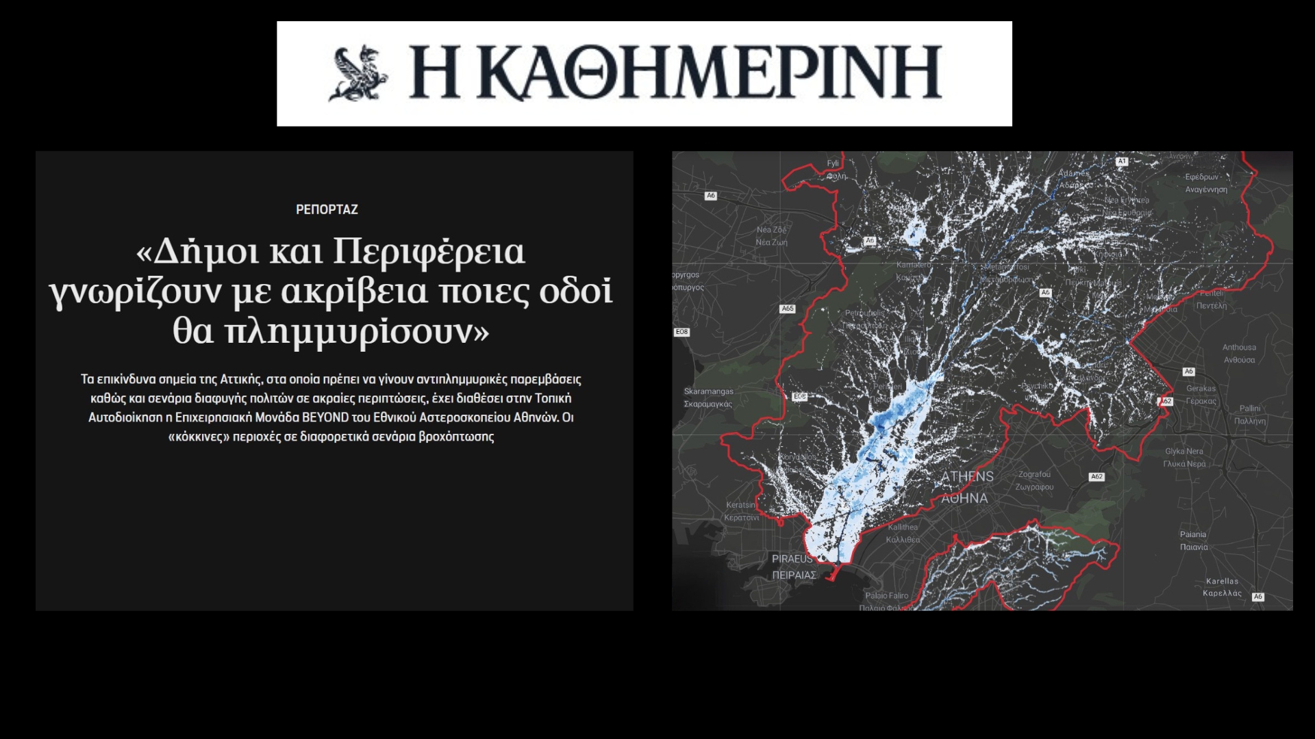
  • Παρουσίαση αποτελεσμάτων της Α’ Φάσης της Προγραμματικής Σύμβασης Περιφέρειας Αττικής-Ε.Α.Α.: Εκτίμηση κινδύνου πλημμύρας στο ρέμα Πικροδάφνης, Αλεξία Τσούνη, Βάσω Παγάνα, Σταυρούλα Σιγούρου, 16/05/2022. [Presentation]
  • AgriHUB - Big Earth data and AI for Sustainable and Resilient Agriculture, Βασίλης Σιτοκωνσταντίνου, Roxanne Lorilla, Ηλίας Τσούμας, Άλκης Κούκος, 30/05/2022. [Presentation]
  • Υπηρεσίες διαχείρισης μεγάλου όγκου δορυφορικών δεδομένων για την παρακολούθηση, αντιμετώπιση και πρόβλεψη γεωκινδύνων, Σταυρούλα Αλατζά, Αλέξης Αποστολάκης, 06/06/2022. [Presentation]
  • Understanding the drivers of changes in agro-ecosystems, Roxanne Lorilla, Γιώργος Γιανναράκης, 14/06/2022. [Presentation]
  • Datacube for Satellite Image Time-series, Θανάσης Δρίβας, Άλκης Κούκος, 20/06/2022. [Presentation]
  • Fusion of space-borne high resolution images and very high resolution images, UAV images and street-level photos for crop classification, Γιώργος Χούμος, Άλκης Κούκος, 04/07/2022. [Presentation]
  • Deep Learning for fusion of Sentinel-1 and Sentinel-2 data and grassland mowing detection, Ιάσων Τσαρδανίδης, 11/07/2022. [Presentation]
  • Forest Fire Risk prediction in Greece, Στέλλα Γκίρτσου, Αλέξης Αποστολάκης, Γιώργος Γιαννόπουλος, 18/07/2022. [Presentation]
  • Smart farming using unsupervised and semi-supervised learning, Ηλίας Τσούμας, Άλκης Κούκος, 25/07/2022. [Presentation]
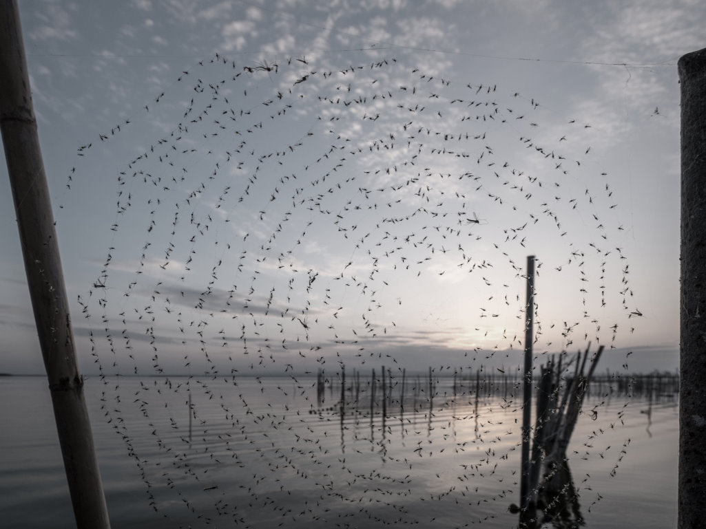
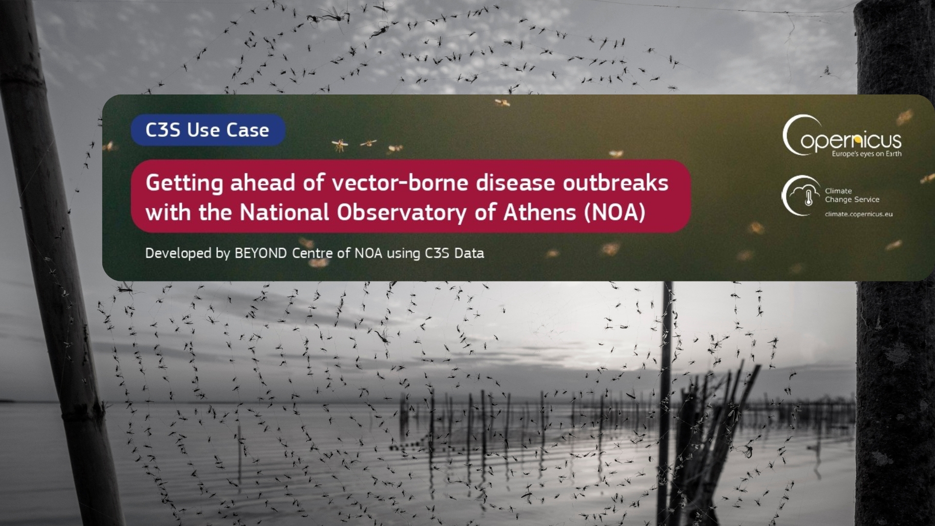
  • Will ΜΑΜΟΤΗ survive in the Modern Age?(from Mosquito Plethora to Human Health and Quality of Life), Γιώργος Αρβανιτάκης, Κώστας Τσαπραΐλης, 05/09/2922 [Presentation]
  • Numerical Weather Prediction: An introduction to the core element of many operational services in BEYOND, Νίκος Μπαρτσώτας, 12/09/2022 [Presentation]

Vector-borne diseases are caused by major human pathogens such as plasmodia (Malaria) and flaviviruses (Zika, Dengue, West Nile), and consist a global threat to public health with far-reaching socio-economic impacts. Vector-borne pathogens move between humans and animals by means of vectors-insects rendering the control of their spread into a major challenge. In order to design an efficient prevention strategy we need to know WHERE and WHEN these pathogens are more likely to emerge. Beside population movements, their transmission risk is highly dependent on the integrated ecology of host and vector populations, the later presenting geographic and seasonal patterns affected by climate/environmental factors.

The West Nile Virus (WNV) which has a global distribution, has relatively recently emerged into SE Europe.

The virus is maintained in bird population reservoirs and is transmitted to humans through mosquitos of the culex genus.

EO is valuable to address this challenge as it systematically provides updated information on climatic and environment variables e.g. rainfall, soil temperature, wind, humidity, habitats, vegetation, water, soil moisture, urbanization, and geo-morphological parameters affecting the number and survival rate of vectors transmitting pathogens.

EO4EViDence studies the WNV as a proof of concept in a Greek site building upon the MALWEST project. It integrates in-situ collected data that will allow calibration and validation of risk modeling and early warning alerts. The early warning application integrates data from disparate fields (climate, environment, population and bird movements, transportation data, epidemiology & molecular epidemiology) to model the transmissibility risk of WNV.

The meteorological radar systems of NOA’s climate change station in Antikythera will detect as aerial plankton migrating birds and insects. The radar based observations are the proxy to identify the spatiotemporal patterns of WNV spread from Africa to Europe.

pdf icon Click here for more information

The EuroGEO Coordination Group is chaired by the Commission (DG RTD and DG GROW jointly) and consists of participants nominated by the GEO European Caucus High Level Working Group (HLWG).

The EuroGEO Coordination Group is involved in the establishment of and provides guidance to the EuroGEO Action Groups that are bringing together existing relevant initiatives.

Please visit the following for further information: https://ec.europa.eu/info/sites/info/files/eurogeoss/terms_of_reference_coordination_group_eurogeoss.pdf


The EuroGEO Disaster Resilience Action Group includes the following 7 Expressions of Intent:

1)      Earth Observation for Disaster-Resilient Societies (EO4DisasteRS), led by IAASARS/NOA, under my coordination. The focus is on flash floοd mapping at large scale (city level) and creation of operational awareness pictures for crisis management in real time by assimilating in flash flood models multiple sources of data including mostly satellite data (Sentinel), in-situ sensors, and crowdsourced data. You can see our progress so far in the video that we presented in the GEO Week 2019 in Canberra.

2)      Disaster Resilience Showcase under the EU H2020 e-shape project, led by IAASARS/NOA, under my coordination, including the following 4 pilots:

Pilot 6.1: EO4D_ASH - EO Data for Detection, Discrimination & Distribution (4D) of Volcanic ash led by CNR, strengthening the EO and in-situ data exploitation and multi-source (satellite, remotely sensed, crowd, and ground-based network) data integration to derive innovation for ash discrimination and monitoring

Pilot 6.2: GEOSS for Disasters in Urban Environment led by CIMA, using available in situ authoritative weather stations, existing citizen scientist weather stations, observations, low-cost sensors, to deploy an hydrometeorological forecasting system for high-impact weather events, such as flash-flood, wind storms, hail storms, lightning storms, peri urban fires.

Pilot 6.3: Assessing Geo-hazard vulnerability of Cities & Critical Infrastructures led by IGME, based on Sentinel 1A/B image processing and in situ data (GNSS station, geological and Geohazard layers as well as urban layers and pipeline network layers).

Pilot 6.4: ReSAgri - Resilient & Sustainable ecosystems including Agriculture & food led by NOA, providing services to insurance companies and farmers’ associations such as risk and damage assessment, adverse selection (underwriting), high-level monitoring, and early warning for perils in agriculture.

3)      Satellite Earth Observation-derived water bodies and floodwater record over Europe, led by the Luxembourg Institute of Science and Technology (LIST). This is one of the pilots of the Water Resources Management showcase of the EU H2020 e-shape project: Pilot 5.2.

4)      Global Flood Awareness System (GloFAS), led by the European Centre for Medium-Range Weather Forecasts (ECMWF). You can visit the website.

5)      NextGEOSS – Enhanced landslide risk assessment framework, led by the IAASARS/NOA based on InSar data assimilated in landslide models. This is one of the pilots of the EU H2020 NextGEOSS project. You can find more info on the website and watch our webinar.

6)      Multi-scale Change Detection for Space and Security, led by the European Union Satellite Centre (SatCen) This is another pilot of the EU H2020 NextGEOSS project. You can find more info on the website.

7)      Strengthen multilevel governance in natural hazards and disaster management, led by the Multi-hazards Functional Centre of the Regional Environmental Protection Agency of Calabria.

All the intents are available here:

pdf icon Intent 10:Multi-hazards Functional Centre - Regional Environmental Protection Agency of Calabria

pdf icon Intent 22:NextGEOSS - Enhanced landslide risk assessment framework

pdf icon Intent 25:Disaster Resilience Showcase under H2020 call GREENING THE ECONOMY IN LINE WITH THE SUSTAINABLE DEVELOPMENT GOALS (SDGS)

pdf icon Intent 30:Multi-scale Change Detection for Space and Security

pdf icon Intent 34:GLOBAL FLOOD AWARENESS SYSTEM (GloFAS)

pdf icon Intent 36:Satellite Earth Observation-derived water bodies and floodwater record over Europe

pdf icon Intent 44:Earth Observation for Disaster-Resilient Societies

  • The EU Copernicus Program and the importance of Earth Observation The European Center of Satellite Remote Sensing BEYOND in Disaster Management, and Civil Protection . Dr. Charalampos (Haris) Kontoes , GROW observatory , Presentation
  • ΑΝΑΛΥΣΗ ΤΗΣ ΠΛΗΜΜΥΡΑΣ ΤΗΣ 15/11/2017 ΣΤΗ ΔΥΤΙΚΗ ΑΤΤΙΚΗ ΜΕ ΑΞΙΟΠΟΙΗΣΗ ΔΟΡΥΦΟΡΙΚΗΣ ΤΗΛΕΠΙΣΚΟΠΗΣΗΣ. Αλεξία Τσούνη. 13.11.2019, Μάνδρα. Παρουσίαση
  • ΠΑΡΑΚΟΛΟΥΘΗΣΗ ΚΑΙ ΑΝΑΛΥΣΗ ΤΩΝ ΠΛΗΜΜΥΡΩΝ ΜΕ ΑΞΙΟΠΟΙΗΣΗ ΔΟΡΥΦΟΡΙΚΗΣ ΤΗΛΕΠΙΣΚΟΠΗΣΗΣ. Δρ. Χάρης Κοντοές. 13.11.2019, Μάνδρα. Παρουσίαση
  • Η συμβολή της διαστημικής τεχνολογίας του Επιχειρησιακού Κέντρου BEYOND/ΕΑΑ στη διαχείριση των καταστροφών στη Μάνδρα και στο Μάτι, Δρ. Χάρης Κοντοές, 29.11.2019, ΕΙΕ. Παρουσίαση
  • BEYOND: Δορυφορική παρακολούθηση φυσικών καταστροφών. Δρ. Γιάννης Παπουτσής. Νύχτα Ερευνητή 2019, 27.9.2019, Ελληνικός Κόσμος. Παρουσίαση
  • Continuous and Transparent EO, Meteo and Social Media Data Access, Ioannis Papoutsis, EOPEN Session, 40th Asian Conference on Remote Sensing, Daejeon, Korea, 2019. Presentation
  • Food Security monitoring through EO datasets, Vassilis Sitokonstantinou, EOPEN Session, 40th Asian Conference on Remote Sensing, Daejeon, Korea, 2019. Presentation
  • A Sentinel-based Agriculture Monitoring Scheme, EGU 2019, 7-12/4/2019, Vienna, Austrria. Presentation
  • Adding value to the Copernicus Climate Change service (C3S), Anestis Trypitsidis, ESA EO4SD Climate, Nairobi, Kenya. Presentation
  • Portfolio of sectoral climate services, Anestis Trypitsidis, ESA EO4SD Climate, Nairobi, Kenya. Presentation
  • Leveraging the Copernicus Big Data Access Hubs and National Satellite Facilities for Global Emergency Response and Decision Making, Dr.Haris Kontoes, CIRSA 2019, Athens, Greece. Presentation
  • Big Satellite Data for Ground Deformation Assessment at Global Scale, Charalampos (Haris) Kontoes, JISDM 2019, Athens, Greece. Presentation
  • Dust Impacts on Solar Energy, Panagiotis Kosmopoulos, Trainig School on Dust Products. Presentation
  • InDust Cost Action – Impacts on Solar Energy, Panagiotis Kosmopoulos, EUROGEOSS Workshop, 3-5 July, Lisbon, Portugal. Presentation
  • SolarHub: Πώς μπορούμε να εκμεταλλευτούμε καλύτερα την ηλιακή ενέργεια; Παναγιώτης Κοσμόπουλος, Βραδιά Ερευνητή 2019, 27.9.2019, Ελληνικός Κόσμος. Παρουσίαση
  • Το Σύστημα Πρόγνωσης της Ηλιακής Ενέργειας του Εθνικού Αστεροσκοπείου Αθηνών, Παναγιώτης Κοσμόπουλος, 6ο Διεθνές Διεπιστημονικό Συμπόσιο Μυκήνες, 11-13 Οκτωβρίου 2019, Ναύπλιο, Ελλάδα. Παρουσίαση
  • Innovative EO based regional-scale, landslide run-out assessment for the conservation and protection of Cultural and Natural Heritage sites (CNHs) Karagiannopoulou, Ch. Kontoes, I. Papoutsis, M. Papakonstantinou & S. Antoniadi, Living Planet Symposium, 13-17 May 2019, Milan, Italy. Presentation
  • "Ανάπτυξη εκπαιδευτικού εργαλείου για την ανάδειξη της συνεισφοράς της δορυφορικής τηλεπισκόπησης στην παρακολούθηση των φυσικών καταστροφών", X. Κοντοές, Α. Καραγιαννοπούλου, Ε. Ιερωνυμίδη & Α. Τσούνη, Marathon Data Systems, 30-31/5/2019, Αθήνα, Ελλάδα. Παρουσίαση
  • BEYOND Ground Segment The Hellenic Mirror Site Initiative , Haris Kontoes, National Observatory of Athens, Xenofon Tsilimparis, Greek Research & Technology Network. Sentinel Collaborative Ground Segment Technical Workshop, 14-15 October 2019, ESRIN . Presentation
  • A Transferable Sentinel-based Agriculture Monitoring Scheme, Vasileios Sitokonstantinou. 38th Annual EARSeL Symposium 9-12 July 2018 Earth Observation Supporting Sustainability Research, Chania, Crete, Greece. Presentation