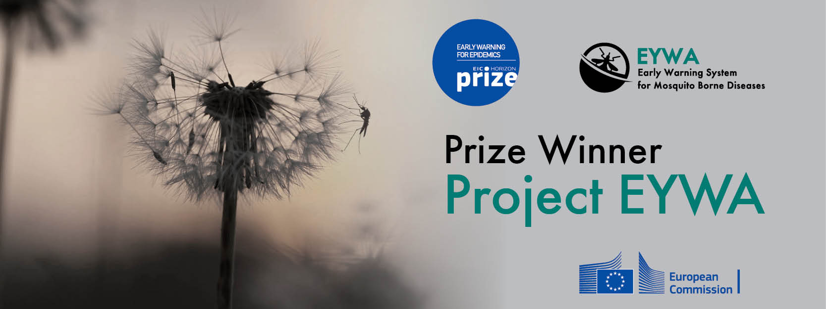
EYWA System Winner of the 1st EIC Horizon Prize on Early Warning for Epidemics
EYWA, Prize Winner Press Release EN
EYWA, Prize Winner Press Release GR
Official Announcement of the EIC
In a nutshell
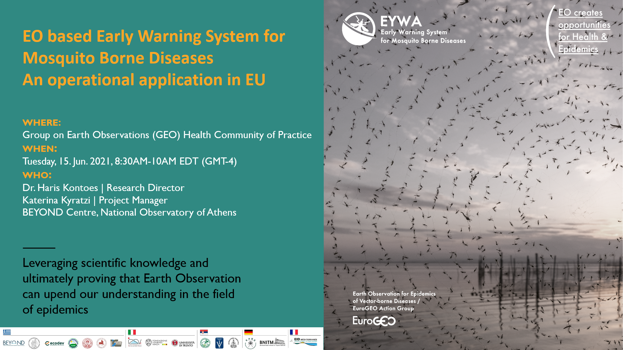
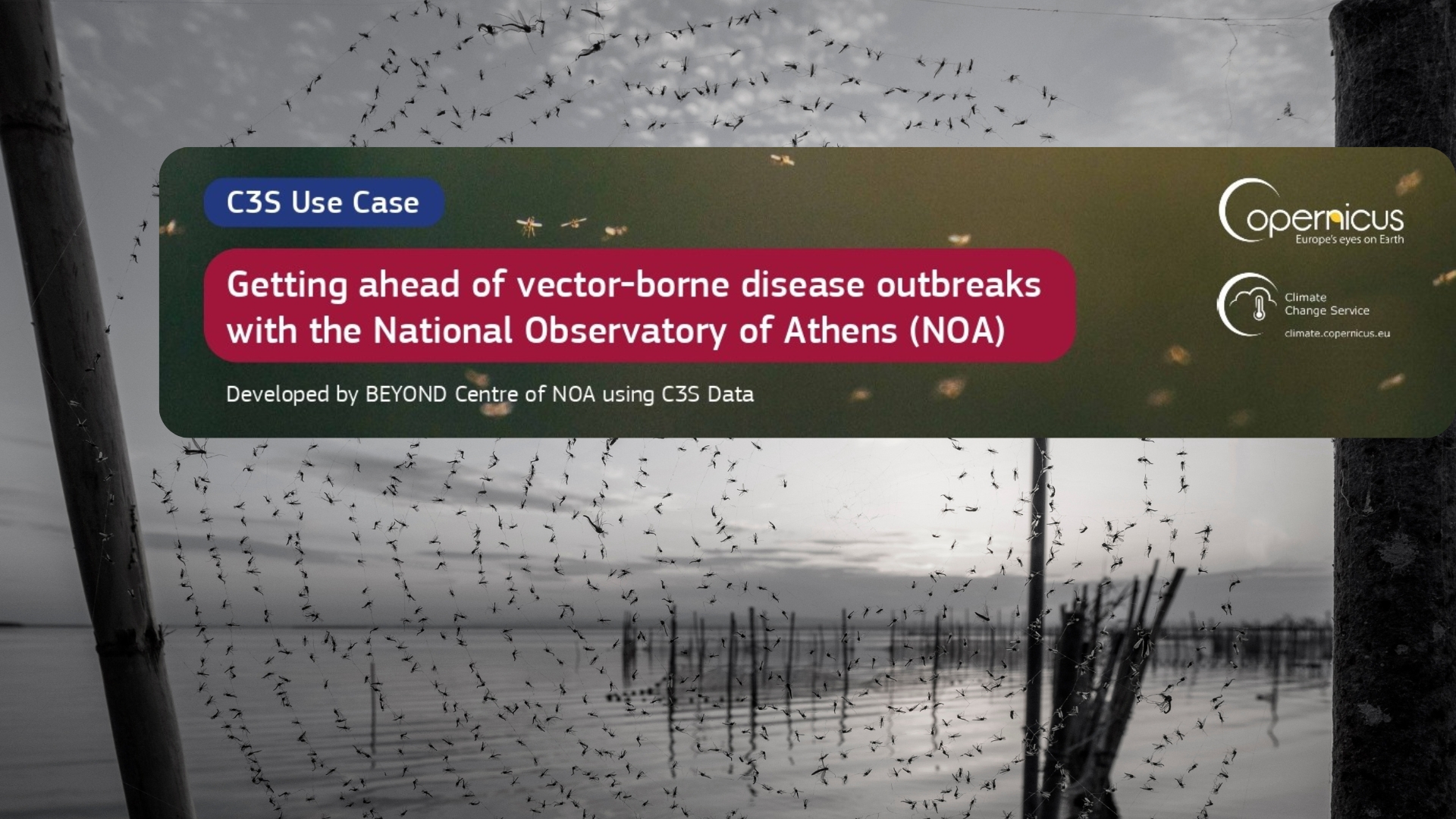
EYWA (EarlY WArning System for Mosquito borne diseases) is a prototype system addressing the critical public health need for prevention and protection against the Mosquito-Borne Diseases (MBDs) and lies under the umbrella of EuroGEO Action Group "Earth Observation for Epidemics of Vector-borne Diseases" which is led by the National Observatory of Athens / BEYOND Centre of Earth Observation Research and Satellite Remote Sensing.
The system combines interdisciplinary scientific fields (entomology, epidemiology, ecology, EO, Big Data Analytics, AI/ML, Ensemble Dynamic/Hybrid vs Data Driven models, Data Fusion and Citizen sciences) towards building new directions in applied research and innovative services for public health, such as outbreak forecasting and decision support modeling for vector control applications and other mitigation actions.
EYWA system is the outcome of the co-development conducted by the BEYOND Centre of EO Research and Satellite Remote Sensing of the Institute for Astronomy, Astrophysics, Space Applications and Remote Sensing (IAASARS) of the National Observatory of Athens, in collaboration with key core partners, the Ecodevelopment S.A. company specialized in mosquito control and data analytics, and the Laboratory of Atmospheric Physics of the University of Patras - Physics Department specialized in mathematical modelling, and along with important European organisations from Italy, France, Germany and Serbia, that serve research purposes, perform mosquito control activities, belong to health and decision making sectors. The partnership scheme is open to include new partners from other European countries. For the time being it is comprising of the following partners:
 Greece
National Observatory of Athens (NOA) – BEYOND Centre of EO Research & Satellite Remote Sensing,
Dimitrios Vallianatos (I.D.Com)
University of Patras – Physics Department - Laboratory of Atmospheric Physics (LapUP)
Aristotle University of Thessaloniki
University of Thessaly, Medical School. Laboratory of Hygiene and Epidemiology
 Serbia
University of “Novi Sad” Faculty of Agriculture
 Germany
German Mosquito Control Association (KABS)
Bernhard Nocht Institute for Tropical Medicine
 France
 Italy
Italy
Main objectives & outcomes
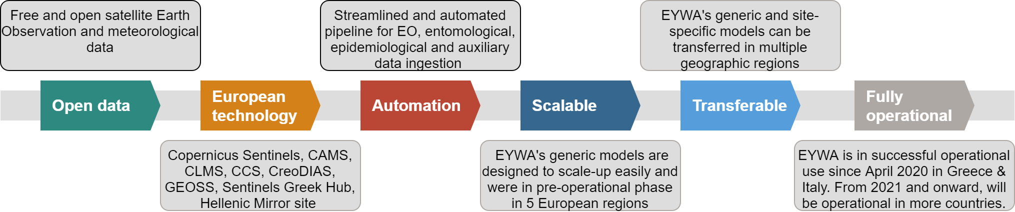
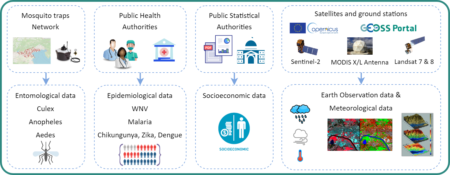
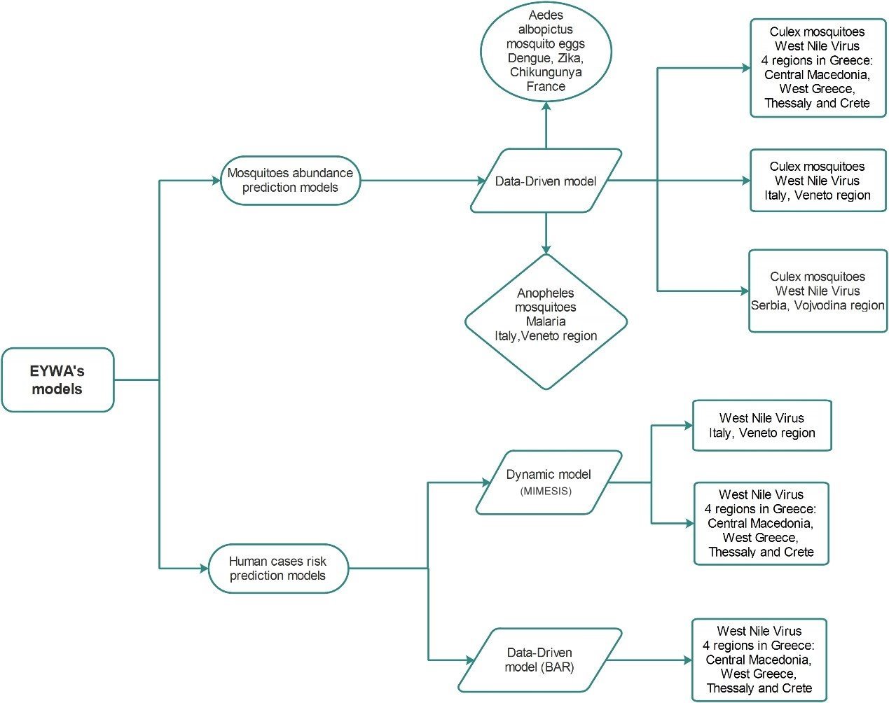
The main objectives of EYWA lie with the need to offer a scalable, reliable, sustainable and cost-effective Early Warning System (EWS) relying on big Earth Observation (EO) data in conjunction with environmental, climatic and meteorological essential parameters, socioeconomic and population data, ecosystem and morphological related parameters, as well as epidemiological and entomological data to forecast and monitor MBDs.