
The earthquake occurred on March 3, 2021 in 10:16:07 UTC, with a magnitude of Mw=6 in Richter scale, a focal depth of 7.8km and an epicenter in 16km South of Elassona city, according to the Institute of Geodynamics of the National Observatory of Athens. Several strong aftershocks, followed the main event. So far, damages have been reported in Mesochori, Damasi and several villages to the South of Týrnavos, located near the epicenter.
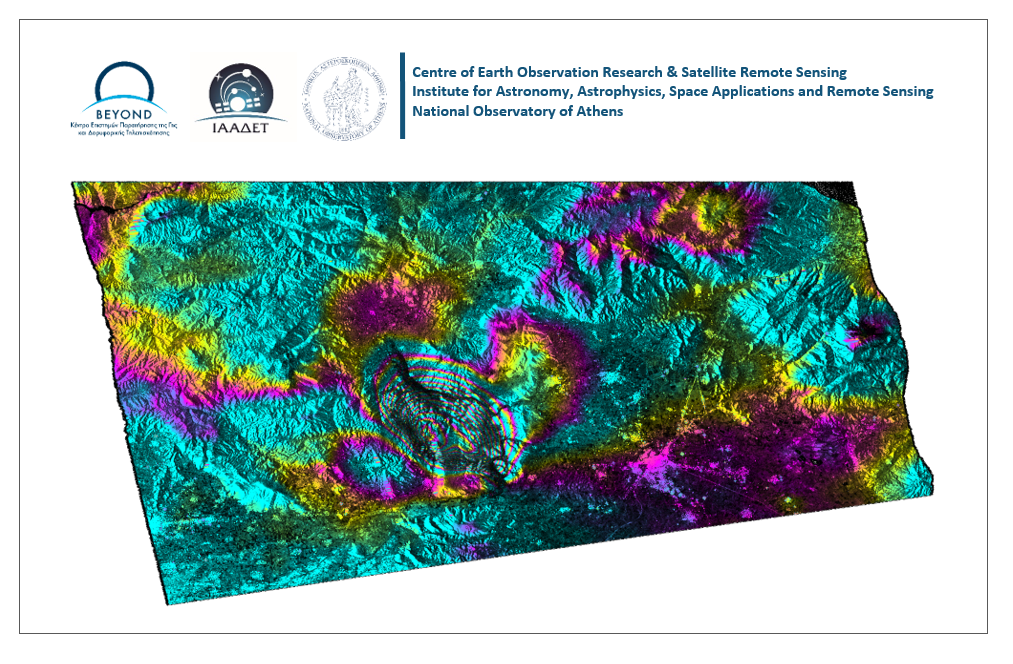
The geObservatory service of BEYOND Center of Earth Observation Research and Satellite Remote Sensing of theNational Observatory of Athens/ IAASARS, was activated within a few seconds after the seismic event. Sentinel-1 Synthetic Aperture Radar images of February 25, 2021 and March 3, 2021 (Ascending satellite track no.102) were downloaded from the Hellenic Mirror Site to produce the co-seismic interferogram, which provides a detailed mapping of ground deformation pattern, in the broader area near the epicenter. This is a first indication for deformation pattern and will be further confirmed in the next couple of days for as long as new Sentinel-1 data will be ingested in the geObservatory and new calculations of the deformation pattern will become available.
All interferograms associated with Týrnavos earthquake are freely available in the geObsevatory website (http://geobservatory.beyond-eocenter.eu/). The website will be updated with new interferograms as long as new Sentinel-1 satellite data becomes available at the Hellenic Mirror Site.