The European Space Agency’s Earth Observation for Sustainable Development (EO4SD) Climate Resilience Cluster is hosting a free webinar series to provide insight about the potential of Earth Observation (EO) to support climate-resilient decision making at the regional and national scale. The seven-part series is will be hosted every Thursday at 16:00 (CEST) starting 11th June 2020. The series is aimed at all those interested in developing a foundational knowledge of EO and how it can be applied practically in the context of climate-resilience projects and programmes.

Drawing on the EO4SD Climate Resilience Cluster’s extensive experience working with leading international finance institutions including the Asian Development Bank, The World Bank, the International Finance Corporation, Africa Risk Capacity and the European Bank for Reconstruction and Development, the webinar series will provide ‘hands-on’ sessions and guided tutorials for existing climate resilience platforms.

Over the course of the series, participants will: understand the basics of EO data in the context of climate resilience, learn how, why and when to use EO data to inform decision making, learn about applying EO data to manage key climate risks including flooding and drought, and learn practical skills about accessing and using EO data tools and platforms.


Space technologies, data and services have become indispensable in the daily lives of European citizens: when using mobile phones and car navigation systems, watching satellite TV or withdrawing cash. The EU’s document on Space Strategy states that "The potential of space solutions has not yet been fully exploited, and nor have the wider possibilities offered by space data [...] The goal [...] is to optimize the benefits that space brings to society and the EU's wider economy.”

Nevertheless, in recent years there has been a negative trend towards the Natural Sciences, Technology, Engineering and Mathematics, raising concerns about the level of STEAM (STEAM: Science, Technology, Engineering, Art, Mathematics) education in Europe. Thus, the educational activities planned by BEYOND Center of Excellence aim to highlight the benefits that space offers to society and the wider EU economy to various social and scientific groups.

Our team has been invited several times to date by schools and educational institutions to present the uses of satellite technology in the daily lives of citizens, in the context of the physics course. The purpose of these visits is to inform members of the educational community that new technologies are an excellent tool in the hands of scientists that can produce services to the benefit of the state, as well as to introduce young people to the world of satellite remote sensing. The visits to the schools highlighted the need for large-scale implementation of educational programs on new technologies and Earth Observation.


INTRO:

In its 2016 Communication on a European Space Strategy the Commission states that "The Commission’s aim is to optimise the benefits that space brings to society and the wider EU economy. Achieving this means boosting demand among public and private users, facilitating access to and use of space data, and stimulating the development and use of innovative downstream applications. It also means ensuring the continuity and user-driven development of EU space programmes."

A principal element of achieving this aim is to enhance user uptake of Copernicus data and services. The Commission has defined a User Uptake Strategy[1], identifying objectives, key principles and 16 specific actions to implement user uptake measures in the framework of Copernicus.

The FP-CUP consortium has scoped the actions to be implemented under the FP-Cup in an Action Plan, which is an Annex to the FPA between the Commission and the Consortium. This Action Plan describes five types of activities to be implemented:

  1. National and multi-national information-/training-/innovation- events, including workshops conducted by national institutions;
  2. Building an active dialogue with actors in these measures regarding their needs;
  3. Developing downstream applications and services, both for public institutions or companies with a need for EO-services;
  4. Piloting downstream applications and services for public institutions in different Member States or Copernicus Participating States;
  5. Promoting national and multi-national innovative actions.

This Work Programme 2018 defines an implementation choice for actions in these five areas. Following the original Caroline Herschel FPA Call, actions are presented in three Tiers:

  1. National User Uptake
  2. Global actions, including European cross border user uptake and international user uptake
  3. Business solutions and innovative products and applications

The BEYOND centre of Excellence in cooperation with Praxis S.A are partners of this important initiative and the following actions were funded by the EC in order to be implemented during 2018.

1. National User Uptake (Tier 1)
National user uptake promotes the use by national stakeholders. This may include national or local awareness events, training sessions, online courses, support to the production and procurement of space applications (e.g. by public authorities), design and dissemination of promotional material, hackathons. This first Work Programme under FPCUP has a strong focus on Tier-1 actions since these are often the first step towards stronger user engagement. 

  • Action 2018-1-52: Seminars for Greek Users

Partner: National Observatory of Athens (NOA), PRAXI Network, General Secretariat for Research & Technology (GSRT), GR
Objective A series of four seminars will be delivered to specific potential users in the domains of Emergencies, Food Security, Energy and Security (especially border control).

Description

NOA will organize a series of 4 seminars in 2018. PRAXI will support NOA for contacting audience and organizing the execution of the seminars. GSRT will intermediate to the public authorities in order to increase the participation of them in these events. The seminars will be hosted at NOA’s premises, either at Visitor Center in Thissio or at Visitor Center in Penteli with a capacity of 12 to 30 participants respectively. If the demand is greater than this number, the seminars will be also broadcasted live via the web in order to serve a much higher number of remote participants. The seminars will address specific potential users (from the public sector, companies and academia), covering their needs in the following thematic areas that have been identified initially as more suitable and relevant for region’s market:

  1. Emergency management, as defined in the respective Copernicus EMS service portfolio (Early Warning, Rapid Mapping, Risk & Recovery actions), focusing on diverse natural and manmade disasters (e.g. geo-hazards, wildfires, floods, industrial accidents, etc.).
  2. Food security, highlighting the use of EO for ensuring sustainable agricultural practices, monitoring GAEC, Greening and SMR requirements imposed by the CAP, technologies for precision agriculture, models of yield estimation, etc.
  3. Energy, displaying the fusion of EO data with different spatial, spectral and temporal resolutions (e.g. Sentinel-3, Sentinel-2, MODIS, etc.) to effectively now-cast and forecast solar energy levels.
  4. Security (boarder control), a hot topic for Greece and how the data and services from Copernicus could contribute in supporting the Greek authorities.

Stakeholders of the mentioned areas will be invited, among them public bodies with a mandate to act upon a crisis (civil protection agencies at local and national scale, fire brigade, etc.), end users (e.g. agricultural cooperatives) private companies (e.g. EO added-value providers) and research bodies.
The seminars will focus in demonstrating the EO data transformation along the entire value chain, from raw Sentinel data to final products and services that provide actionable knowledge, transparency, increase in efficiency and is some cases commercial value. The seminars will be also a tool to map the interest of the different actors participating in them. A feedback form will be distributed in the end of the seminar in order to help NOA and PRAXI to provide more targeted services to the participants.

  • Action 2018-1-53: Greek training activities at NOA

Partner: National Observatory of Athens (NOA), PRAXI Network, General Secretariat for Research & Technology (GSRT), GR
Objective The organization of training activities delivered to a wide range of recipients. The aim is to increase the knowledge and the capacity of the participants for the Copernicus and to foster lifelong education on leading-edge technologies on EO.

Description

These activities will include:

  • Five training visits to NOA infrastructure. Provide to the participants an advanced technical training for the use of Copernicus. This will be based on their needs supported by NOA’s team in the Center that will include but not limited to: i) hands-on training on the use of the Copernicus Collaborative Ground Segment for the generation of EO-based products using open-source software; ii) field visits to ground infrastructure at NOA related to Copernicus will take place; iii) showing a direct link and vision for typical day of a EO scientist (e.g. Antennas, Storing, pre-processing, value chains etc.).
  • One training course (1-day duration) for Earth Observation to secondary school students delivered in the form of summer school in September 2018.
  • One training course (2-days duration) aiming at companies, researchers and the Copernicus Academy network. In this training the participants will learn how to use the data and services offered by Copernicus and the emerging market opportunities.

In case of a new Copernicus service or new knowledge acquired, an additional training session will be offered to its relevant recipients.

2. Global actions, including European cross-border user uptake and international user uptake (Tier 2)

The activities under this tier will aim at supporting European cross-borders user uptake (e.g. actions or events organised in several Member States) and the internationalisation of European companies offering applications based on Copernicus and space data

  • Action 2018-2-06: Building an active user dialogue with the Balkans, Middle East, and North Africa

Partner: National Observatory of Athens (NOA), PRAXI Network, General Secretariat for Research & Technology (GSRT), GR
Objective This activity is going to provide the necessary connections between different users in the Balkans, Middle East and North Africa for a dialogue, which will allow the achievement of collaboration. Partner NOA mainly is intending to leverage on existing networking activities in these regions:

  1. Allow the European scientific and research communities to collaborate with local stakeholders to tackle open research questions and
  2. to invite European companies to penetrate these new market segments by providing tailored and Copernicus-based technical solutions to address existing needs.

This activity will provide the instrument to allow stakeholders in the Balkans, Middle East, and North Africa to connect with each other on the one hand, and with the European Copernicus players on the other. The activity will help the users to identify their needs, to collaborate in the pursue of common solutions and to interact with the developers of applications/services.

Description

Background
NOA is well positioned in the EU continent but also specifically in the areas of the Balkans, Middle East, and North Africa through specific coordination and support action (GEO-CRADLE[2] H2020 project coordinating and integrating state-of-the-art Earth Observation activities in the regions of North Africa, Middle East, and Balkans and developing links with GEO related initiatives towards GEOSS) and networks (National Contact Points, Enterprise Europe Network). In the context of this ongoing activity, the following assets have already been generated of the specific geographic region:

  1. A map of the entire EO ecosystem, including inventories of assets and players.
  2. An analysis of the gaps and the maturity levels of the different EO activities along the EO value chain (from data to products).
  3. The identification of regional priority areas for which EO uptake has significant potential.
  4. Set up of a Regional Data Hub[3] to enable the exchange of EO data between the different entities.
  5. Performed feasibility studies to highlight concrete ways of tackling regional challenges related to adaptation of climate change, improved food security & water extremes management, better access to raw materials and energy.
  6. Developed a Regional Networking Platform[4] to facilitate the cooperation between EO stakeholders.
  7. Proposed a roadmap for the implementation of GEO, GEOSS and Copernicus in the three regions.

New activities in this line
NOA will capitalize and build upon this background experience and momentum, to engage stakeholders and end-users outside the core of Europe, and strategically target the regions of the Balkans, Middle East and North Africa.

The following are foreseen within this activity:

  1. Specify concrete scenarios to uptake Copernicus Sentinel data to tackle the already defined regional challenges.
  2. Build upon the existing database of local stakeholders and facilitate its wider use, fostering networking activities and collaboration between organizations from this area.
  3. Downstream the networking platform and the regional data hub to address the identified regional priority areas. In this context two different working groups will be formed for the priority areas already identified:
  4. a. improved food security

    b. water extremes management &

    c. energy

    The different thematic working groups will convene in four regional workshops and will take care of tailoring the networking platform and the Regional Data Hub branches to their specific needs.

  5. Identifying best practices for setting up standard and coordinated mechanisms at the local level that connects to national and European levels. Existing networks such as the Copernicus Relays will be engaged too.

In collaboration with the PRAXI Network and in the context of the "Caroline Herschel Framework Partnership Agreement" (HORIZON 2020), NOA’s BEYOND Center of Excellence, undertook the implementation of educational activities on the use of satellite remote sensing at a national level, as well as in the wider region of North Africa, the Balkans, and the Middle East and (GEO-CRADLE coordination action - http://geocradle.eu/en/). During 2021the Center will conduct three training courses for organizations operating in areas of Civil Protection on the subject of "Rapid Exposure, Vulnerability and Risk Assessment Service for Natural Disasters - The Use of EMS Risk and Recovery".

What is FPCUP?

The project started in July 2018 and is led by the German Aerospace Center (DLR) and funded by the European Commission (DG DEFIS) responding on an EU-call to establish the Caroline Herschel Framework Partnership Agreement between the Commission and Copernicus Participating States. Thus, FPCUP is one specific part in the Commissions‘ User Uptake Strategy setting up a Framework Partnership Agreement (FPA) for User Uptake with Member States. 

The project objectives are implemented in annual work programmes. The work programme contains different action proposals by the FPCUP consortium. The consortium consists of 48 partners from 23 European countries. Currently, about 70 actions are running.

The actions comprise national and international user uptake activities as well as business solutions and innovative products and applications. In the framework of FPCUP the following four actions types are supported:

  • National and multi-national information-/training-events (e.g. workshops, information days)
  • Building an active dialogue
  • Developing and piloting downstream applications and services
  • Promoting national and multi-national innovative actions


Announcements

  • FPCUP Info Day, 8th October 2020 (for greek users and organisations)

"The contribution of Copernicus in the development of dedicated services for the environment and European citizens"

COPERNICUS e banner 2

The BEYOND Centre of Excellence of the National Observatory of Athens, in collaboration with PRAXI Network, are organising an info-day, on the services and data of the European Earth Observation Programme ‘Copernicus’. The info-day will be organised on the 8th of October, via Zoom platform.

During the info-day, Greek stakeholders (public sector, research organisations and private companies) will present the services and products they have developed and are used for natural disasters management, for most effective tackling of climate change consequences, and for precision agriculture.

This info-day is organised in the framework of the European project ‘FP CUP’ which aims at increasing the user uptake of Copernicus data and services for the development of innovative products and services.

The agenda of the event can be found here: http://praxinetwork.gr/el/doclib/FP_CUP_draft_agenda.pdf


  • Webinar to the Tunis scientific and academic community

BEYOND Center of EO research and satellite remote sensing of the National Observatory of Athens will organise on 22/2/2021 a webinar with several stakeholders from Tunis under the FPCUP action 2019-2-40: Capacity building in Balkans, Middle East, North Africa & Black Sea.

NOA is well positioned in the EU continent but also specifically in the areas of the Balkans, Middle East, and North Africa through specific coordination and support action (GEO-CRADLE H2020 project coordinating and integrating state-of-the-art Earth Observation activities in the regions of North Africa, Middle East, and Balkans and developing links with GEO related initiatives towards GEOSS) and networks (National Contact Points, Enterprise Europe Network).

The main goal of this webinar is to introduce the Copernicus services, the Sentinel missions and the access to data through the Hellenic Mirror Site and the Sentinel Missions-Federated Access and also other web services.

afisa


BEYONDialogues!

A series of scientific presentations will take place during March, April and May 2021, under the Action 2018-1-53: Greek training activities at NOA (National Observatory of Athens (NOA) & PRAXI Network, GR). The main goal is to introduce Copernicus and specialised services to companies, researchers and the Copernicus Academy network.

Banner FPCUP


EYWA banner invitation 14 4 21
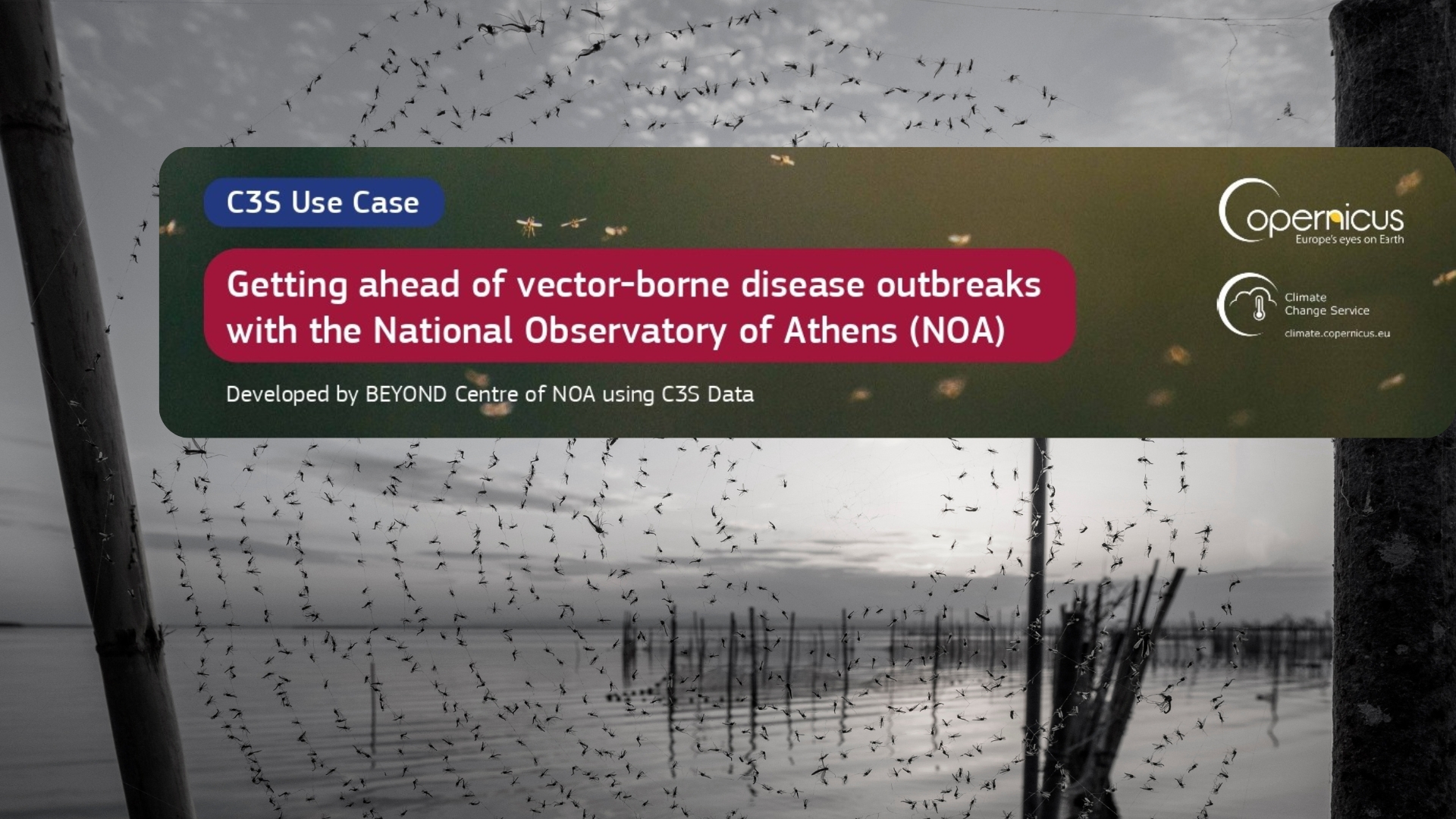
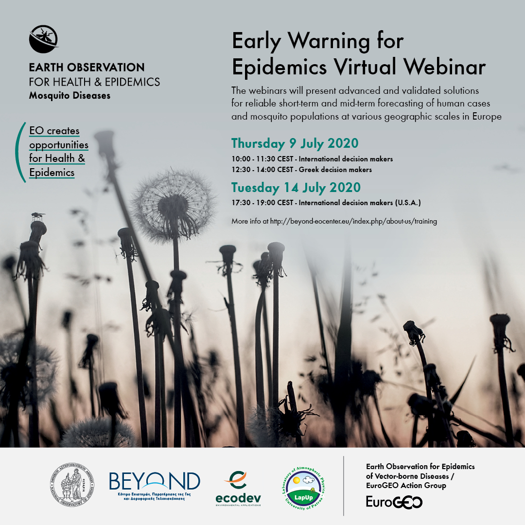
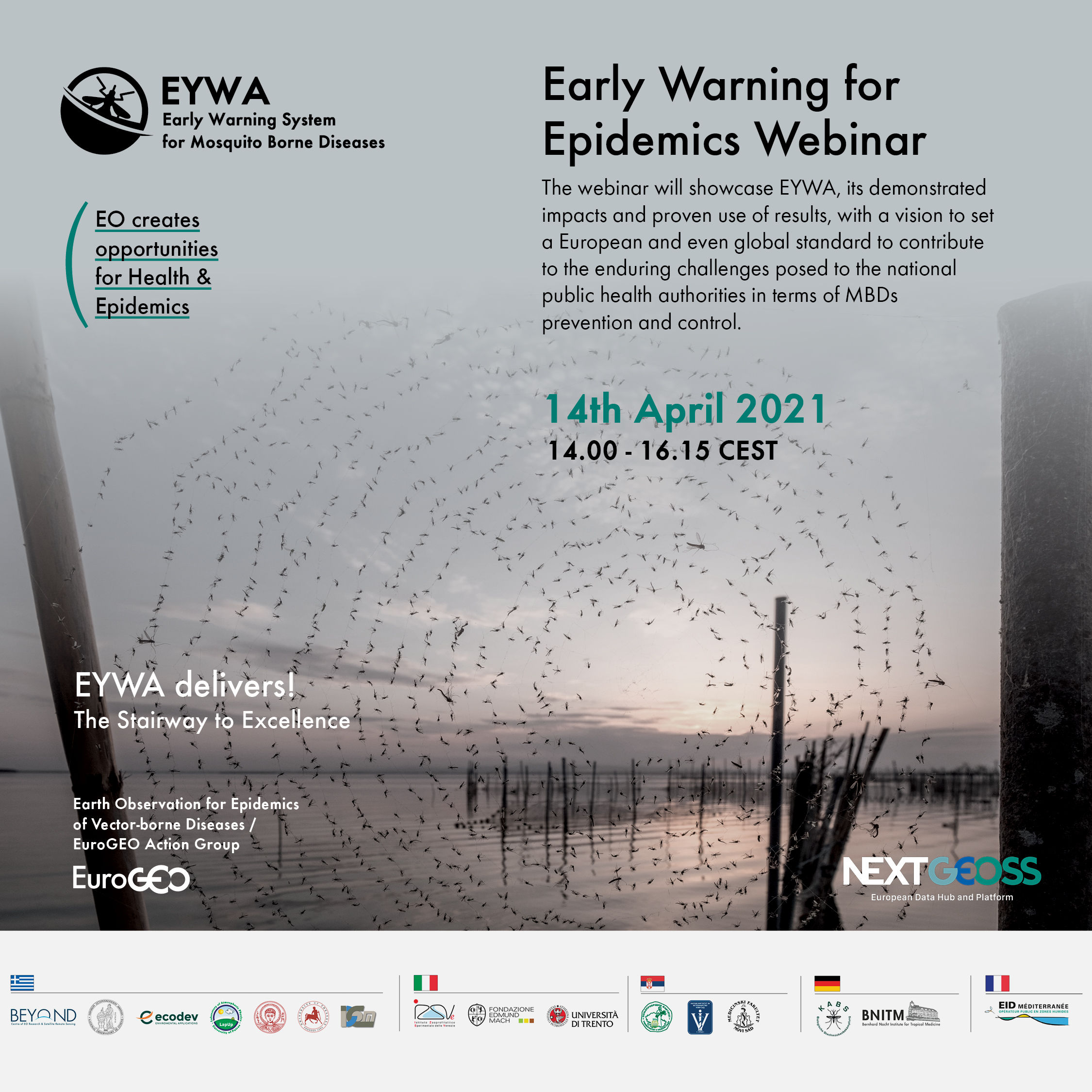
EYWA (EarlY WArning System for Mosquito borne diseases) a prototype system addressing the critical public health need for prevention and protection against the Mosquito-Borne Diseases (MBDs), lies under the umbrella of EuroGEO Action Group "Earth Observation for Epidemics of Vector-borne Diseases - EO4EViDence" and is the outcome of the co-development between the BEYOND Centre of EO Research and Satellite Remote Sensing of the National Observatory of Athens, the Ecodevelopment S.A., the Laboratory of Atmospheric Physics of the University of Patras, and 12 more interdisciplinary European organisations from Italy, France, Germany and Serbia.

EYWA supports sustainability by addressing the relevant priorities of the GEO Societal Benefit Areas, the Agenda 2030 and the Sustainable Development Goals (SDGs), such as Good Health and Well-Being (SDG 3) and Climate Action (SDG 13) and Sustainable cities and communities (SDG 11).

The system is based on a plethora of satellite and in-situ Earth Observation data and state-of-the-art technological tools, leveraging scientific knowledge and ultimately proving that EO can upend our understanding in the field of epidemics. The pivotal role of EYWA is to become a key lever for Public Health authorities and decision makers, support preparedness and timely strategic design of the health system response actions, and raise citizens awareness on the expected risk, with a view to fight Mosquito-Borne Diseases.

In this context and as a continuation of the first webinars hosted on June 9th & 14th 2020, we are organising a virtual workshop for "Early Warning for Epidemics", which will take place in April 14th, 2021.

This workshop aims to reach members of the Mosquito-Borne Diseases and Earth Observation related communities, Public Health authorities and decision makers to showcase EYWA, its demonstrated impacts and proven use of results through selected use cases. The vision is to contribute to the process towards setting a European and even global standard for early warning and decision support to help reduce MBDs infections and prevent outbreaks along with the enduring challenges posed to the European national public health authorities in terms of MBDs prevention and control.


Location To join please click here
Date: 14/04/2021
Time: 14.00-16.15 CEST
Facilitator: NOA


Agenda items

14:00 – 14:15

Welcome & Introductions

Speakers

Dr. Haris Kontoes (BEYOND – National Observatory of Athens)

Steven Ramage (Group on Earth Observations- GEO)

PART I The challenge – The EYWA solution
14:15 - 14:25

“'Infectious diseases in a globally changing environment”

Keynote speaker: Dr. Nikolaos Stilianakis (JRC – Joint Research Centre)

14:25 - 14:40

“EYWA: A key tool to the epidemics arsenal”

Speaker: Dr. Haris Kontoes (BEYOND – National Observatory of Athens)
PART II Operational implementation of EYWA
14:40 - 14:55

“Reliability of early warning signals in WNV predictions”

Speaker: Dr. Ioannis Kioutsioukis (University of Patras, Laboratory of Atmospheric Physics)

14:55 - 15:10

“Operational use of EYWA in Greece”

Speaker: Dr. Spiros Mourelatos (Ecodevelopment S.A.)
PART III EYWA in Europe
15:10 - 15:20

“Vector Control Strategies Against West Nile Virus Infection in Serbia”

Speaker:  Dr. Dušan Petrić (UNSFA - University of Novi Sad, Faculty of Agriculture, Laboratory for Medical and Veterinary Entomology)

15:20 - 15:30

“WNV in Germany: potential implementation of EYWA for targeted monitoring and vector control by KABS”

Speaker: Dr. Daniel Wohlgemuth (KABS - Kommunale Aktionsgemeinschaft zur Bekämpfung der Schnakenplage)

15:30 - 15:40

“Entomological situation and arboviruses transmissions in Southern France”

Speaker: Grégory L’Ambert (EID Méditerranée)
PART IV Policy framework & Actions for MBDs in Europe
15:40 - 15:50

“Discovery, ecology and evolution of novel and emerging/re-emerging arboviruses”

Speaker:  Prof. Dr. Dr. Jonas Schmidt-Chanasit (BNITM - Bernhard Nocht Institute for Tropical Medicine)

15:50 - 16:00

"Early Warning System at European Union level: policy framework and operational role"

Speaker:  Olimpia Imperiali  (DG ECHO - Directorate-General for European Civil Protection and Humanitarian Aid Operations, European Commission)

16:00 - 16:15 Questions & Discussion

The Webinar is available in Youtube https://youtu.be/SKqHgGfUlEI


Early Warning for Epidemics Webinar using dynamic models, AI and space technology

Mosquito Diseases Banner 1080x1080px

Mosquito-Borne Diseases (MBDs) infect almost 700 million people every year and are recognized in over 100 countries, causing millions of deaths annually. The changing climatic and ecological conditions, global travel and trade, human behavior, as well as the rapid and unplanned urbanization, are key factors that influence the seasonal and geographic distribution of vectors' population and therefore the transmission of the pathogens, causing the re-emerging and even more emerging of these diseases in countries where they were previously unknown. West Nile Virus (WNV) infection in humans and animals have been recorded in various areas of Greece, during the years 2010-2014 and 2017-2019, but also in other regions in Europe reaching a usually high record in 2018.

The BEYOND Centre of EO Research and Satellite Remote Sensing of the Institute for Astronomy, Astrophysics, Space Applications and Remote Sensing (IAASARS) of the National Observatory of Athens, in collaboration with the leading company in mosquito control and data analytics Ecodevelopment S.A., Laboratory of Atmospheric Physics of the University of Patras - Physics Department, and along with several European organisations from Italy, France, Germany and Serbia, that serve research purposes, perform mosquito control activities, belong to health and decision making sectors,  has seized the initiative to develop an Early Warning System for combating the West Nile Virus.

The pivotal role of the system is to inform decision makers, help them improve health system responses, inform citizens and combat mosquitoes, with the prospect of organizing strategic intensifying actions of the entomological and epidemiological surveillance and take preventive measures to curtail the spread of WNV in Europe. 

Furthermore, NOA/BEYOND is coordinating the EuroGEO Action Group "Earth Observation for Epidemics of Vector-borne Diseases" which is linked to the GEO 2017-2019 Work Programme, especially with the Community Activities: Earth Observations for Health (EO4HEALTH) which includes vector borne infectious diseases, Copernicus Atmospheric Monitoring Service (CAMS) and Copernicus Climate Change Service (C3S). Our recently launched initiative supports the relevant priorities of the Sustainable Development Goals (SDGs) such as good health and well-being (SDG 3) and climate action (SDG 13).

In this context, we are organising a one-day virtual workshop for "Early Warning for Epidemics" which will take place in July 9th and 14th, 2020.

This workshop aims to reach members of the vector-borne diseases, epidemics communities and decision makers, bring together interdisciplinary teams across the entire value chain, and demonstrate through selected use cases the value provided by the advanced European scientific and technological assets towards the development of robust, reliable, scalable, and replicable system solutions to combat mosquito-borne diseases using EO space technologies and AI. The webinars will present advanced and validated solutions for reliable short-term and mid-term forecasting of human cases and mosquito populations at various geographic scales in Europe.   

Please confirm your participation at This email address is being protected from spambots. You need JavaScript enabled to view it.

 EYWA's presentation is available here.