Διαδικτυακή συνάντηση με τον Δρ.Βασίλη Αμοιρίδη την Τετάρτη 17 Μαρτίου στις 19.00, με θέμα “Ανακαλύπτοντας τα μυστικά της ερημικής σκόνης με μεθόδους επίγειας τηλεπισκόπησης”.
Διαδικτυακή συνάντηση με τον Δρ.Βασίλη Αμοιρίδη την Τετάρτη 17 Μαρτίου στις 19.00, με θέμα “Ανακαλύπτοντας τα μυστικά της ερημικής σκόνης με μεθόδους επίγειας τηλεπισκόπησης”.

![]()
FIRE is looking for charismatic professionals from various sectors. FIRE, the industry-led Forum for Innovation and Research in European Earth Observation, is inviting luminaries from six key sectors – agriculture, energy, raw materials, infrastructure, marine, and urban, with an affinity for technology to express their interest in becoming the first ever Earth Observation (EO) “evangelists”.
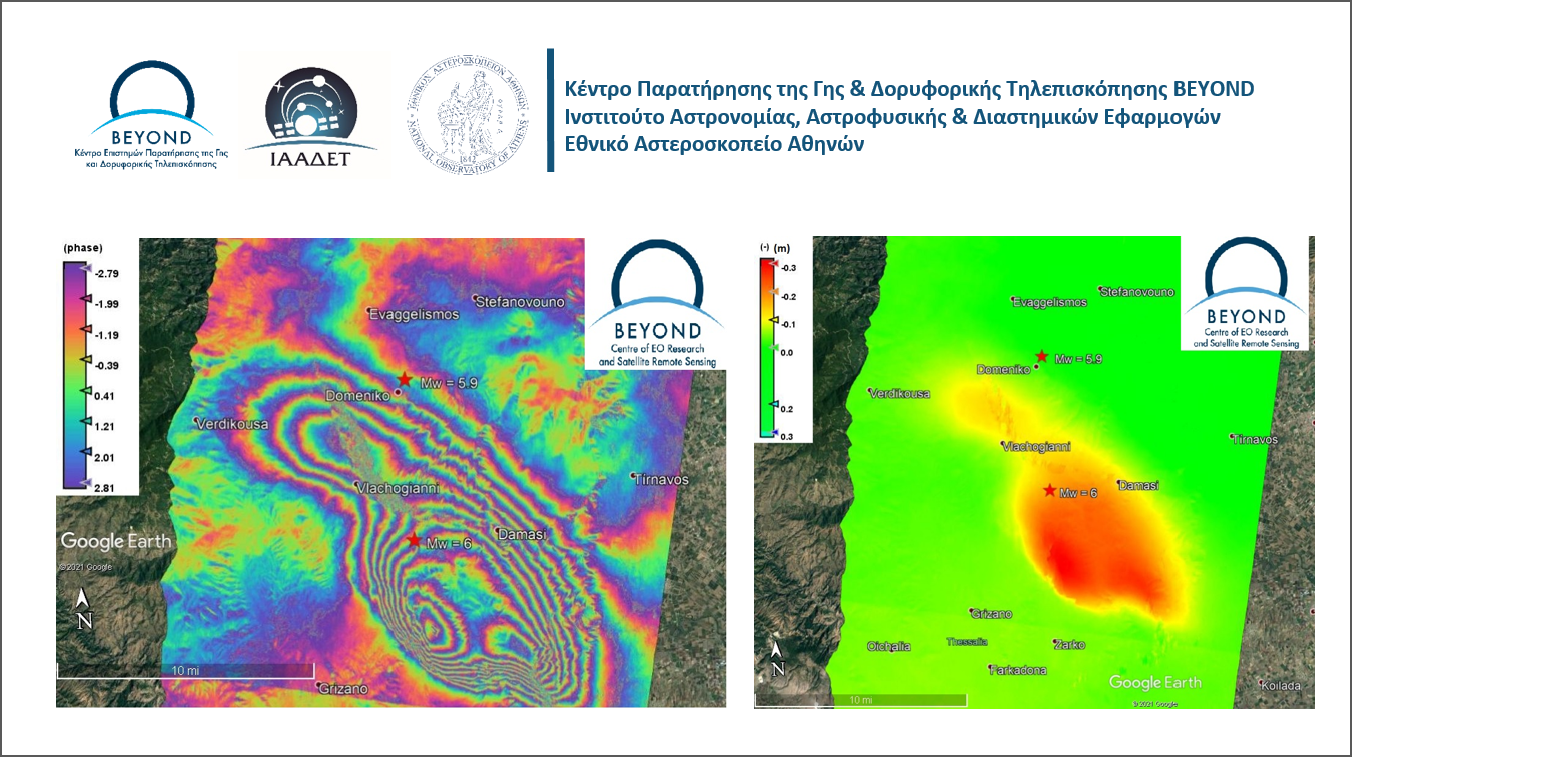
The geObservatory service of BEYOND Center of Earth Observation Research and Satellite Remote Sensing of the National Observatory of Athens, was again activated on March 4, 2021, 18:38:17 UTC, to monitor a new strong earthquake, near Elassona city in Thessaly, with a magnitude of Mw=5.9.
Η υπηρεσία geObservatory του Κέντρου Παρατήρησης της Γης και Δορυφορικής Τηλεπισκόπησης BEYOND του Εθνικού Αστεροσκοπείου Αθηνών, ενεργοποιήθηκε εκ νέου στις 4 Μαρτίου του 2021 στις 18:38:17 UTC, μετά τον νέο ισχυρό σεισμό, κοντά στην πόλη της Ελασσόνας, στην Θεσσαλία, με μέγεθος Mw=5.9.
Η Αττική ενώνει τις δυνάμεις της με στόχο τη δημιουργία «ασπίδας προστασίας» των πολιτών και του περιβάλλοντος από τις φυσικές καταστροφές.
Interferogram of Týrnavos earthquake of March 3, 2021 10:16:07 UTC. The earthquake occurred on March 3, 2021 in 10:16:07 UTC, with a magnitude of Mw=6 in Richter scale, a focal depth of 7.8km and an epicenter in 16km South of Elassona city, according to the Institute of Geodynamics of the National Observatory of Athens.
Δορυφορική συμβολομετρική απεικόνιση του πεδίου εδαφικής παραμόρφωσης από τον σεισμό του Τυρνάβου στις 3 Μαρτίου 2021 10:16:07 UTC. Σεισμός έντασης Mw=6 στην κλίμακα ρίχτερ, με εστιακό βάθος 7.8χλμ και επίκεντρο 16χλμ Νότια της Ελασσόνας, σύμφωνα με τα στοιχεία του Γεωδυναμικού Ινστιτούτου του Εθνικού Αστεροσκοπείου Αθηνών, πραγματοποιήθηκε στις 3 Μαρτίου 2021.
Υπεγράφη η τριμερής Προγραμματική Σύμβαση μεταξύ της Περιφέρειας Αττικής,του Εθνικού Αστεροσκοπείου Αθηνών και του Εθνικού και Καποδιστριακού Πανεπιστημίου Αθηνών, για την εκπόνηση έρευνας με τίτλο «Εκτίμηση κινδύνων Σεισμού, Πυρκαγιάς και Πλημμυρών στην Περιφέρεια Αττικής», με χρηματοδότηση της Περιφέρειας ύψους 2.2 εκ. ευρώ.
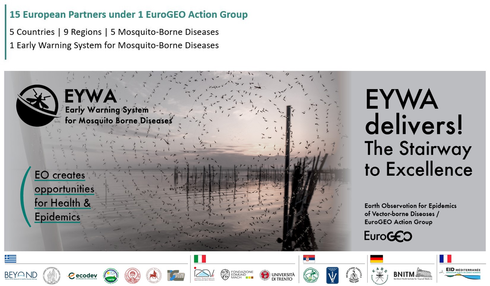
EYWA is a game changer Early Warning & Decision Support system in the domain of epidemics.
Το Σύστημα Έγκαιρης Προειδοποίησης & Υποστήριξης Λήψης Αποφάσεων EYWA ανατρέπει τα δεδομένα στον τομέα της επιδημιολογίας.

Our colleague Dr. N.Stathopoulos has published 2 papers in collaboration with esteemed colleagues from the University of West Attica,Harokopio University of Athens,the Agricultural University of Athens and the University of Patras.
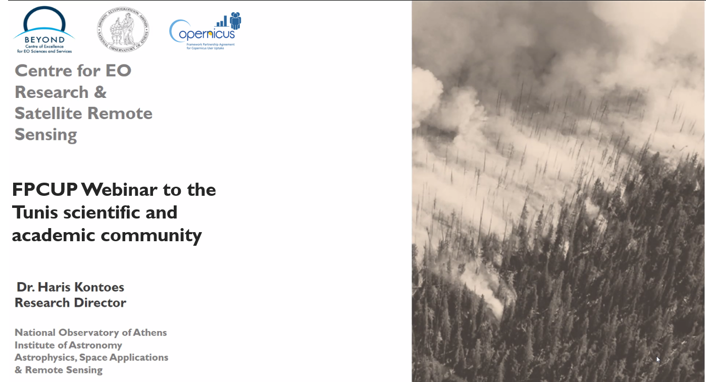
BEYOND Center of EO research and satellite remote sensing of the National Observatory of Athens organized yesterday 22/2/2021 a webinar with several stakeholders from Tunis under the FPCUP action 2019-2-40: Capacity building in Balkans, Middle East, North Africa & Black Sea.