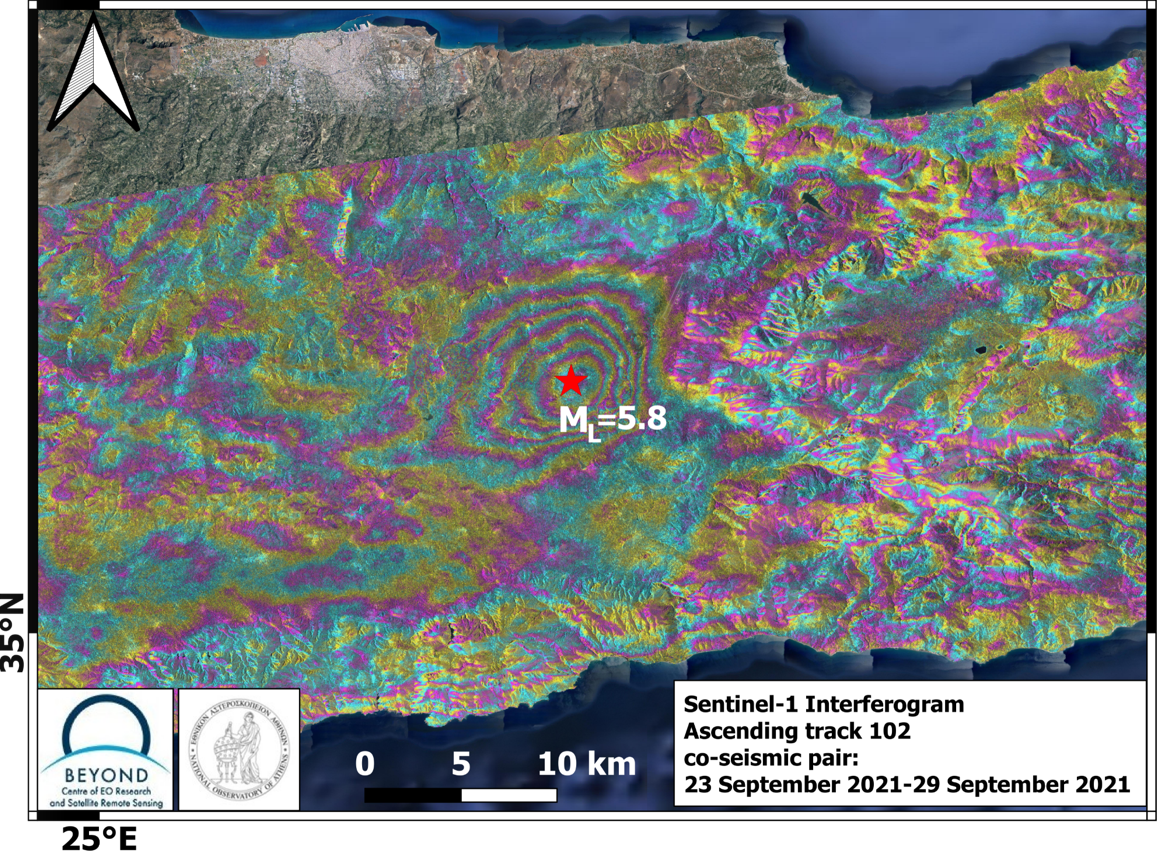
On September 27, 2021 06:17:22 UTC, a strong earthquake occurred in Crete, Greece, with a magnitude of M6.0, a focal depth of 10.0 km and an epicenter near Arkalochori, according to the European-Mediterranean Seismological Centre (EMSC). The earthquake caused extensive damages in Arkalochori, Roussochoria, Archontiko and Patsideros villages. Several people were injured and there was one casualty. geObservatory service of BEYOND Center of Earth Observation Research and Satellite Remote Sensing of the National Observatory of Athens, was activated to monitor ground deformation using two Sentinel-1 Synthetic Aperture Radar images of September 23, 2021 and September 29, 2021 (Ascending satellite track no.102). In the co-seismic interferogram, which provides a detailed mapping of ground deformation pattern, in the broader area near the epicenter, each fringe corresponds to 2,8 cm ground deformation. In the produced interferogram 5 fringes are observed, that indicate deformation of 14 cm. This is a first indication for deformation pattern and will be further confirmed in the next couple of days for as long as new Sentinel-1 data will be ingested in the geObservatory and new calculations of the deformation pattern will become available.
All interferograms associated with Crete earthquake are freely available in the geObsevatory website (http://geobservatory.beyond-eocenter.eu/).

