BEYOND partcipated at the online AGU Fall Meeting with two presentations in the sessions B037 - Smart Farming and Natural Resource Management Enabled by Remotely Sensed Big Data II Posters and H203: Advancing Flood Characterization, Modeling, and Communication I. Our colleagues, Nikos Bartsotas and Alexia Tsouni, presented the following topics.
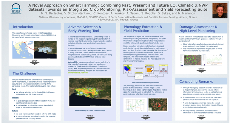
- A Novel Approach on Smart Farming: Combining Past, Present and Future EO, Climatic and NWP datasets Towards an Integrated Crop Monitoring, Risk-Assessment and Yield Forecasting Suite, Nikolaos S Bartsotas, et.al , Poster session, Wednesday, 9 December 2020; 14:00 PST.
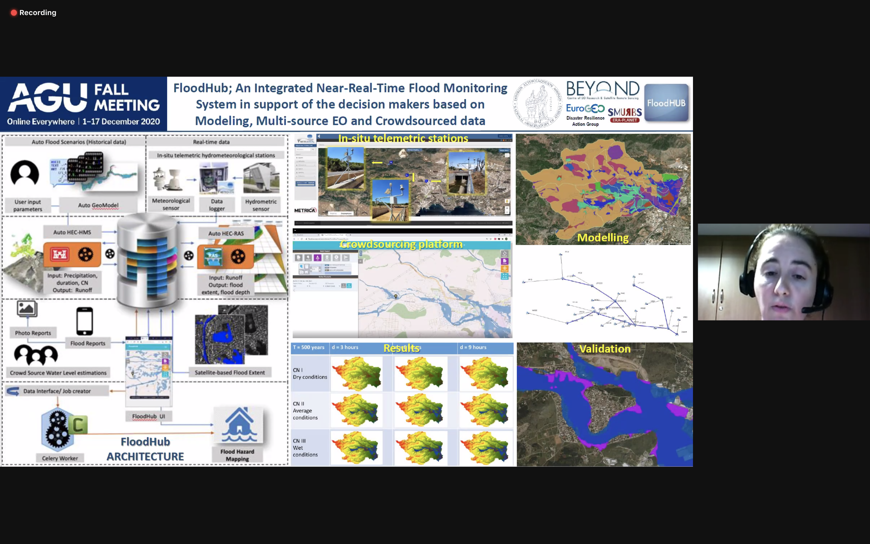
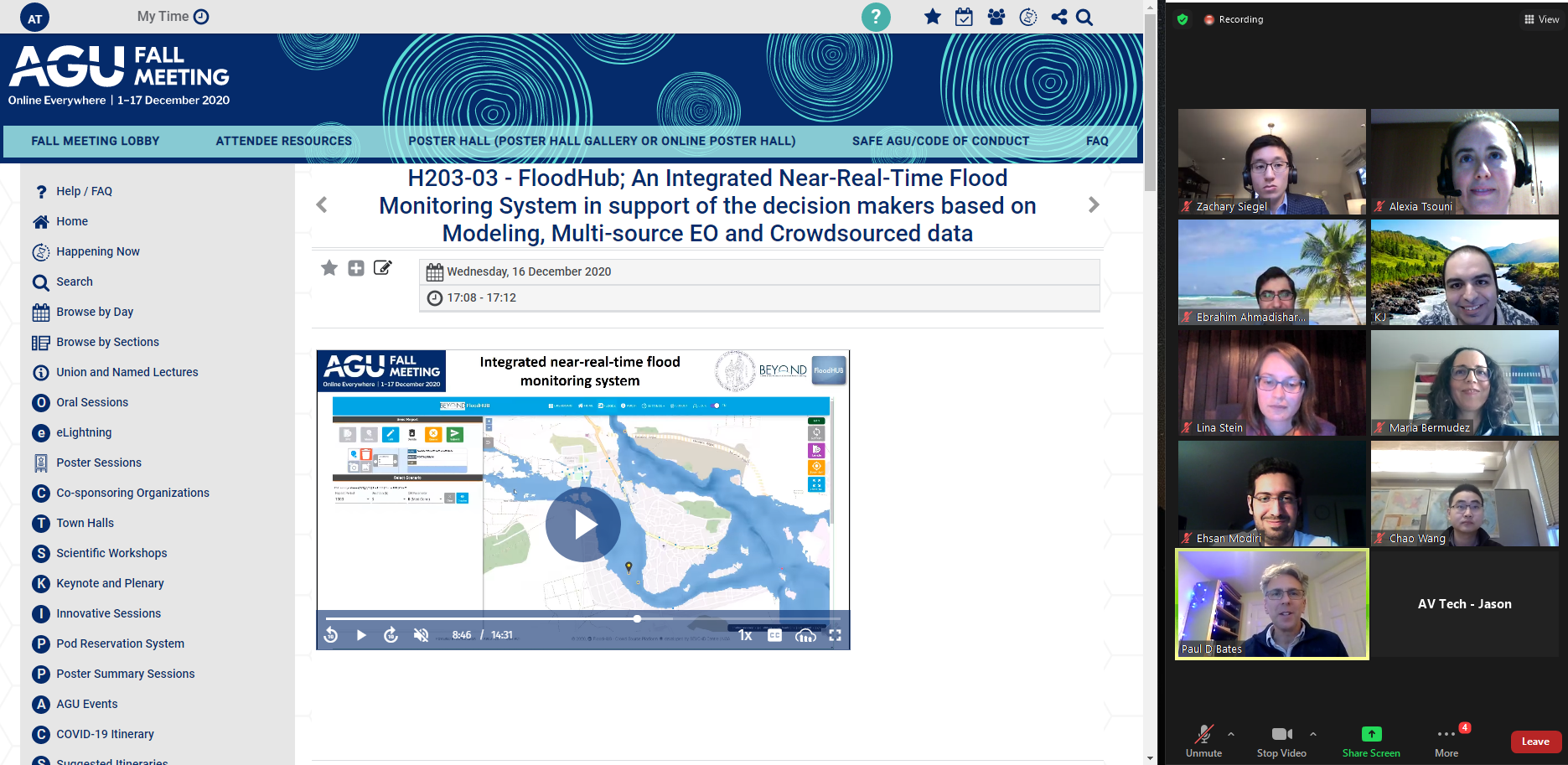
- FloodHub; An Integrated Near-Real-Time Flood Monitoring System in support of the decision makers based on Modeling, Multi-source EO and Crowdsourced data. Alexia Tsouni, et.al., Oral presentation, Wednesday, 16 December 2020; 07:00 PST.
Abstract
The most frequent disaster is flood, corresponding to 43,4% of the total number of disasters, and affecting the largest number of persons worldwide: 45% of the population affected by disasters, that is 2 billion people (CRED, UNISDR, 2018). High accuracy flood monitoring systems are needed in order to provide support to the decision-making process of the relevant stakeholders in the direction of early warning, flood management, mitigation measures and disaster risk reduction towards disaster resilience, especially in the urban areas.
In this direction the Center of Earth Observation and Satellite Remote Sensing BEYOND of the National Observatory of Athens (NOA) develops the collaborative flood monitoring system FloodHub, also in the framework of the EuroGEO Disaster Resilience Action Group. FloodHub improves Near Real Time (NRT) flood monitoring and assessment of flood extent by assimilating flood modeling with the integration of multi-source data, integrating crowdsourced data, in-situ sensor data, satellite earth observation data, as well as advanced web-based technologies with innovative techniques.
To that end, fully automated flood simulations were made using the HEC-HMS hydrologic model and the HEC-RAS hydraulic model for a variety of combinations of parameters, such as different return periods (T), rainfall durations (d) and Curve Numbers (CN) in the pilot area of Mandra, Attica in Greece. A large set of flood scenarios with related information on flood extent and water depth was produced and then the training dataset was ingested as a-priori knowledge to the system. This in turn is further tuned with the reported reality from crowd and multi-source data i.e. in-situ observations and satellite EO, thus timely generating a near real time situational awareness picture. The free and open access BEYOND/FloodHub web and mobile application platform is a useful communication tool in the hands of the relevant authorities and key stakeholders supporting their decision-making process in the framework of a more effective flood risk management towards disaster risk reduction and more resilient communities. This is in line with the requirements for the implementation of the EU Floods Directive 2007/60/EC, the Sendai Framework for Disaster Risk Reduction, and the UN SDGs.
- The Agenda of the session is available here.
- The presentation is available here.
- An overview presentation is available here.