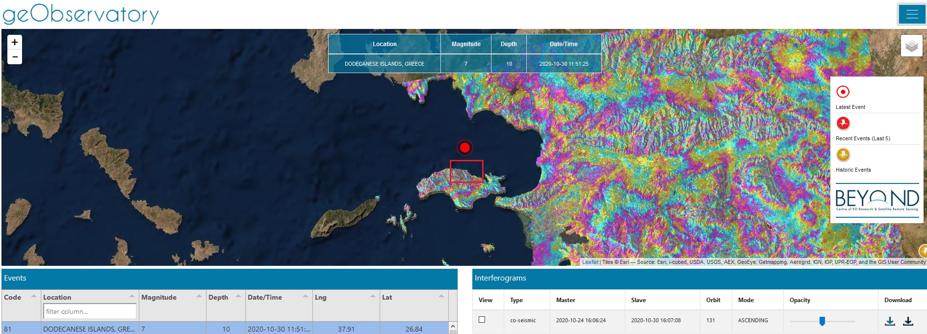
On October 30, 2020, the geObservatory service of BEYOND Center of Erath Observation Research and Satellite Remote Sensing of the National Observatory of Athens, downloaded the first available SAR image from the Hellenic Mirror Site, after the strong earthquake that occurred in Samos island and provides a detailed mapping of ground deformation pattern, in the broader area near the epicenter. This first indication for deformation pattern, we give it with reservations, and will be further refined in the next couple of days for as long as new Sentinel-1 data will be ingested in the geObservatory and new calculations of the deformation pattern will become available.
In the differential interferogram shown below we present the line-of-sight deformation pattern. In the vicinity of Kampos, located in the norther part of Samos island and is approximately 15 km south of the earthquake epicenter, we can detect two to three deformation fringes. Each fringe corresponds to 2.8 cm of LOS deformation.
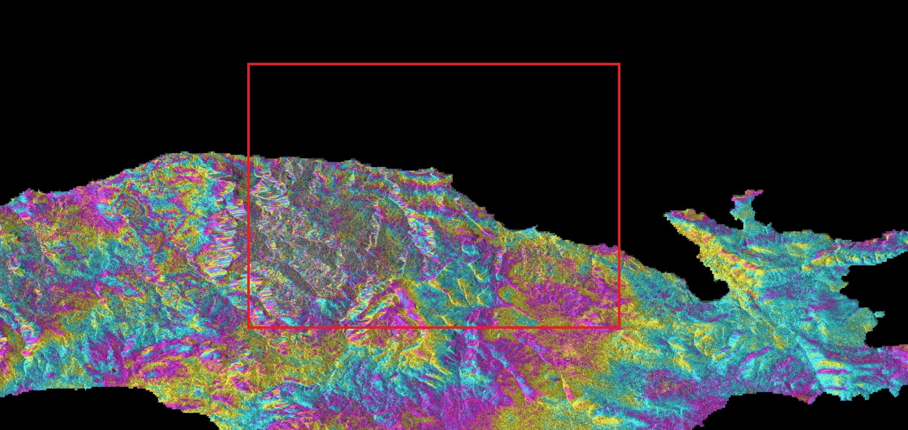
To be noted that the Hellenic Mirror Site provides high resolution radar images of the European satellites Copernicus Sentinels. The post-seismic SAR image, is an ascending Sentinel-1A image with a 10m resolution and an acquisitions time 18:04:31 (local time in Greece).
The earthquake occurred on Friday 30/10/2020 in 11:51 UTC, with a magnitude of 6.7 in Richter scale, a focal depth of 11.8km and an epicenter in 17km North of Samos island, according to the Institute of Geodynamics of the National Observatory of Athens.
So far, the tragic toll in Samos, and neighboring Greece's islands Chios and Ikaria, and Turkey coast line refers to dead people, many hundreds of injured, and major destructions of buildings.
The product was created through the automated processing chain of geObservatory for the generation of interferograms from Synthetic Aperture Radar images. The technique uses two SAR images, one before and one after the earthquake, and calculates the difference in the distance between satellite-Earth, of two consecutive acquisitions.
In the geObsevatory website (http://geobservatory.beyond-eocenter.eu/) all interferograms associated with this seismic event, are available. The website will be updated and make freely available for downloading new products as long as new Sentinel-1 satellite data becomes available at the Hellenic Mirror Site. The BEYOND Center for the Management of the Natural Disasters will continue assessing the event and inform the authorities and the scientific community about the earthquake.