The BEYOND Center of Earth Observation Research and Satellite Remote Sensing of the National Observatory of Athens, publishes today a report that sheds light on the fire that broke out on August 30, 2020 in the Municipality of Argos- Mycenae, which hit a significant part of the Mycenaean archeological UNESCO site.
The fire was detected by our Centre’s FIREHUB system immediately, with its outbreak at 13.40 local time, in an agroforestry area close to the archeological site. (see Figure 1)
The fire spread rapidly and burned a total area of 114 ha (1140 acres) according to the high resolution satellite images of Sentinel-2 (10 m) of the area. Two satellites images were used, pre-fire (6/08/2020) and after-fire (31/08 / 2020) event, which were collected in the hubs of the Greek Mirror Site that operate at the BEYOND Center of Excellence and were processed by the research team of FIREHUB. This area, according to the Diachronic Mapping of Burnt Areas System of our center, which records all the fires from 1984 until today, have never been affected by wildfire.
In the following image (see Figure 2), the red color depicts the total burned area, while the boundaries of the visitable archaeological site are indicated in yellow color, as they are defined east of the local road, that leads to the entrance of the site.
The burned area inside the archeological site (red-yellow grid), extends east of the local road, hitting monuments from within and out of the cyclopean walls (south and southwest side). The fire did not cause any damage to antiquities nor the Archaeological Museum of Mycenae, the Lions' Gate, the Tomb Circle A, part of the citadel and the vaulted tomb of Atreus.
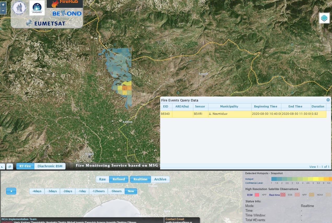
Image 1
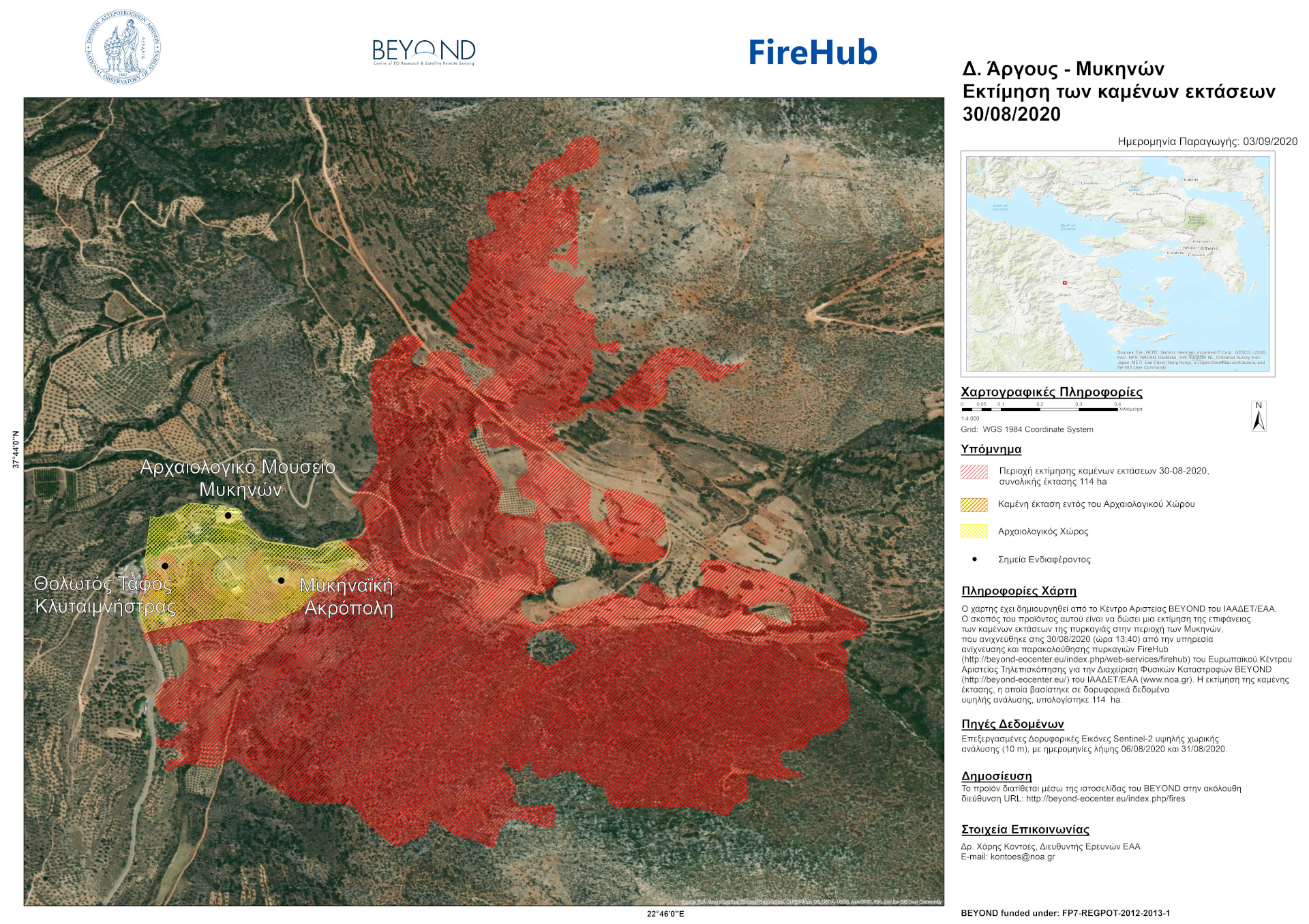
Image 2