

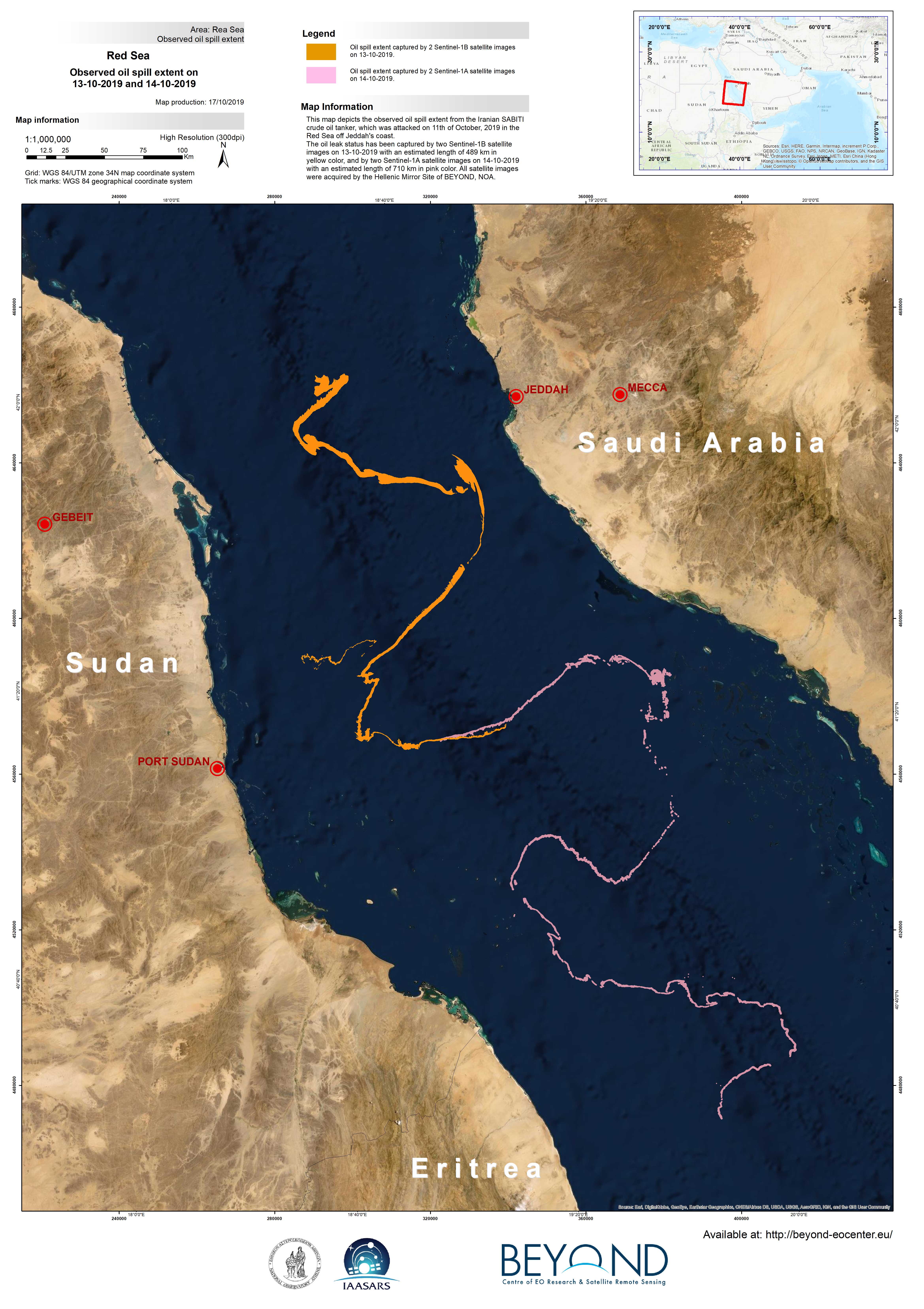
BEYOND EO Center was mobilized to assess the spread of the oil spill in the Red Sea, and produced this map depicting the observed oil spill extent from the Iranian SABITI crude oil tanker, which was attacked on October 11th 2019 off Jeddah's coast.
The oil leak status has been captured by two Sentinel-1B satellite images on 13-10-2019 with an estimated length of 489 km in yellow color, and by two Sentinel-1A satellite images on 14-10-2019 with an estimated length of 710 km in pink color. All satellite images were acquired by the Hellenic Mirror Site of BEYOND, NOA.
It is undoubtedly a large disaster, rendering a severe contamination effect.
BEYOND will continue to monitor the oil spill for the next few days in order to detect changes and assess the level of marine pollution.