Η υπηρεσία geObservatory της Επιχειρησιακής Μονάδας BEYOND του Εθνικού Αστεροσκοπείου Αθηνών, ενεργοποιήθηκε και κατέγραψε την εδαφική παραμόρφωση, που προκλήθηκε από τον σεισμό στην Νεβάδα, Μ5.7, στις 14 Απριλίου 2026, στις 01:29:15 UTC. Δημιουργήθηκε συμβολογράφημα με χρήση εικόνων Sentinel-1 καθοδικής τροχιάς δορυφόρου. Στο συμβολογράφημα είναι εμφανής η μετατόπιση του εδάφους που προκλήθηκε από τον σεισμό. Κάθε κροσσός συμβολής αντιστοιχεί σε εδαφική παραμόρφωση ίση με 2.8 εκ. Όλα τα διαφορικά συμβολογράμματα που σχετίζονται με τον σεισμό, είναι διαθέσιμα στην ιστοσελίδα του geΟbsevatory (http://geobservatory.beyond-eocenter.eu/).
-//-
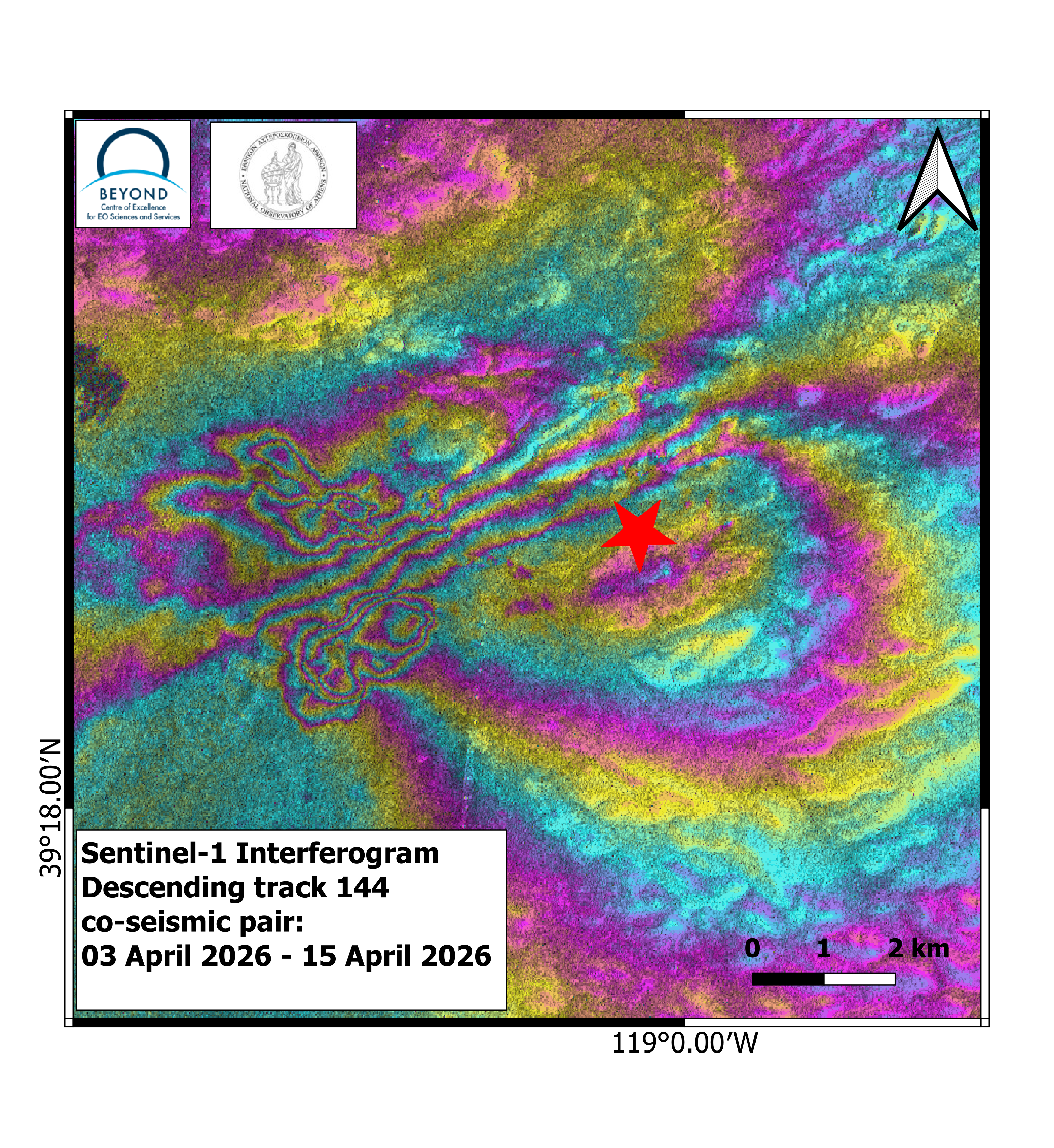
First co-seismic interferogram of the Nevada (14-04-2026, 01:29:15 UTC).
The geObservatory service of the Operational Unit BEYOND Center of Earth Observation Research and Satellite Remote Sensing of the National Observatory of Athens, was activated to map ground deformation induced by the Nevada earthquake, M5.7 of April 14th, 2026, 01:29:15 UTC. Co-seismic interferogram was produced with the use of Sentinel-1 images of descending no 144, satellite pass. In the co-seismic interferogram, surface deformation induced by the seismic event is mapped. Each fringe corresponds to a ground deformation equal to 2.8 cm. All co-seismic and pre-seismic interferograms, associated with the event are freely available on the geObsevatory website (http://geobservatory.beyond-eocenter.eu/).